February 2023
Current Set Up Across the Nation
Tuesday Night Forecast for the Dallas – Fort Worth Metroplex
DFW Early Tuesday Afternoon Update
Tuesday’s National Forecast Maps
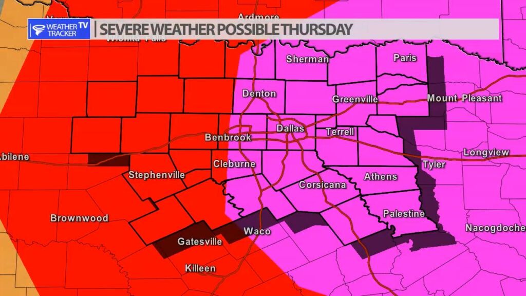
Severe Risk Returns to North Texas

The risk of severe weather returns to North Texas in two waves. First, tomorrow (Wednesday) there is a spotty opportunity of rain and storms across the area. Anything that does develop would have some severe potential with quarter sized hail and winds to 60 MPH.

Thursday there appears to be a more significant severe risk developing. As a strong upper level storm system moves out into the area – storms will develop west of I-35 by late afternoon and track east through the evening. There are still a few questions that need to be answered about Thursday. 1) the exact timing of the storm system and 2) if there will be any morning showers and T-Storms that could limit the instability by later in the day. Right now, the latest data shows morning showers could be quite possible. The Storm Prediction Center has issued an enhanced risk of severe weather for Thursday for the region and it does include part of North Texas. As always, we will have more updates on the mobile app, on the channel and live severe weather coverage as needed.
Today’s DFW Temperature Trend

The last day of February in North Texas and you are not typically expecting highs in the 80s. However, that’s the case today. Your Tuesday evening also looks great with temperatures easing down through the 70s.