Dangerous Heat Indices Expected Today
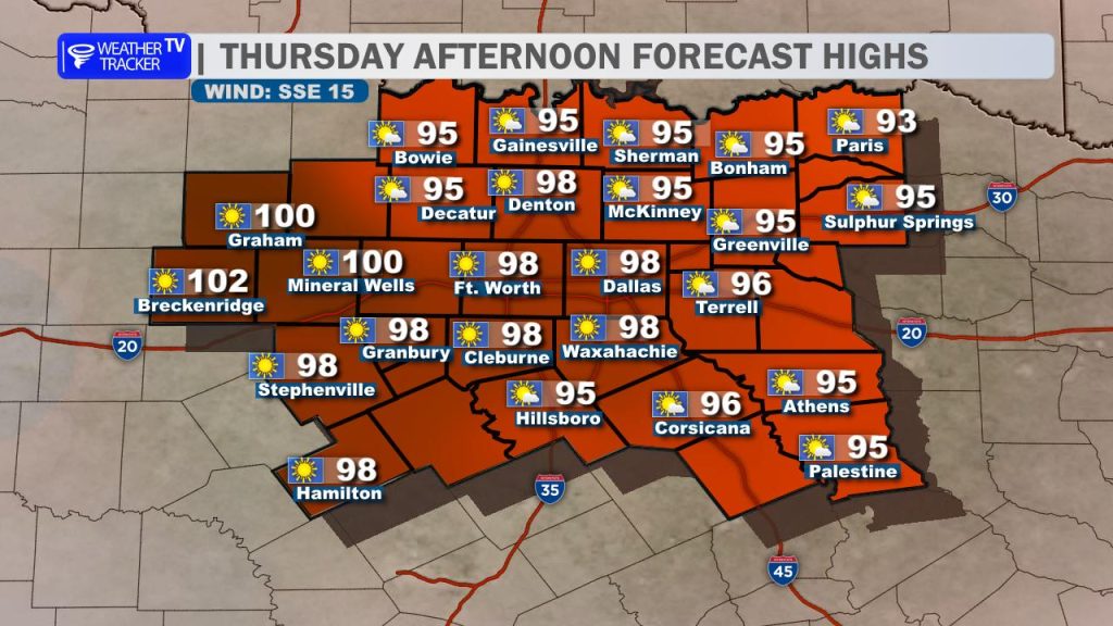
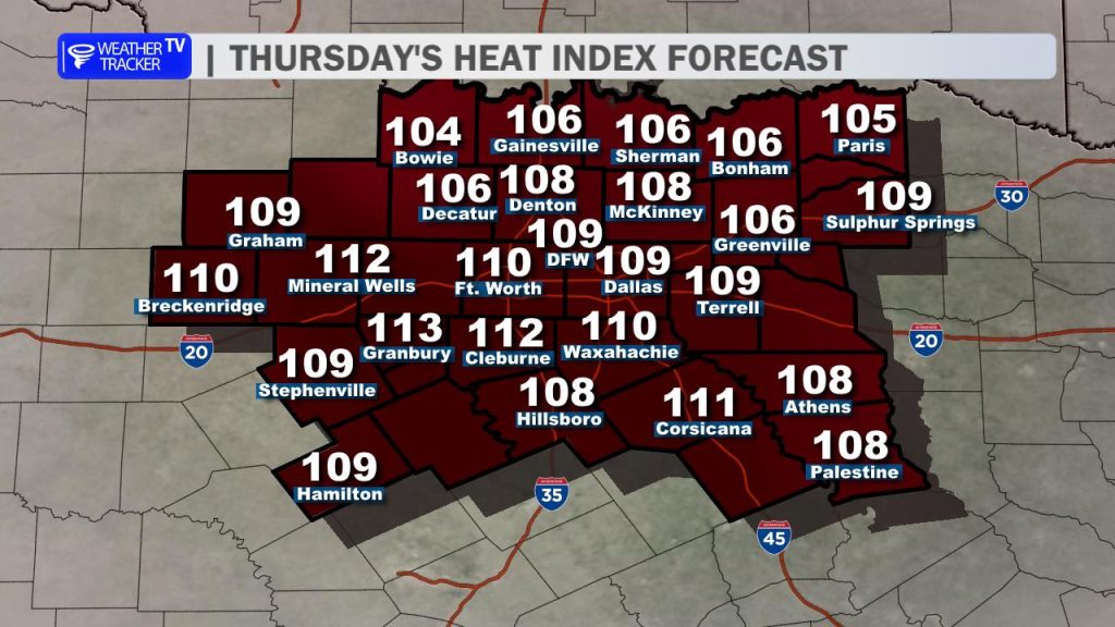
Get ready for a scorching and very humid afternoon across the area. Daytime highs will push through the mid-to-upper 90s, stretching close to the 100-degree mark in our western counties. That intense heat combined with thick Gulf moisture will drive “feels-like” numbers well above 105 – with maximum heat index values climbing between 105 and 110 degrees for most locations. Because of this, a Heat Advisory is in effect for all of North and Central Texas from noon through 9 PM. Make sure you practice your heat safety precautions: drink plenty of water, take frequent breaks in the shade or air conditioning, and look out for pets and neighbors.
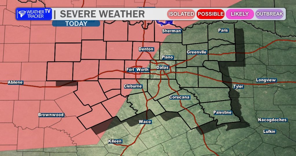
Relief is on the horizon, but it comes with a stormy transition. A weak cold front is slowly sagging southward through Oklahoma. By late this afternoon and evening, where that boundary intersects with a dryline just to our west and northwest, scattered thunderstorms are expected to ignite. While localized wind shear is seasonally marginal, the high heat and moisture mean any storms that do develop could become strong to severe. The primary threats will be isolated damaging straight-line winds up to 60 miles per hour and half-dollar-sized hail.
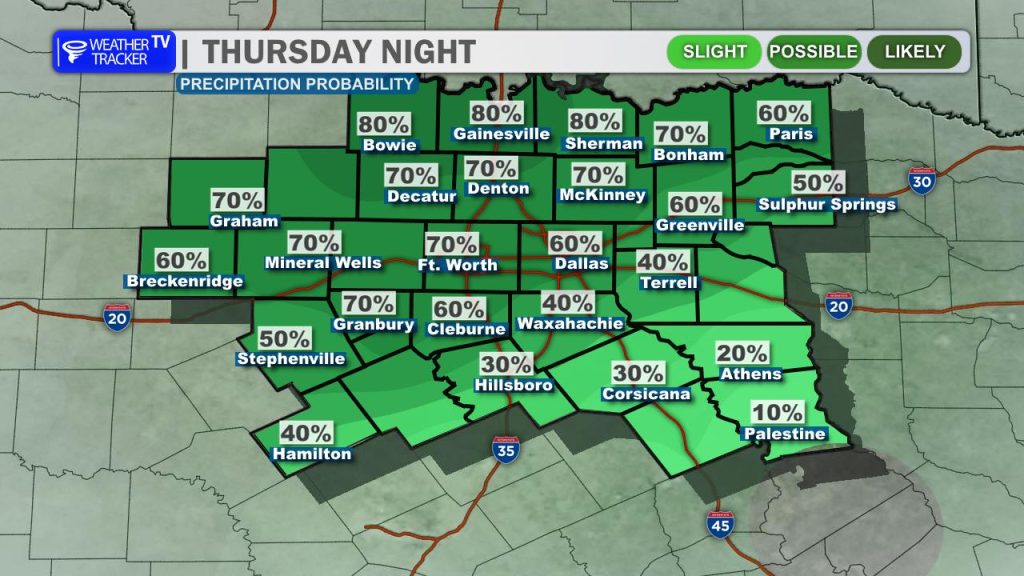
As we head into the overnight hours, this activity is expected to organize into a larger storm complex along the advancing cold front as it pushes deeper into North Texas. Rain and storm chances will ramp up significantly in the immediate Dallas-Fort Worth metroplex after 3 AM and will linger straight through the Friday morning commute.
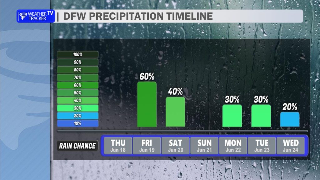
The frontal boundary is expected to stall right over the region, serving as the focal point for additional scattered storm development through Friday afternoon and into Saturday. Heavy downpours, frequent lightning, and gusty outflow winds will be possible with any passing cell. Because storm steering winds are relatively weak, any cells that slow down or dump heavy rain over the same areas could easily trigger isolated localized flooding concerns.

Thanks to the widespread cloud cover and rainfall, temperatures will trend downward into the cooler upper 80s and low 90s on Friday and Saturday. Enjoy the brief break, because the intense summer heat bounces right back on Sunday, steering afternoon highs back into the upper 90s with triple-digit heat index values returning for Father’s Day. Looking further ahead, this unsettled pattern stays alive with additional daily thunderstorm complexes tracking out of the north through the first half of next week.