After a very active night of severe weather across North Texas, our weather pattern remains unsettled as we head through the day today.
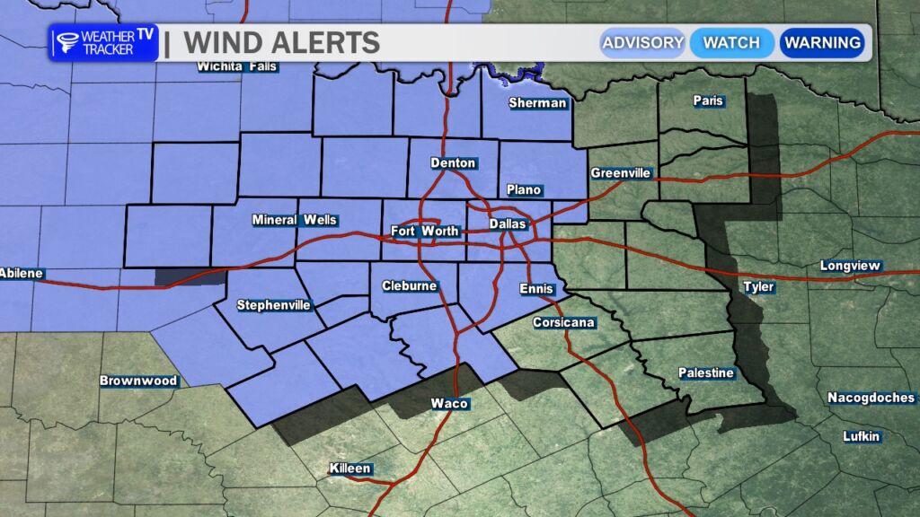
A windy cold front will continue pushing across the region, bringing gusty north winds behind it. Winds will increase through the afternoon with gusts that could exceed 40 mph at times. Because of this, a Wind Advisory is in effect for much of North Texas until 10 PM. Secure any loose outdoor items and use caution if you’ll be driving, especially in high-profile vehicles.
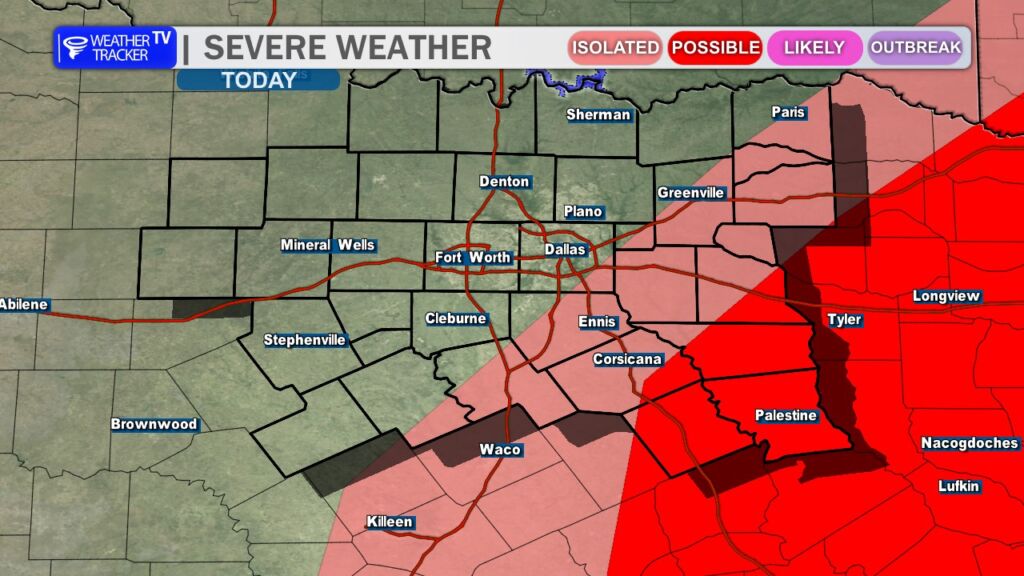
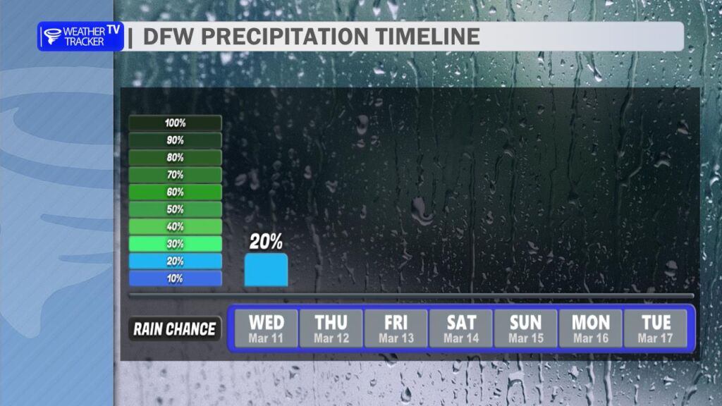
Rain and storm chances will linger into the afternoon, mainly southeast of the Dallas–Fort Worth Metroplex. While the overall severe threat is limited, a few stronger storms cannot be ruled out. The primary hazards would be quarter-size hail and wind gusts up to 60 mph. Most of the activity should gradually move out of the area and weaken by early evening.
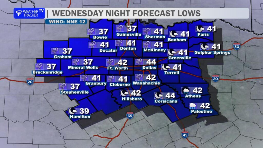
Behind the front, noticeably cooler air settles into North Texas tonight. Overnight temperatures will drop into the 30s and 40s by Thursday morning, making for a much colder start to the day compared to what we’ve experienced recently. You’ll likely want to grab the winter coat on the way out the door Thursday morning.
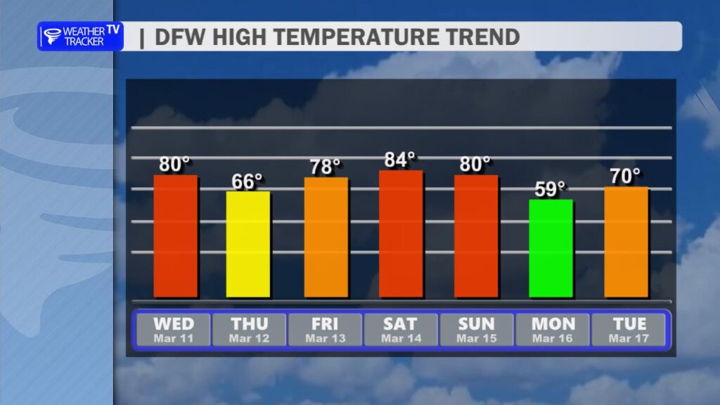
The cooler weather will be brief. Temperatures rebound quickly heading toward the weekend, with highs climbing back toward 80 degrees by Saturday.
Another cold front is expected to arrive late Sunday, bringing another round of cooler air for Monday. At this time, the extended forecast looks quiet and dry across North Texas for the next 7 to 10 days, offering a welcome break after the recent stretch of active weather. -William
A WIND ADVISORY goes into effect at 1 PM for the Dallas–Fort Worth Metroplex and continues through 10 PM as a strong cold front moves through.
Today will start mild, with a mix of sun and clouds and a spotty shower or thunderstorm possible, mainly late morning into early afternoon. Rain coverage will be limited across DFW, but you may briefly run into a downpour. Highs will climb into the upper 70s before temperatures begin falling this afternoon once the front pushes through. Winds will shift to the north and increase to 15 to 25 mph, with gusts up to 35 mph creating difficult travel for high-profile vehicles.
Tonight turns mostly clear, breezy early, and much colder. Lows drop into the lower 40s with lingering north winds.
Tomorrow looks bright and cooler, with afternoon highs in the mid 60s under sunny skies. Winds ease and turn more easterly by afternoon.
Be prepared for strong wind gusts late today and a sharp temperature drop by evening.
Stay with William Cole & Weather Tracker TV.
Let’s stay safe together.
A Wind Advisory is in effect for North Texas this afternoon and evening. Gusty north winds will make for difficult travel and could blow around loose outdoor items.
**Timing:**
– From 1 PM this afternoon to 10 PM this evening
**What to Expect:**
– North winds 20 to 30 mph
– Wind gusts up to 40 mph
**Potential Impacts:**
– Unsecured outdoor items may be blown around
– Difficult driving conditions, especially for high-profile vehicles
– Small tree limbs could break and cause damage
– Boating conditions on area lakes may become hazardous
**What to Do Now:**
– Secure trash cans, lawn furniture, and other lightweight outdoor objects
– Use extra caution if driving, especially in trucks, vans, and SUVs
– Boaters should use extra caution on area lakes
Stay with William Cole and Weather Tracker TV.
Let’s stay safe together.
From William Cole: Strong T-Storms will impact portions of Kaufman, western Van Zandt, central Henderson, northeastern Ellis and eastern Navarro Counties through 230 AM
At 202 AM , Live Radar was tracking strong T-Storms along a line extending from Combine to Angus. Movement was northeast at 50 mph.
Winds In Excess Of 40 Mph And Pea Size Hail. Gusty Winds Could Knock Down Tree Limbs And Blow Around Unsecured Objects. Minor Damage To Outdoor Objects Is Possible.
Stay with William Cole and Weather Tracker TV Dallas – Fort Worth for continuing coverage, online, on our app and on TV. Let’s stay safe together.
From William Cole: A Flash Flood Warning has been issued in the Weather Tracker TV DFW coverage area for Collin, Dallas, Denton & Tarrant Counties in North Texas until 3:00 AM.
At 1243 AM , Live Radar indicated T-Storms producing heavy rain across the warned area. Between 1 and 2 inches of rain have fallen. Additional rainfall amounts of 1 to 2 inches are forecast. Flash flooding is ongoing or expected to begin shortly.
Remember if you see water across a roadway do not drive through it. Turn Around Don’t Drown.
Stay with William Cole and Weather Tracker TV Dallas – Fort Worth for continuing coverage, online, on our app and on TV. Let’s stay safe together.