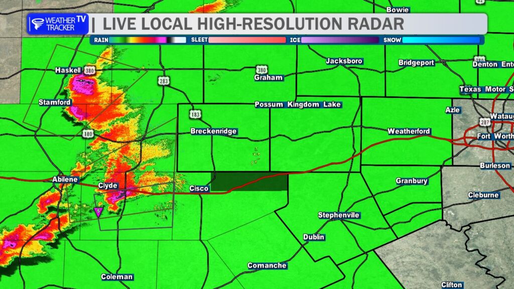
5:30 PM – Classic “screaming eagle” supercell now along I-20 just west of our viewing area. A tornado has been reported on the ground. Eastland and Stephens Counties, heads up on this storm over the next hour. Moving east at 30 mph.
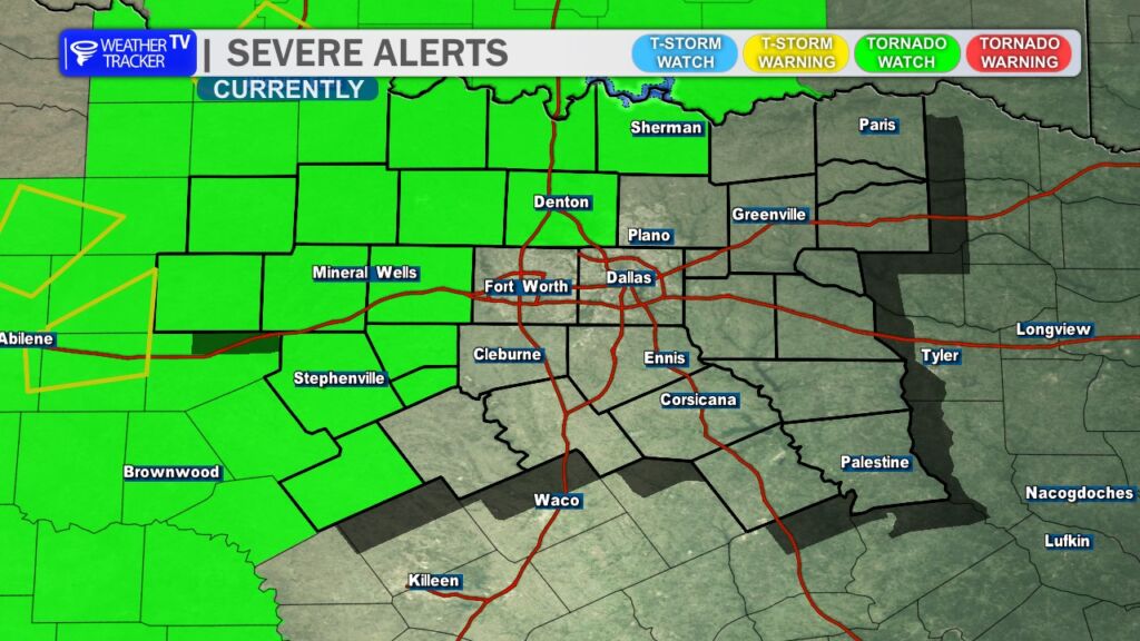
5:25 PM – Tornado Watch for our western and northwestern counties until 11 PM. Currently includes Denton County. Expect Tarrant, Dallas, and Collin Counties to likely be added later this evening. Stay alert. -William
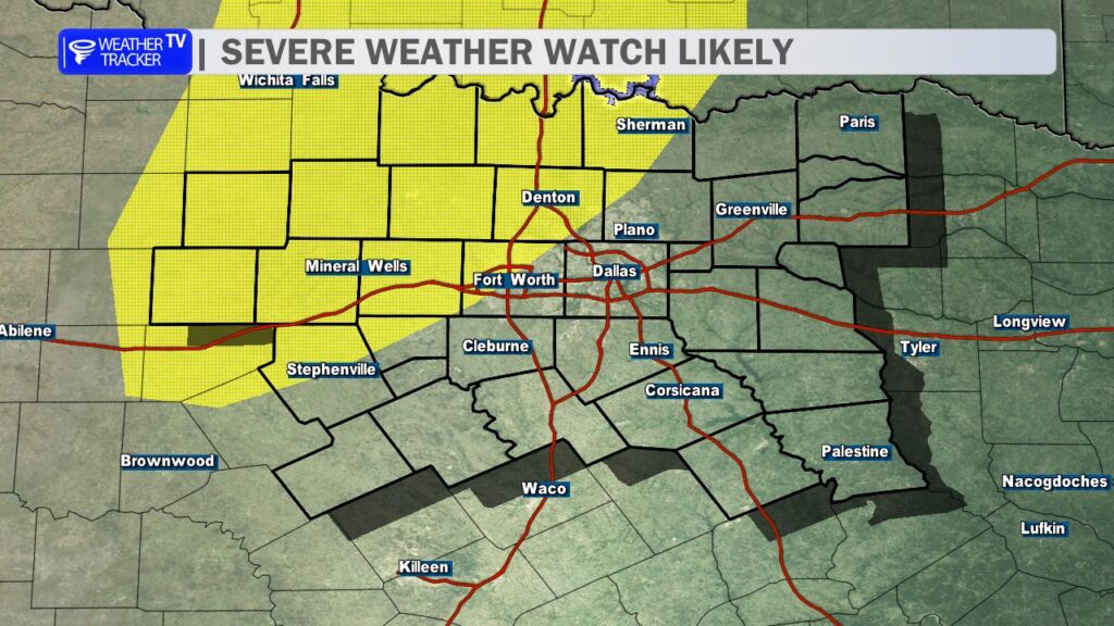
A Weather Watch is likely later today, as conditions become increasingly favorable for severe storm development across western North Texas and Oklahoma.
According to the latest guidance from the Storm Prediction Center, scattered severe thunderstorms are expected to develop over the next few hours along and east of a dryline stretching across the region. The atmosphere is already very unstable, with warm, humid air in place and dew points sitting in the mid to upper 60s.
That moisture combined with daytime heating is producing a highly energized atmosphere capable of supporting intense thunderstorms. Forecast data shows instability values exceeding 2500 J/kg, which is more than sufficient to support strong updrafts capable of producing severe weather.
Wind patterns in the atmosphere are also very supportive of supercell thunderstorms, which are rotating storms capable of producing the most dangerous types of severe weather. Wind shear values around 50 mph will help storms organize and rotate, while increasing low-level wind energy later this evening may further enhance the tornado threat.
Because of these ingredients, all modes of severe weather appear possible, including:
Very large hail, potentially destructive in the strongest storms
Damaging wind gusts
Tornadoes, including the possibility of a strong tornado
Another concern is the potential for extremely large hail, as the atmosphere contains steep temperature lapse rates and powerful upper-level winds approaching 100 mph. This combination can allow hailstones to grow very large before falling to the ground.
Storms will likely begin as isolated supercells during the late afternoon and early evening. As the night progresses, storms may begin to merge into a larger line or cluster of storms, which could continue producing damaging winds as it moves east.
Here’s a look at Live Temperatures across North Texas, MesoScan Radar and the Updated Forecast Map.
DFW TODAY Cloudy with a chance of showers. A slight chance of T-Storms this morning, then a chance of T-Storms this afternoon. Highs around 80. South winds 10 to 15 mph. Chance of rain 40 percent. -William