Happy Monday, North Texas!
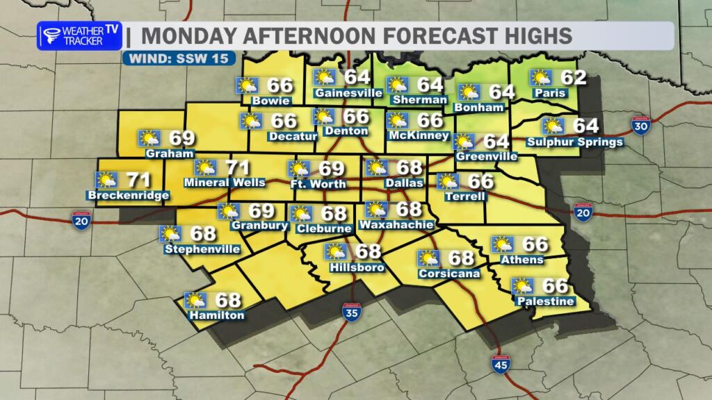
Enjoy a sharp warm-up today as temperatures rebound nicely this afternoon. We’ll start the day with plenty of sunshine, but clouds will gradually increase as the day goes on. A steady southerly breeze will help boost temperatures, with most locations climbing well into the 60s by late afternoon – quite the turnaround from recent days.
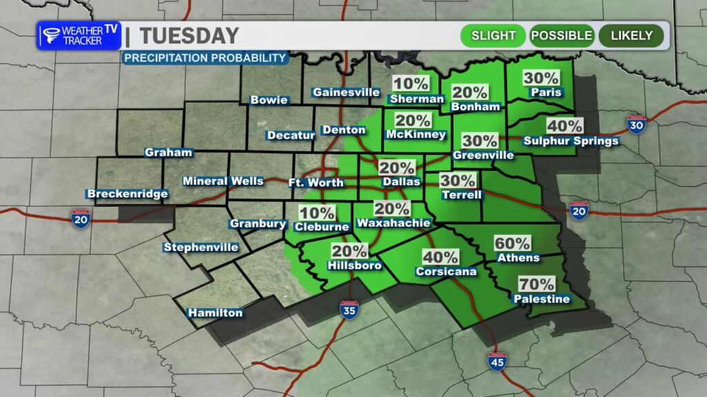
Our next weather system and accompanying cold front will slide out of the Rockies tonight. This system will bring a small chance for scattered showers by daybreak Tuesday, continuing into early Tuesday afternoon. Rain chances will be limited, with the highest probabilities focused east and southeast of the Dallas–Fort Worth Metroplex. For the Metroplex itself, rain chances remain low – generally around 10–20% through early afternoon.
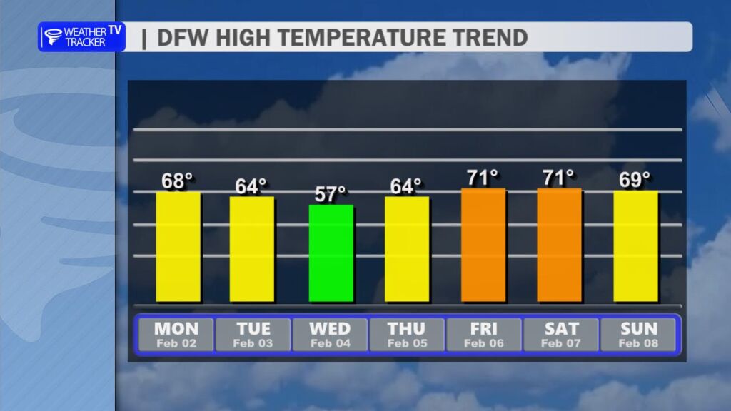
Behind this system, a cold front will move through Tuesday, shifting winds to the north and ushering in slightly cooler air. This is not a strong or arctic front, but temperatures will ease back by midweek. Highs on Wednesday will settle into the 50s, offering a brief cooldown.
The cooler weather won’t last long. Temperatures quickly rebound late in the week, with highs climbing back into the 70s as we head toward the weekend.
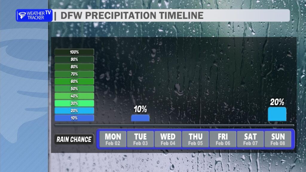
Looking ahead, aside from Tuesday’s spotty rain chances, we’re also monitoring another potential rain opportunity next Sunday. New data this morning suggests a few showers – and possibly even a few thunderstorms – could develop. It’s still early, but we’ll be keeping a close eye on that setup and fine-tuning the forecast as we get closer.