Here’s a look at the Wednesday evening planner for the DFW Metroplex.

Here’s a look at the Wednesday evening planner for the DFW Metroplex.

DFW TONIGHT Clear, cold with lows in the mid 30s. North winds 5 to 10 mph in the evening, becoming light and variable. -William

Here’s a look at our Wednesday evening commute in the DFW Metroplex.


Here’s a look at Live Temperatures across North Texas, MesoScan Radar and the Updated Forecast Map.
DFW THIS AFTERNOON Mostly sunny. Highs in the upper 50s. North winds around 10 mph. -William


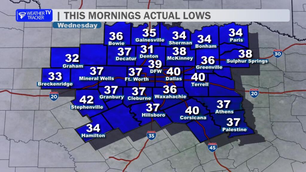
It was a noticeably chillier start to the day across North Texas with most locations waking up to temperatures in the 30s around sunrise. A few spots briefly dipped below freezing. That cooler air is settling in behind the cold front that pushed through the region yesterday.
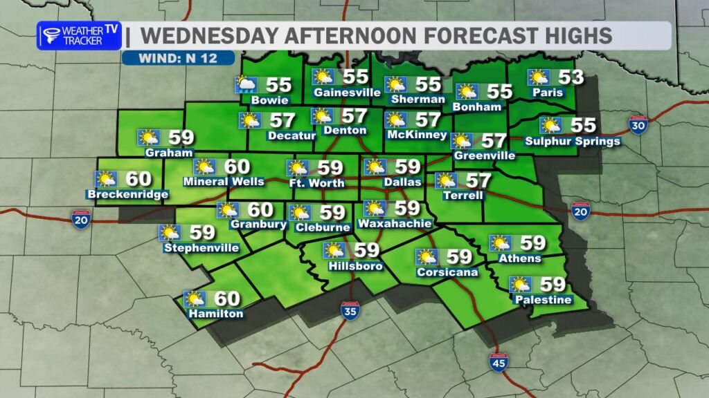
The cool feel sticks around this afternoon. High temperatures will struggle to climb much beyond the 50s, and a brisk northerly wind will add an extra bite to the air. We’ll start the day with a mix of clouds, but skies will turn mostly sunny as we head through the afternoon.
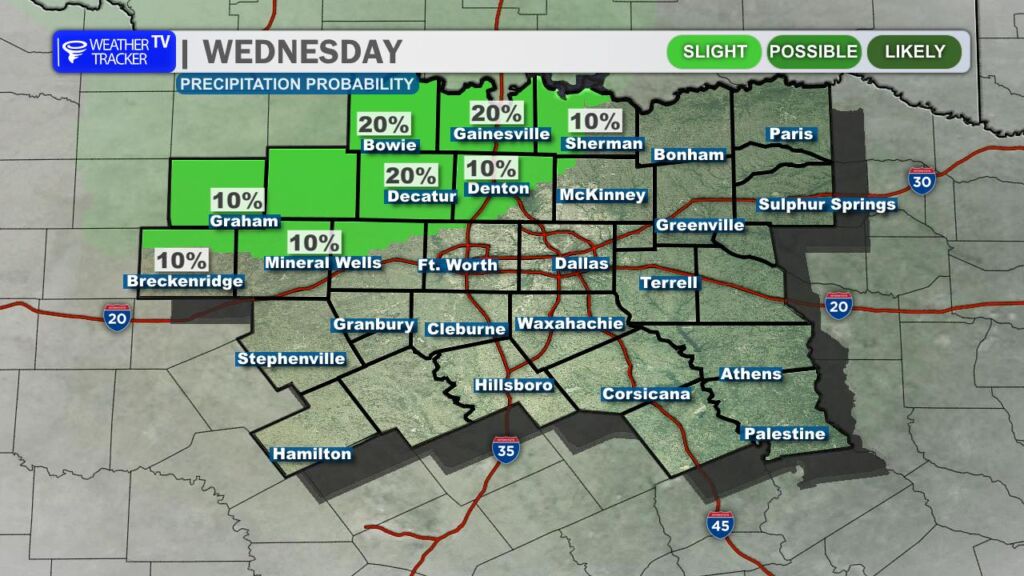
We’re also watching a few very light showers sliding south out of Oklahoma this morning. These could briefly impact parts of our northwestern counties through early afternoon. If you catch a shower or some sprinkles, it will be very light – no measurable rainfall is expected.
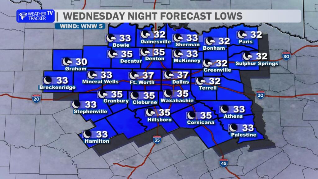
Another cold night is ahead tonight as temperatures drop back into the 30s across the region. Several locations across North Texas will dip to or just below the freezing mark by daybreak.
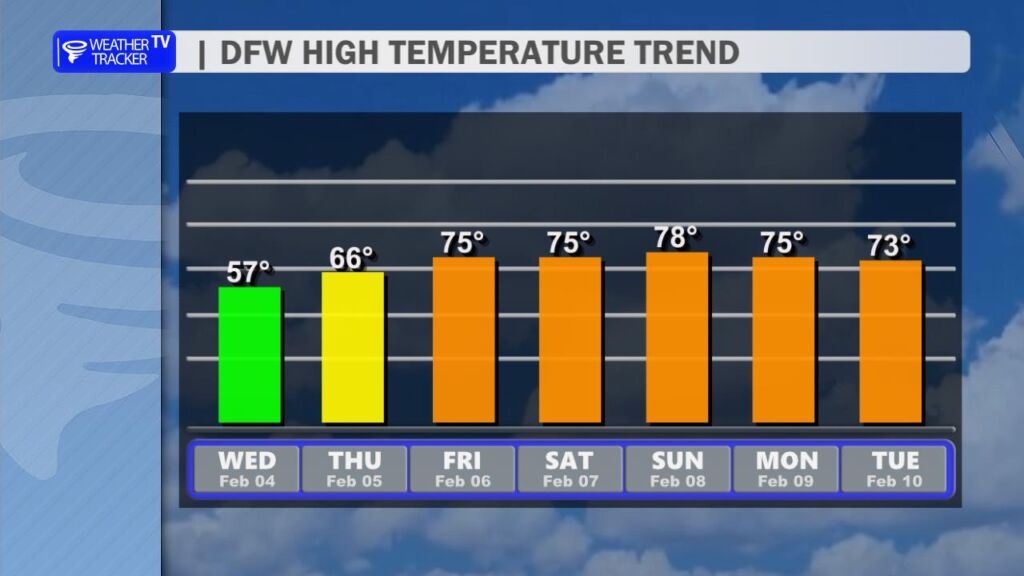
The good news comes quickly as we head toward the weekend. A strong warming trend is on the way with highs rebounding into the 70s. A few locations could even flirt with 80 degrees by the weekend.
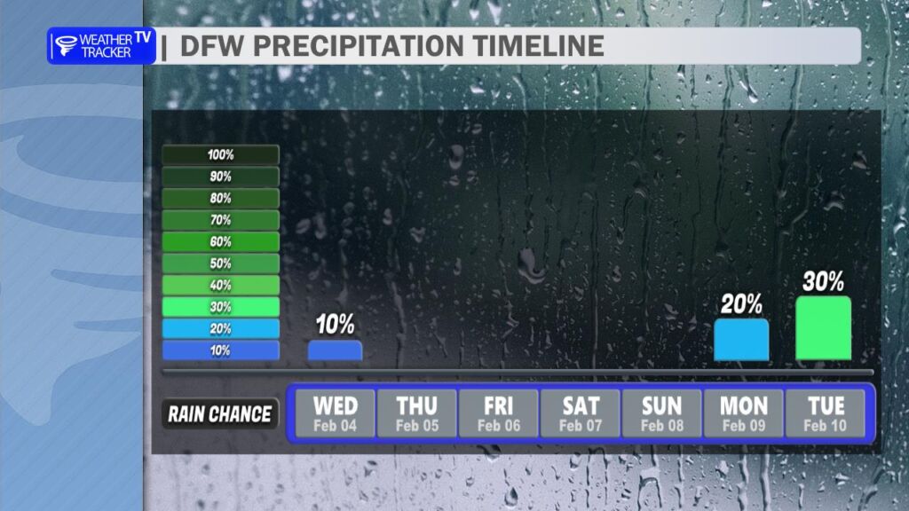
Looking ahead to next week, we continue to see signals for potential rain chances – one window appears possible Tuesday into Wednesday, with another late in the week from Thursday into Friday. At this point, the data is not in full agreement, so we’ll continue to fine tune those rain chances over the coming days.
Here is a look at Actual Lows from around North Texas this morning.

Actual Lows from around the Dallas – Fort Worth Metroplex this morning.

Here’s a look at our Wednesday planner for the DFW Metroplex.


DFW TODAY…Mostly sunny. Highs in the upper 50s. North winds 5 to 10 mph. -William


Here’s a look at our Wednesday morning commute in the DFW Metroplex.

Here’s a look at MesoScan Radar and Live Temperatures across North Texas.
DFW TODAY Mostly sunny. Highs in the upper 50s. North winds 5 to 10 mph.