Here’s a look at our Saturday morning commute in the DFW Metroplex.

Here’s a look at our Saturday morning commute in the DFW Metroplex.

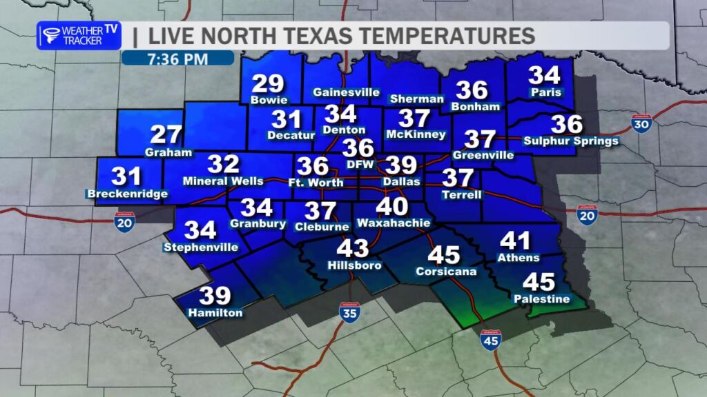
Here’s a look at MesoScan Radar and Live Temperatures across North Texas.
DFW TODAY Freezing rain and sleet. Precipitation may be heavy at times this morning. Up to one inch of sleet accumulation. Ice accumulation of up to less than two tenths of an inch. Much cooler with highs in the upper 20s. North winds 10 to 15 mph. Chance of precipitation near 100 percent. Wind chill values as low as 8 above.

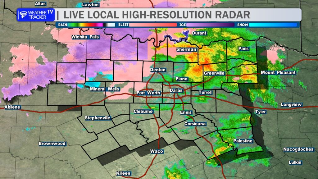
Temperatures are falling to freezing or below just northwest of Dallas–Fort Worth, with freezing rain now developing. Expect travel conditions to worsen, particularly on elevated roadways.
Take a behind-the-scenes look at North Texas weather today as Chief Meteorologist William Cole breaks down the latest models and shares an updated timeline for our winter storm.
Here’s a look at our Friday late evening planner for the DFW Metroplex.

Here is a look at Actual Highs from around North Texas today.

Actual Highs from around the Dallas – Fort Worth Metroplex today.

Today’s complete DFW Almanac.

Here’s a look at the Friday evening planner for the DFW Metroplex.


DFW TONIGHT Rain and freezing rain. Sleet after midnight. Around half an inch of sleet accumulation. Ice accumulation of up to less than two tenths of an inch. Much colder with lows in the mid 20s. Northeast winds 10 to 15 mph. Chance of precipitation near 100 percent. Wind chill values as low as 18. -William

Here’s a look at our Friday evening commute in the DFW Metroplex.

Here’s a look at Live Temperatures across North Texas, MesoScan Radar and the Updated Forecast Map.
DFW THIS AFTERNOON Rain. Patchy fog. Highs in the lower 50s. Temperatures falling into the lower 40s late. Northeast winds 10 to 15 mph. Chance of rain near 100 percent. -William
