Here’s a look at our Sunday planner for the DFW Metroplex.

Here’s a look at our Sunday planner for the DFW Metroplex.
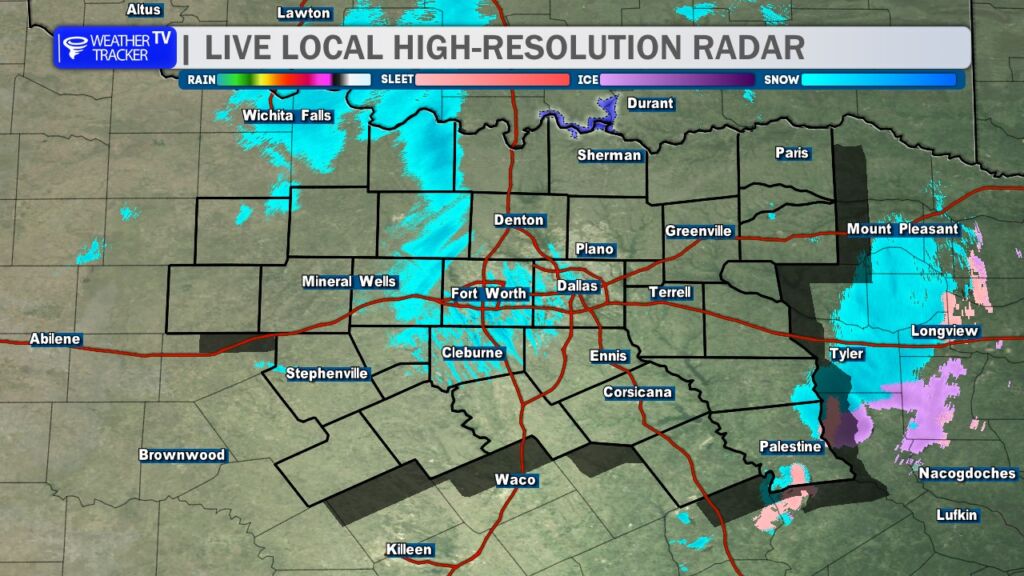
6:20 AM – Good morning. Patchy areas of light wintry precipitation continue across North Texas. Roadways are reported as slick and hazardous. Temperatures remain bitterly cold, ranging from the single digits to the teens.

DFW TODAY…Mostly cloudy. A slight chance of snow showers and sleet this morning, then a chance of flurries this afternoon. No snow or sleet accumulation expected. Cold with highs in the lower 20s. Northwest winds 10 to 15 mph. Chance of precipitation 20 percent. Wind chill values as low as 3 below. -William


Here’s a look at our Sunday morning commute in the DFW Metroplex.


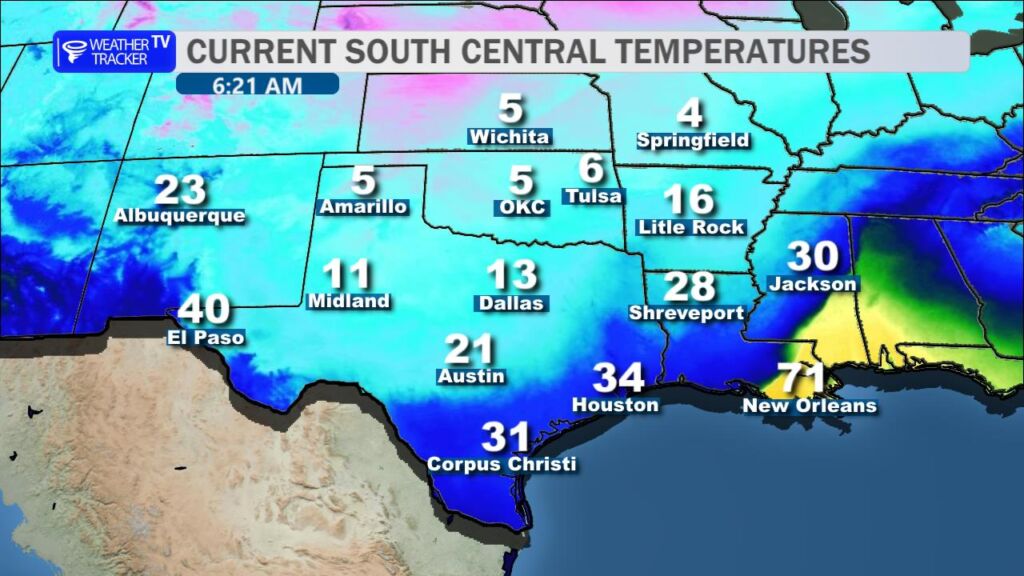
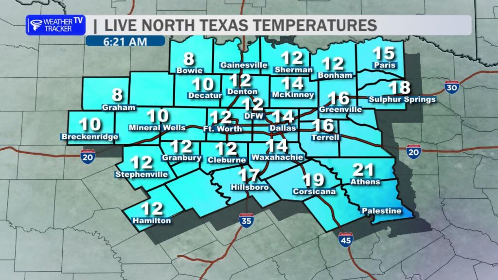
Here’s a look at MesoScan Radar and Live Temperatures across North Texas.
DFW TODAY Mostly cloudy. A chance of snow showers this morning, then a chance of flurries this afternoon. A light dusting of snow possible. Cold with highs around 19. Northwest winds 10 to 15 mph. Chance of snow 40 percent. Wind chill values as low as 2 below.

Here’s a look at our Saturday late evening planner for the DFW Metroplex.

Here is a look at Actual Highs from around North Texas today.

Actual Highs from around the Dallas – Fort Worth Metroplex today.

Today’s complete DFW Almanac.

Here’s a look at the Saturday evening planner for the DFW Metroplex.


DFW TONIGHT Sleet with a chance of freezing rain in the evening, then sleet with possible snow showers and freezing rain after midnight. Precipitation may be heavy at times after midnight. Up to one inch of snow and sleet accumulation. Ice accumulation of up to less than one tenth of an inch. Colder with lows around 14. North winds 10 to 15 mph. Chance of precipitation near 100 percent. Wind chill values as low as zero. -William

Here’s a look at our Saturday evening commute in the DFW Metroplex.
