5:40 AM- Good Tuesday morning. A few showers are redeveloping to the west of DFW this morning. There is a low/spotty 20% rain chance through the morning commute.
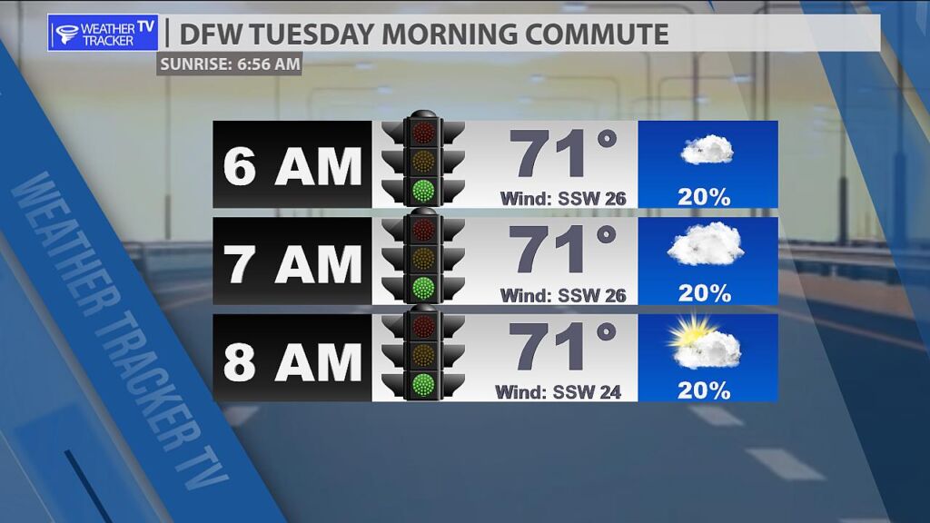
5:40 AM- Good Tuesday morning. A few showers are redeveloping to the west of DFW this morning. There is a low/spotty 20% rain chance through the morning commute.

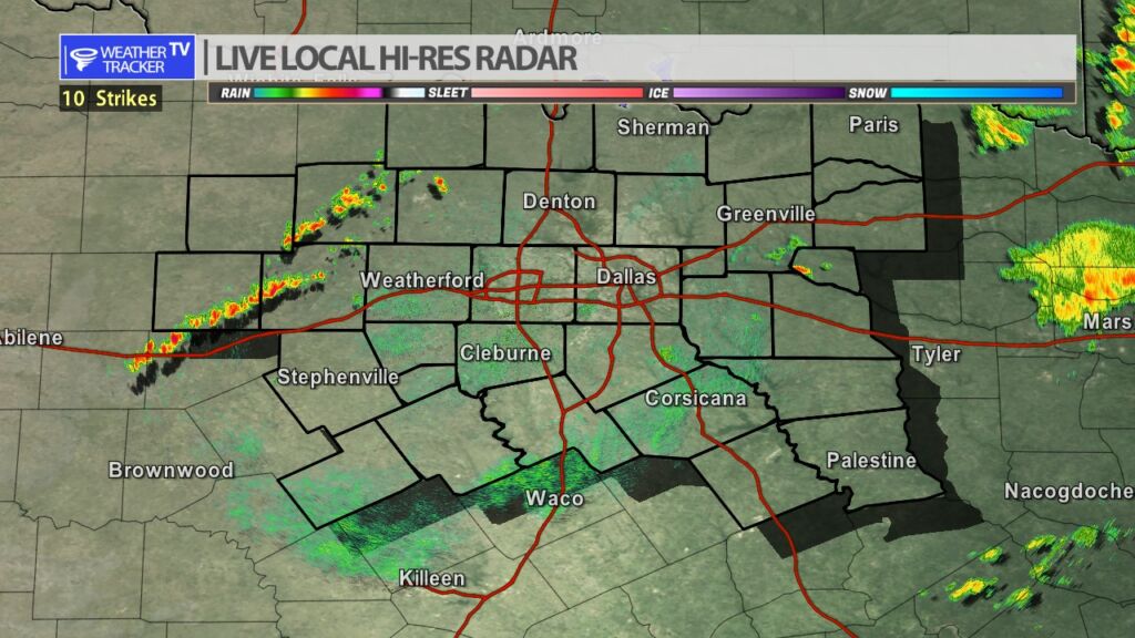
Here’s a look at Local Radar and Live Temperatures across North Texas.
DFW the rest of tonight: Mostly cloudy. A slight chance of showers and T-Storms late this evening, then a chance of showers and T-Storms. Lows in the upper 60s. South winds 15 to 20 mph. Gusts up to 30 mph. Chance of rain 30 percent.

9:15 PM- The Tornado Watch out west has expired. A few showers remain across North Texas. Isolated T-Storms out in the Big County. Widely scattered showers remain possible overnight. -William

William’s North Texas Hazardous Weather Forecast this Evening:
T-Storms are possible late this afternoon into tonight mainly across western North Texas. A few strong to severe storms are possible, especially west of I-35 and north of I-20. Hail and gusty winds will be the primary hazards with a low, but non-zero, tornado threat.
Here’s a look at our Monday late evening planner for the DFW Metroplex.

Here is a look at Actual Highs from around North Texas today.

Actual Highs from around the Dallas – Fort Worth Metroplex today.

Today’s complete DFW Almanac.

5:20 PM- Watching a few T-Storms going up along the dryline in the Big Country. Moving ENE 35. We’ll keep our eyes on those this evening IF they are able to hold together long enough to make a run toward North Texas.
Here’s a look at the Monday evening planner for the DFW Metroplex.

DFW tonight Mostly cloudy with a 40 percent chance of showers and T-Storms. Lows in the upper 60s. Southeast winds 10 to 20 mph, becoming south 15 to 20 mph after midnight. Gusts up to 30 mph. -William


Here’s a look at our Monday evening commute in the DFW Metroplex.
