Here’s a look at our Thursday evening commute in the DFW Metroplex.

Here’s a look at our Thursday evening commute in the DFW Metroplex.

Here’s a look at Live Temperatures across North Texas, Local Radar and the Updated Forecast Map.
DFW this afternoon Mostly cloudy with a 50 percent chance of showers and T-Storms. Some T-Storms may be severe. Highs in the mid 80s. Southwest winds around 10 mph. -William


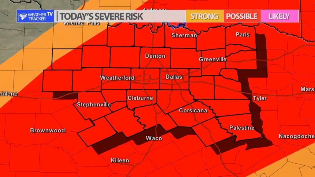
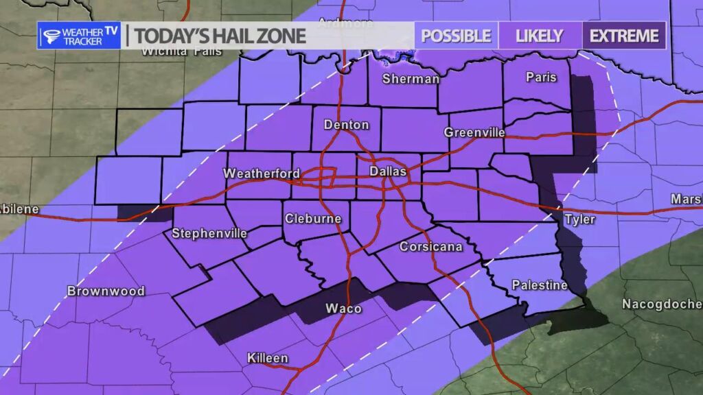
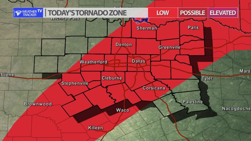
The risk of severe weather returns to North Texas later this afternoon as a cold front pushes into the area. A broken line of thunderstorms develops along the cold front around 3 PM. The cold front at that point and time will be near or just over the DFW Metroplex. Severe weather may be quite possible during the evening commute in the Metroplex. The primary concern is large damaging hail and wind gusts up to 60 MPH. The broken line of storms shifts south and southeast through the evening.


Here is a look at Actual Lows from around North Texas this morning.

Actual Lows from around the Dallas – Fort Worth Metroplex this morning.


William’s North Texas Hazardous Weather Forecast for Thursday:
Scattered T-Storms will accompany a cold front this afternoon and evening. A few storms may become severe with large hail and damaging winds.
Here’s a look at our Thursday planner for the DFW Metroplex.


DFW today Mostly cloudy. Patchy fog this morning. A 40 percent chance of showers and T-Storms this afternoon. Highs in the upper 80s. South winds 5 to 10 mph. -William

Here’s a look at our Thursday morning commute in the DFW Metroplex.
