

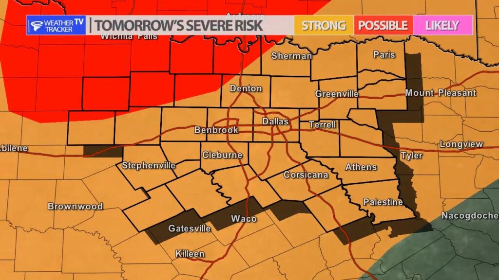
The risk of severe weather returns to the Southern Plains and North Texas tomorrow (Thursday) into Friday. A strong upper level storm system approaches the area tomorrow, and a dryline will form well to the west of North Texas. There is a slight chance of a few storms developing. The “cap” or what limits thunderstorm activity will be relatively strong – so a few storms or no storms may form. Any activity will be west and northwest of Dallas – Fort Worth. The primary concern tomorrow is hail up to the size of golf balls.
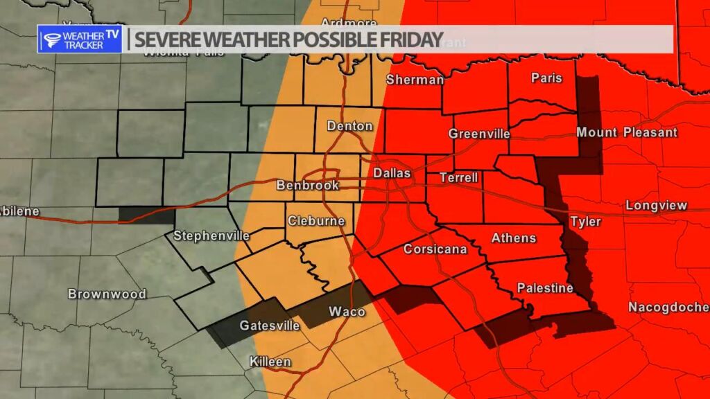
Early Friday morning a cold front from the same storm system arrives in the area. It appears storms will develop between 7 AM and 10 AM in the DFW Metroplex and then push off to the east through the late morning and early afternoon. Any activity on Friday could be severe with a hail and wind threat. A tornado warning – especially east of DFW can’t be ruled out.


William’s North Texas Hazardous Weather Forecast for Wednesday:
Isolated T-Storms will be possible this morning across portions of Central Texas. Lightning will be the primary hazard.
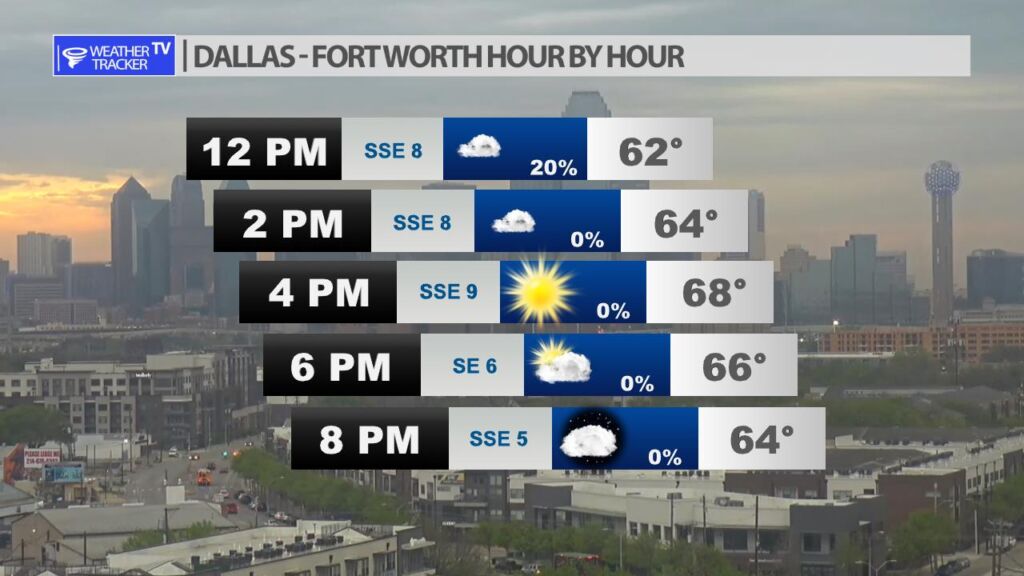
Scattered showers are possible this morning in the Metroplex, but probabilities taper off quickly after 12 PM. Metroplex temperatures this afternoon will bounce into the mid to upper 60s.
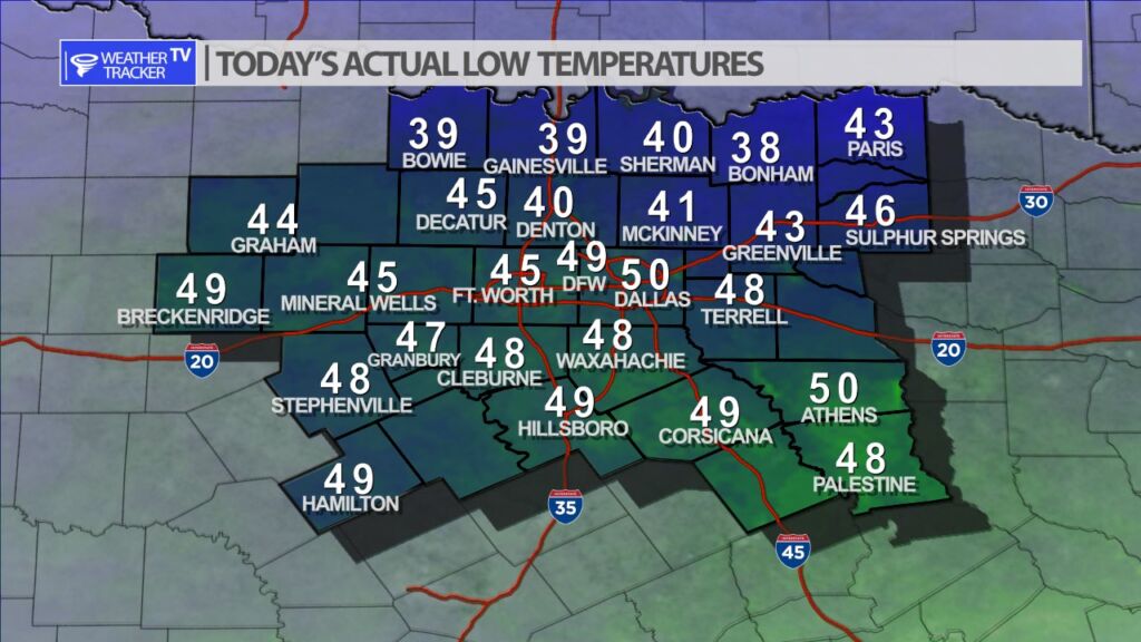
It was another chilly start to the morning across North Texas. Actual morning lows were wide ranging from 30s along the Red River Valley to around 50 at Dallas Love Field.
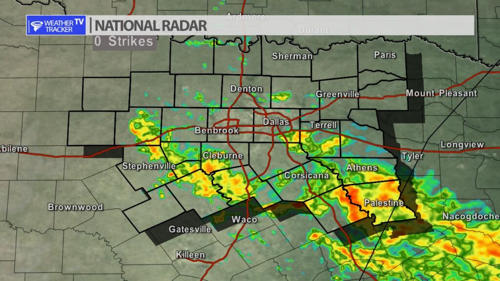
Very light scattered showers continue across North Texas this morning. Rainfall rates are very light and will only amount to few hundredth to a tenth of an inch in the rain gauge. Roadways may be damp for the morning commute.


DFW today Partly sunny. A 30 percent chance of showers this morning. Highs in the upper 60s. Southeast winds 5 to 10 mph. -William
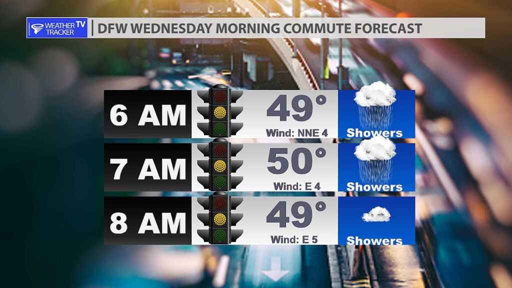
It’s a chilly start to this Wednesday morning commute with Metroplex temperatures around 50. Roadways may be damp from light scattered showers. Winds remain light.