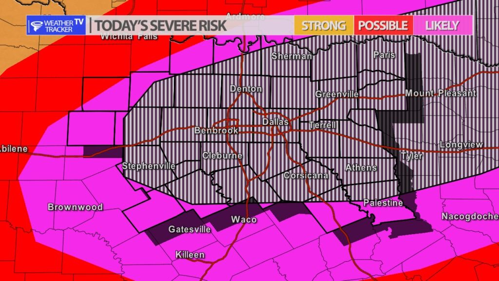
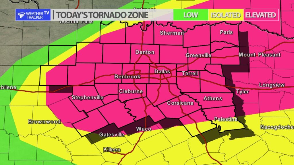
From William Cole: A Severe T-Storm Warning has been issued in the Weather Tracker TV DFW coverage area for Grayson County in North Texas until 3:45 PM.
At 240 PM , a severe T-Storm was located near Lake Kiowa, or near Whitesboro, moving northeast at 45 mph.
Hometowns Impacted: Sherman, Whitesboro, Denison, Pottsboro, Collinsville, Randell Lake, Eisenhower State Park, Lake Texoma, Preston, Southmayd, Sadler, Dixie, Locust, Gordonville, Sandusky And Sherwood Shores.
Primary Threats: 60 Mph Wind Gusts And Half Dollar Size Hail.
Stay with William Cole and Weather Tracker TV Dallas – Fort Worth for continuing coverage, online, on our app and on TV. Let’s stay safe together.