Here’s a look at Live Temperatures across North Texas, Local Radar and the Updated Forecast Map.
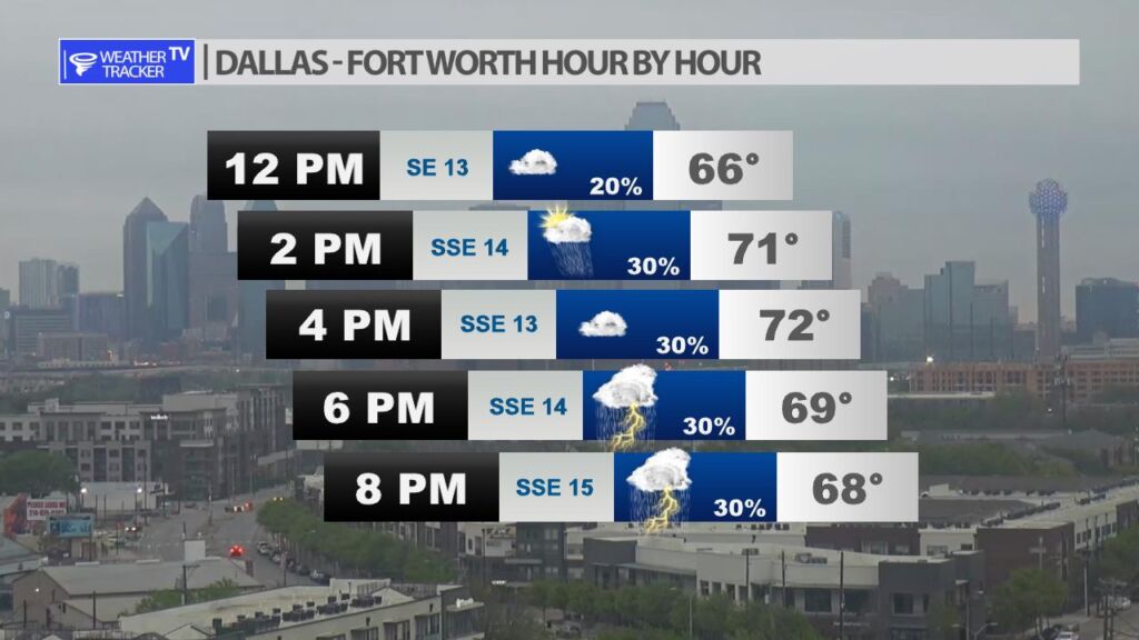
DFW this afternoon Cloudy with a chance of showers with a slight chance of T-Storms. Highs in the lower 70s. South winds 15 to 20 mph with gusts up to 30 mph. Chance of rain 50 percent. -William
It’s opening day for the Texas Ranger with first pitch just after 3 PM. Scattered showers and a few T-Storms will be possible this afternoon with temperatures near 70. Luckily, Globe Life Field has a roof if it needs to be closed.
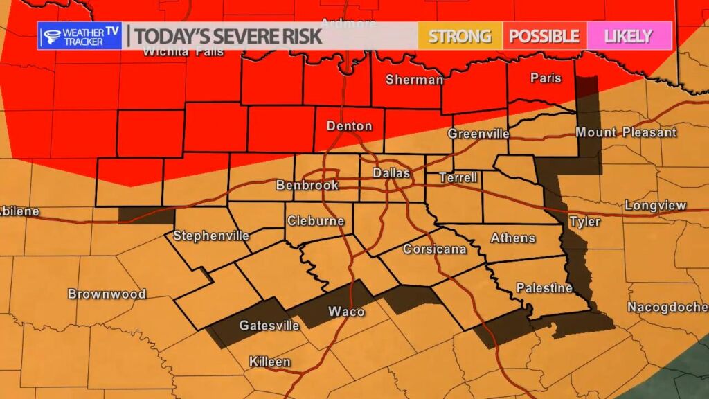
The risk of severe weather returns to North Texas today and tomorrow as a strong upper level storm system approaches from the west. Today scattered showers and a few T-Storms are possible – it’s essentially a 30% probability through the day of scattered activity. A few of the storms could be severe with a half dollar sized hail threat. A few showers are also possible overnight.
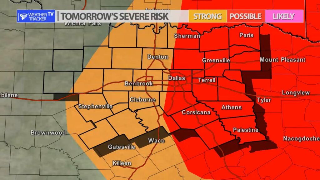
Friday as a cold front moves across the area – storms will try and form from the I-35 corridor to the east. It’s a 40% probability in the Metroplex. There is a better opportunity in our eastern and southeastern counties. Any activity on Friday will organize into a line of storms and push southeast. Severe weather is possible with a half dollar sized hail and winds to 60 MPH threat.
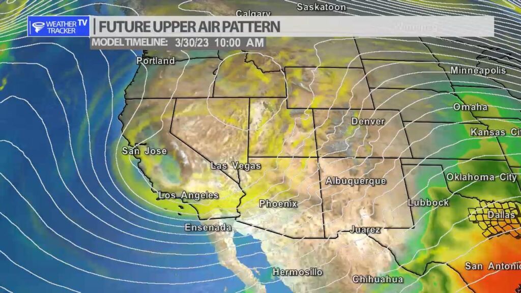
Tap to play future radarStrong upper level storm system approaching the Great Plains.