DFW tonight Cloudy with a 50 percent chance of showers and T-Storms. Lows around 50. North winds 5 to 10 mph. -William

DFW tonight Cloudy with a 50 percent chance of showers and T-Storms. Lows around 50. North winds 5 to 10 mph. -William

Here’s a look at Live Temperatures across North Texas, Local Radar and the Updated Forecast Map.
DFW REST OF today Patchy fog late this morning. Cloudy with a 50 percent chance of showers and T-Storms. Highs in the upper 60s. South winds 5 to 10 mph, becoming west this afternoon. -William


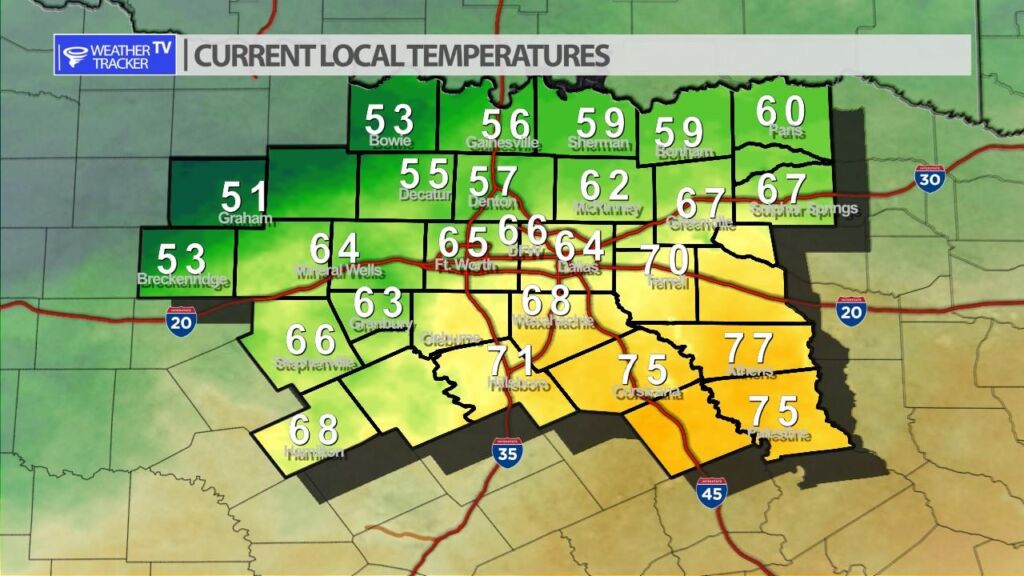
Big contrast in temperatures this afternoon across North Texas. 50s near the Red River to 70s in our southeastern counties. A cold front moves back through the area this afternoon and will be the focus of scattered T-Storms.


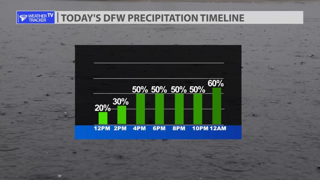
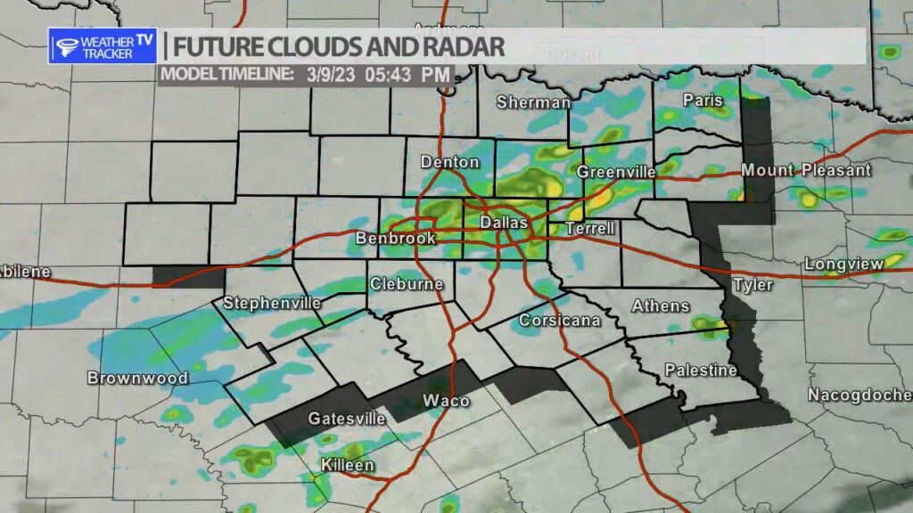
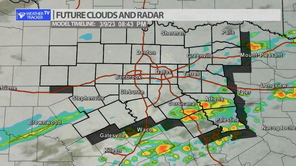
Rain and T-Storm chances returns later this afternoon and tonight as a cold front moves back through the area. After 3 PM this afternoon scattered showers and a few T-Storms will be possible in the Metroplex. Rain chances spread into our southern counties near the front by late afternoon and early evening. The activity will still be scattered so not everyone will see rain. A couple of isolated severe storms can’t be ruled out with a quarter sized hail threat.
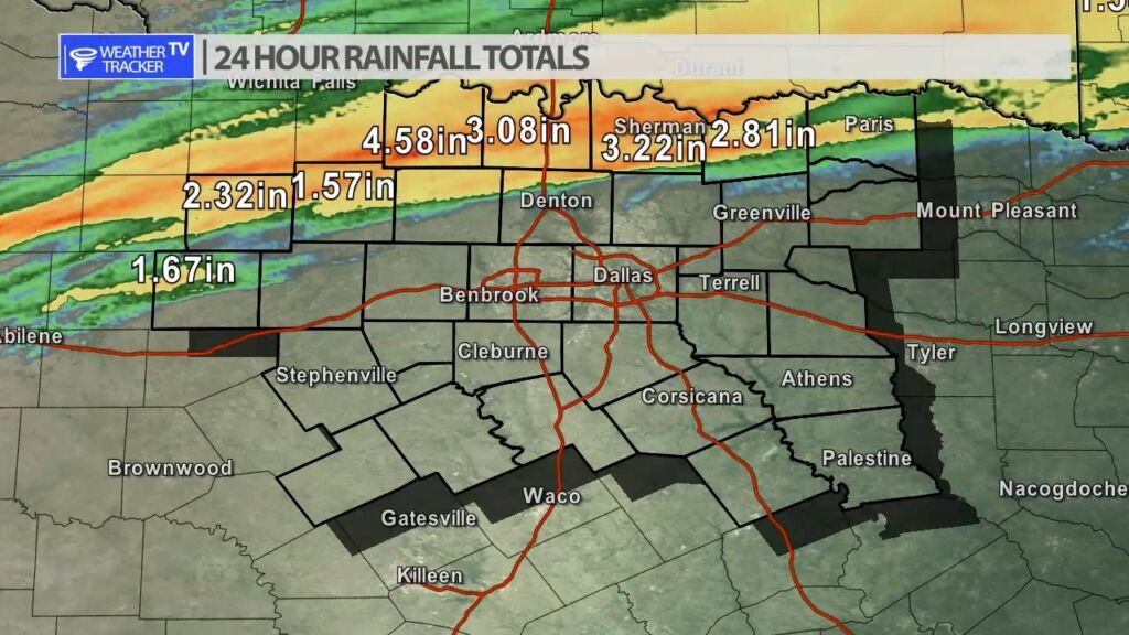
Areas along the Red River Valley in our northern counites received several rounds of rain and T-Storms yesterday evening and overnight. Rainfall totals were quite generous with 2″ – 4″ being common. A Flash Flood Warning was issued overnight at one point for Grayson county.


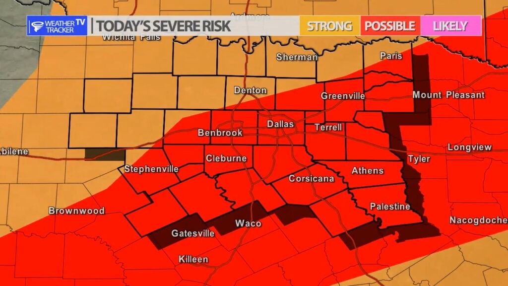
William’s North Texas Hazardous Weather Forecast for Thursday:
Isolated T-Storms are possible today across North Texas with more widespread T-Storms expected tonight across much of the area. The severe threat is low, but a few storms may be able to produce small to marginally severe hail and heavy rain.


DFW today Areas of fog this morning. Mostly cloudy with a 50 percent chance of showers and T-Storms. Highs in the upper 60s. Southeast winds 5 to 10 mph, becoming west this afternoon. -William