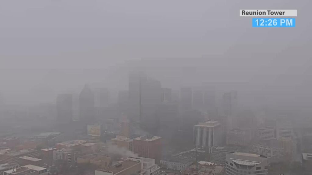
It’s cloudy in the Metroplex for your lunch hour with areas of drizzle. Temperatures have not moved much through the 50s.
It’s cloudy in the Metroplex for your lunch hour with areas of drizzle. Temperatures have not moved much through the 50s.
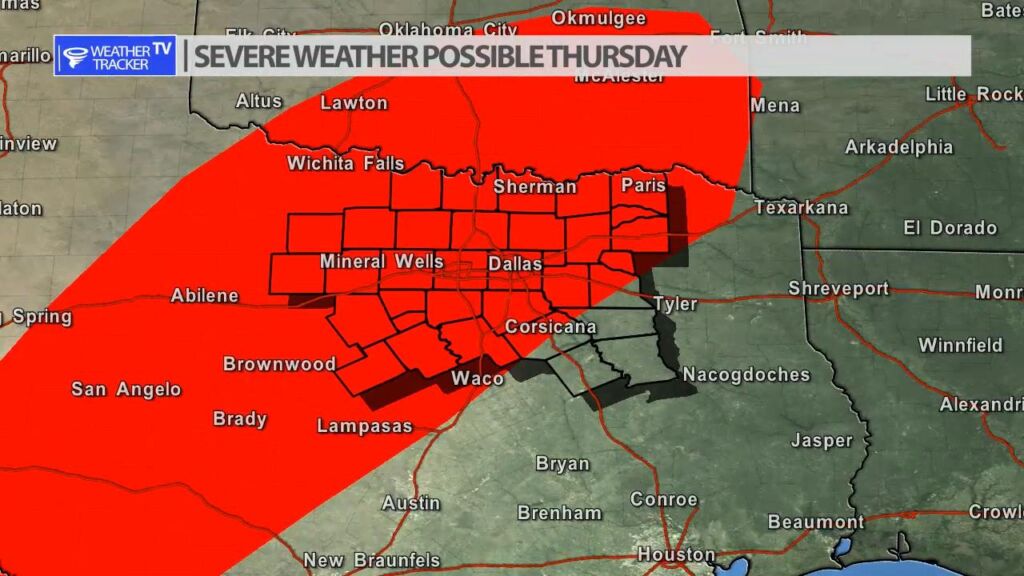
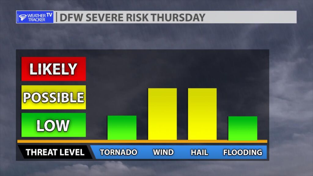
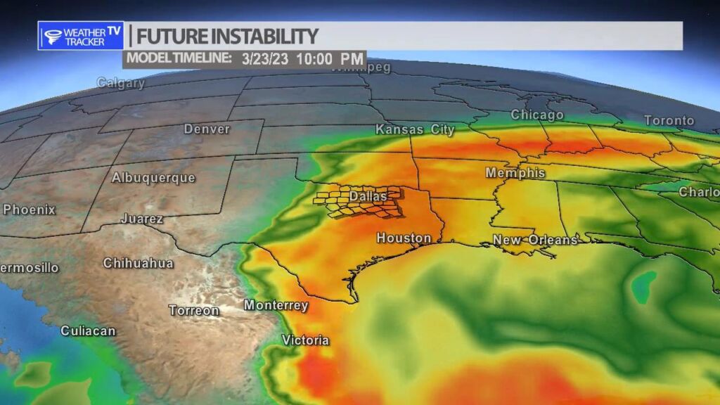
We are still tracking a risk of severe weather on Thursday. As a strong upper level storm system and cold front meet warm and humid air over the southern plains. A dryline will set up out in the Big Country and our western counties. It will be the focus of late afternoon storms. Large hail will be the threat during that time. A cold front will eventually arrive from the north and a broken line of storms will sweep across the area. A damaging wind threat will develop with the line of storms. A tornado warning or two can’t be ruled out.


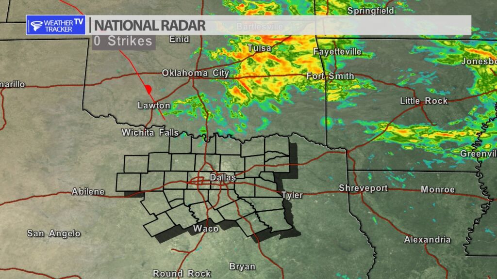
Large area of rain is ongoing up in Oklahoma. A few very light showers have been possible this morning along the Red River Valley. A light showers will remain possible this today – mainly from I-35 east.
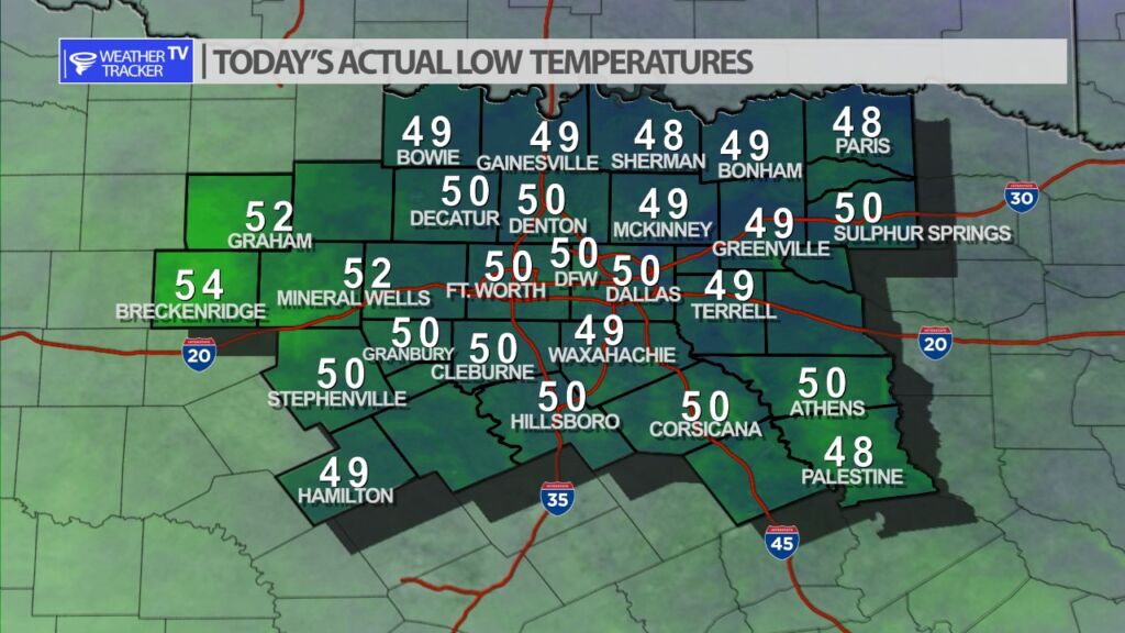
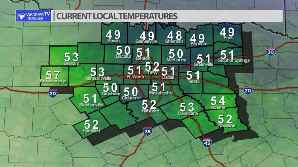
It was chilly but not as cold this morning with actual lows across North Texas right around 50 in most locations.

William’s North Texas Hazardous Weather Forecast for Tuesday:
No hazardous weather is expected at this time.


DFW today Mostly cloudy. A 20 percent chance of showers this morning. Not as cool with highs in the upper 60s. South winds 15 to 20 mph. Gusts up to 30 mph this afternoon. -William
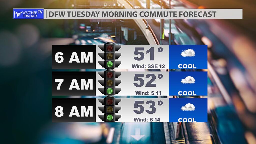
Expect a cool and breezy Tuesday morning commute in the Metroplex. An isolated light shower or drizzle is possible.