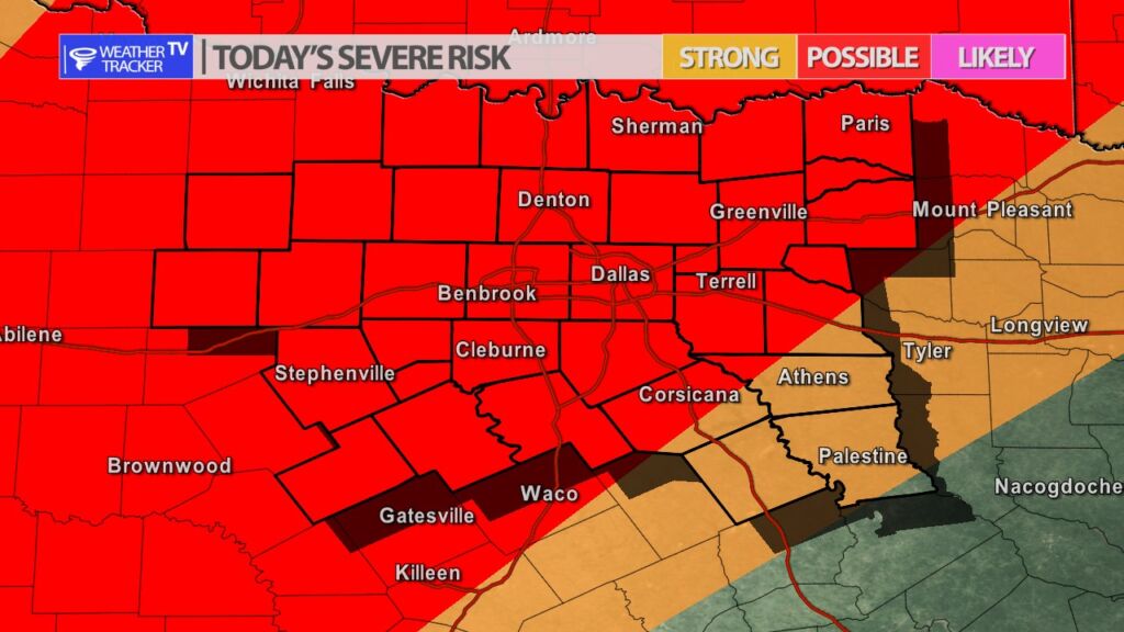
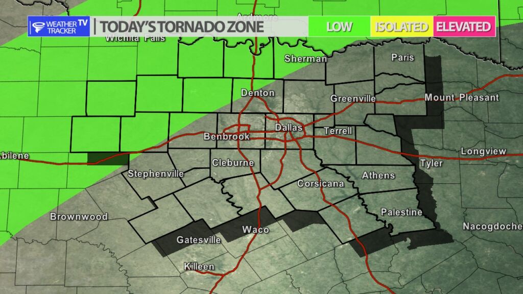
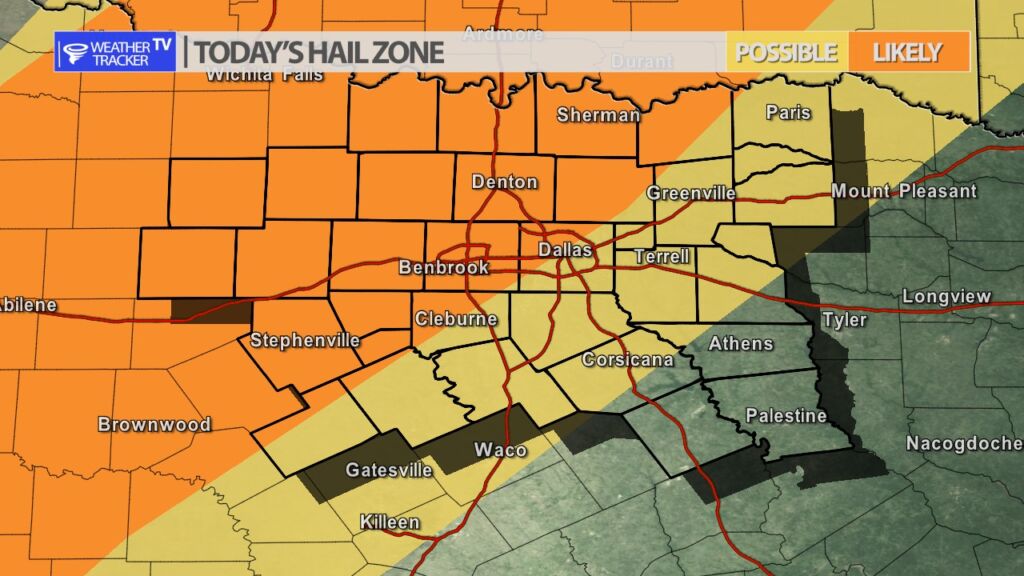
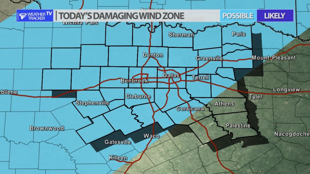
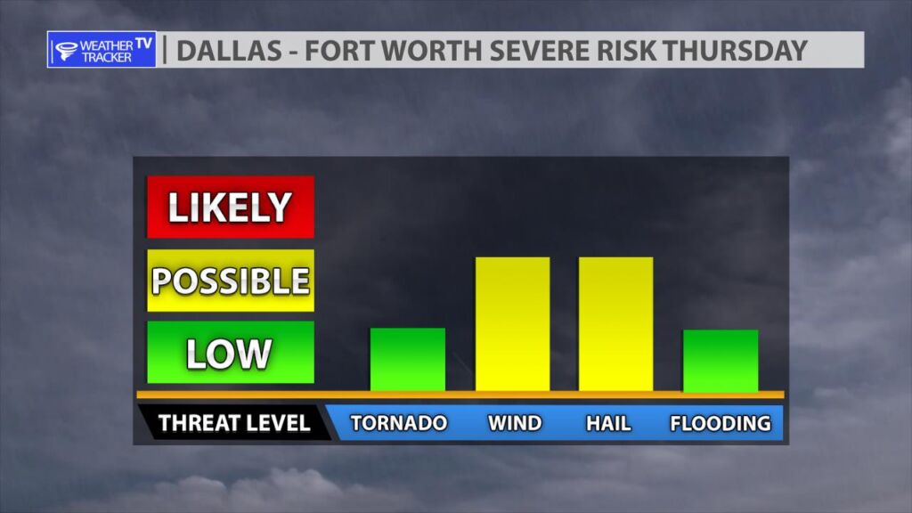
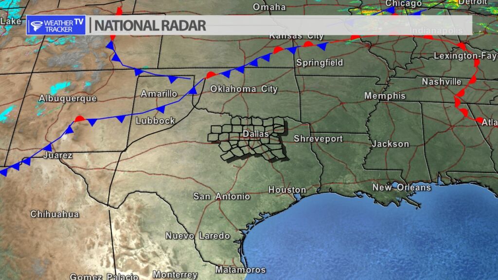
Severe Risk Later Today and Tonight

The risk of severe weather returns to North Texas later today, tonight and tomorrow morning. A strong upper level storm system is approaching the area from the west. A cold front and dryline is also setting up across the region. A few storms will be possible late this afternoon in our NW counties however, the main activity is expected overnight as a line of storms forms after midnight and pushes across the area. The storm timeline for the DFW Metroplex is 4 AM – 9 AM early Friday morning. Hail and wind will be the primary concerns with any activity. The tornado threat is low, but not zero.

Tap to play future radar.
A cold front is approaching from the north with a dryline coming in from the west.