
Here’s a look at Live Temperatures across North Texas, Local Radar and the Updated Forecast Map.
DFW this afternoon Mostly sunny. Highs in the lower 70s. Northeast winds 5 to 10 mph. -William


Here’s a look at Live Temperatures across North Texas, Local Radar and the Updated Forecast Map.
DFW this afternoon Mostly sunny. Highs in the lower 70s. Northeast winds 5 to 10 mph. -William


The risk of severe weather returns to the Sothern Plains Thursday into Friday. Another strong upper level storm system comes out of the Pacific west this week. Thursday a dryline will set up in West Texas and parts of the Big Country. The newest data today shows most of the activity on Thursday may stay west of North Texas. Then Thursday night into Friday as a cold front moves through the area there may be a better opportunity of rain, storms and severe weather in North Texas. The details are still a little murky as they typically are when you’re talking about severe weather several days in advance. We’ll keep you up to date as this forecast evolves over the next day or two.


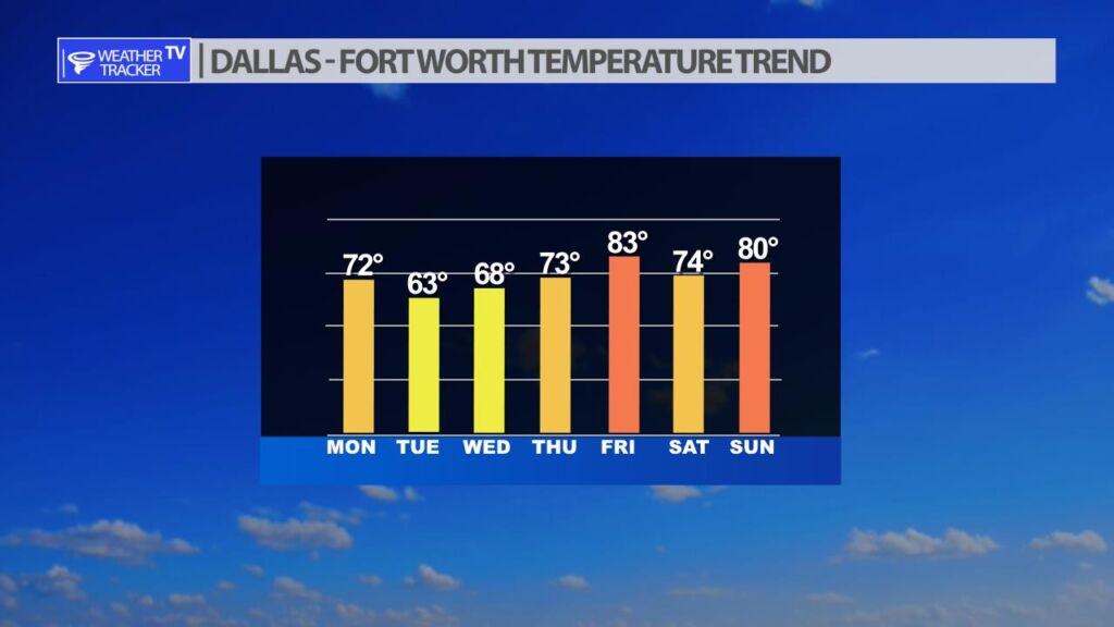
A windy cold front arrives in North Texas predawn tomorrow (Tuesday) morning with gusty north winds – winds may gust over 30 MPH through Noon. This front will not have a blast of cold air with it, but it will edge our temperatures back for Tuesday and Wednesday into the 60s.

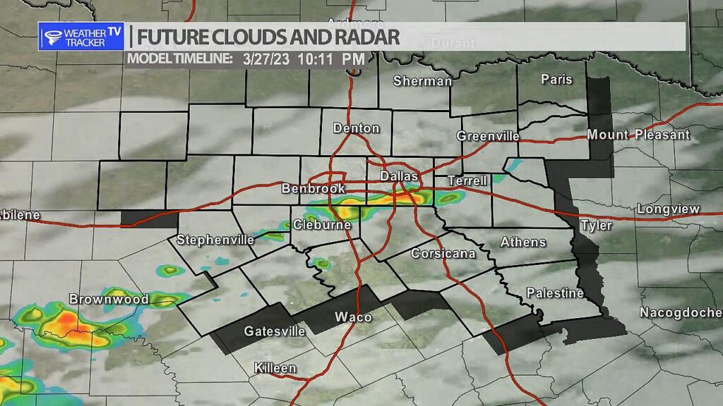
A few very light showers will be possible later today and this evening. The airmass is very dry (not a lot of humidity) so any showery activity will be very light. The most likely area to see activity is from I-20 to the south.


William’s North Texas Hazardous Weather Forecast for Monday:
Isolated to scattered showers and T-Storms are possible primarily south of I-20 later this evening into tonight.
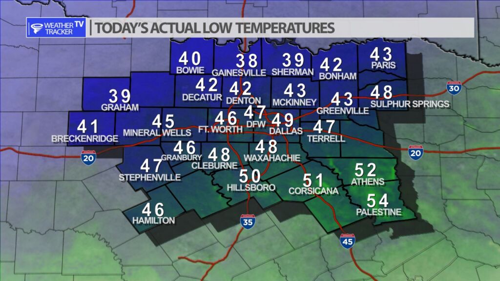
It was a chilly to cool start to the morning across North Texas. Actual morning lows ranged from the 30s along the Red River Valley to the mid 50s in our southeastern counties.


DFW today Mostly sunny. Highs in the lower 70s. Northeast winds 5 to 10 mph. -William