

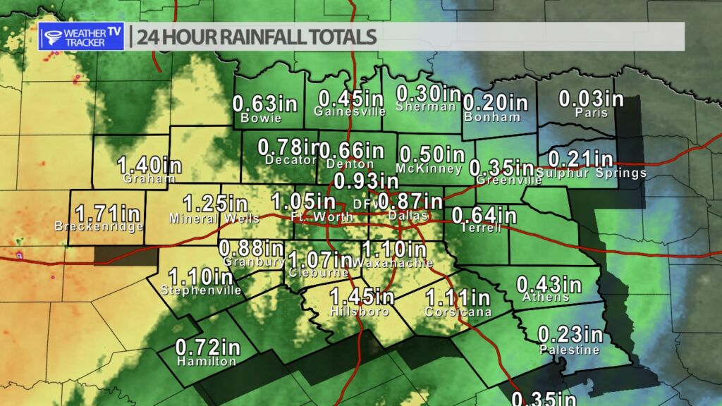
Radar estimated rainfall totals as of 8 AM (for this second wave of rain which started late last night night and now this morning). Totals are most impressive out west. Eastern counties will receive more as the day moves along.

William’s North Texas Hazardous Weather Forecast for Saturday:
Areas of rain and embedded T-Storms will continue across much of North and Central Texas today. Locally heavy rainfall and minor flooding will be the main threat, particularly east of I-35 through early afternoon. The strongest storms will produce frequent lightning and perhaps some small hail.
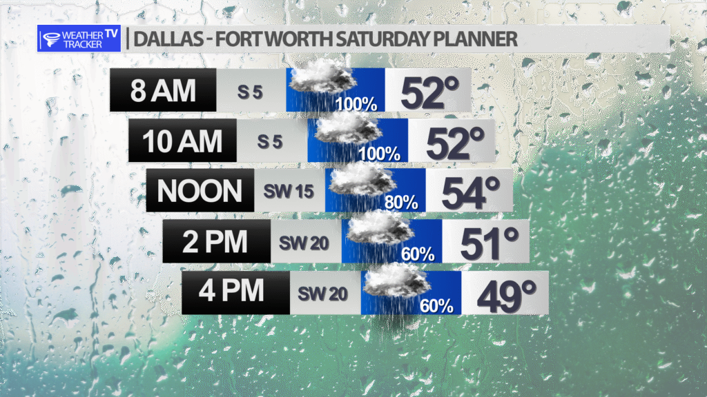
Expect a soggy Saturday in the Metroplex. Rain is likely this morning but it will taper off to lighter showers with drizzle this afternoon.


DFW today Showers and perhaps an isolated T-Storm this morning, then a slight chance of showers this afternoon. Highs in the mid 50s. Northwest winds 5 to 10 mph, becoming west 10 to 15 mph this afternoon. Chance of rain near 100 percent. -William

Here’s a look at Local Radar and Live Temperatures across North Texas.
DFW the rest of tonight: A slight chance of showers and T-Storms late this evening, then showers with a chance of T-Storms. Patchy fog. Locally heavy rainfall possible. Lows in the lower 50s. Northeast winds 5 to 10 mph. Chance of rain near 100 percent.


William’s North Texas Hazardous Weather Forecast this Evening:
Showers and T-Storms will increase in coverage overnight across all of North and Central Texas. Locally heavy rainfall could cause minor flooding of low lying areas, particularly east of I-35 late tonight into early Saturday morning.
DFW tonight A chance of showers in the evening, then showers with a chance of T-Storms after midnight. Patchy fog after midnight. Lows in the lower 50s. Northeast winds 5 to 10 mph. Chance of rain near 100 percent. -William
