William’s North Texas Hazardous Weather Forecast this Evening:
No hazardous weather is expected at this time.
William’s North Texas Hazardous Weather Forecast this Evening:
No hazardous weather is expected at this time.

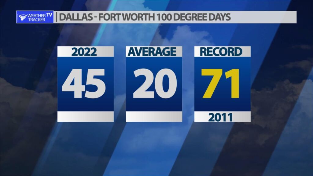
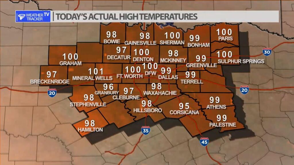
We added another 100 degree day for DFW to the tally for 2022. Several other locations around North Texas also touched the 100 degree mark this afternoon.
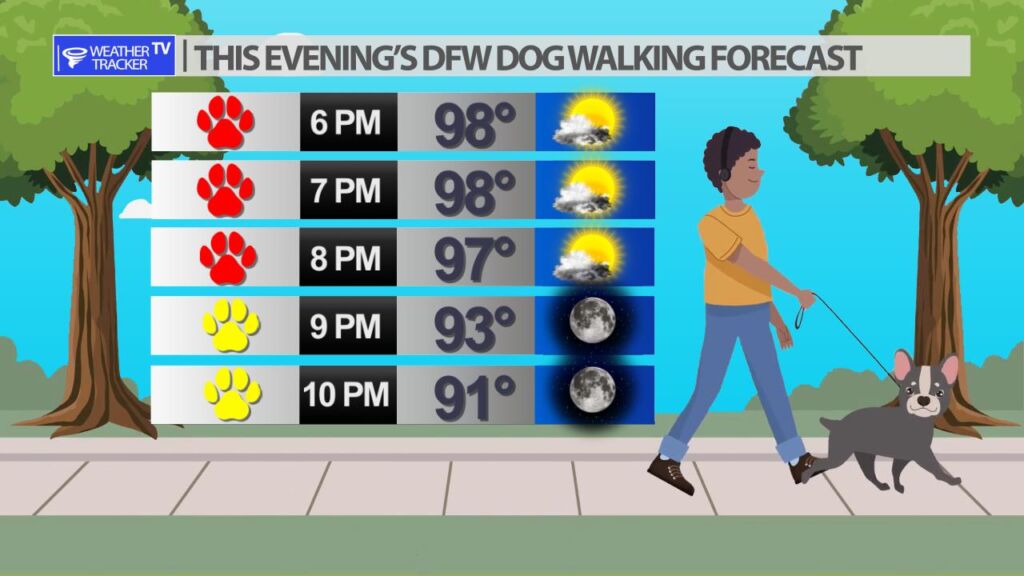
It’s going to be a fairly typical hot and dry August evening across North Texas.
DFW tonight Partly cloudy. Lows around 80. South winds around 5 mph. -William


From William Cole: A Air Quality Alert has been issued for the following counties in North Texas until Tuesday August 16. Collin, Dallas, Denton, Ellis, Henderson, Hunt, Johnson, Kaufman, Parker, Rockwall, Tarrant & Wise.
OZONE ACTION DAY The Texas Commission on Environmental Quality (TCEQ) has issued an Ozone Action Day for the Dallas-Fort Worth area for Tuesday, August 16, 2022. Atmospheric conditions are expected to be favorable for producing high levels of ozone air pollution in the Dallas-Fort Worth area on Tuesday. You can help prevent ozone pollution by sharing a ride, walking, riding a bicycle, taking your lunch to work, avoiding drive-through lanes, conserving energy, and keeping your vehicle properly tuned. For more information on ozone: Ozone: The Facts (www.tceq.texas.gov/goto/ozonefacts) Air North Texas: (www.airnorthtexas.org) EPA Air Now (www.airnow.gov/index.cfm?action.local_state&STATEID=45&TAB=0) Take care of Texas (www.takecareoftexas.org) North Central Texas Council of Governments Air Quality (www.nctcog.org/trans/air/index.asp)
Stay with William Cole and Weather Tracker TV Dallas – Fort Worth for continuing coverage online, on our free mobile app and on TV thru Roku, Apple and Amazon Fire TV.

Here’s a look at Live Temperatures across North Texas, Local Radar and the Updated Forecast Map.
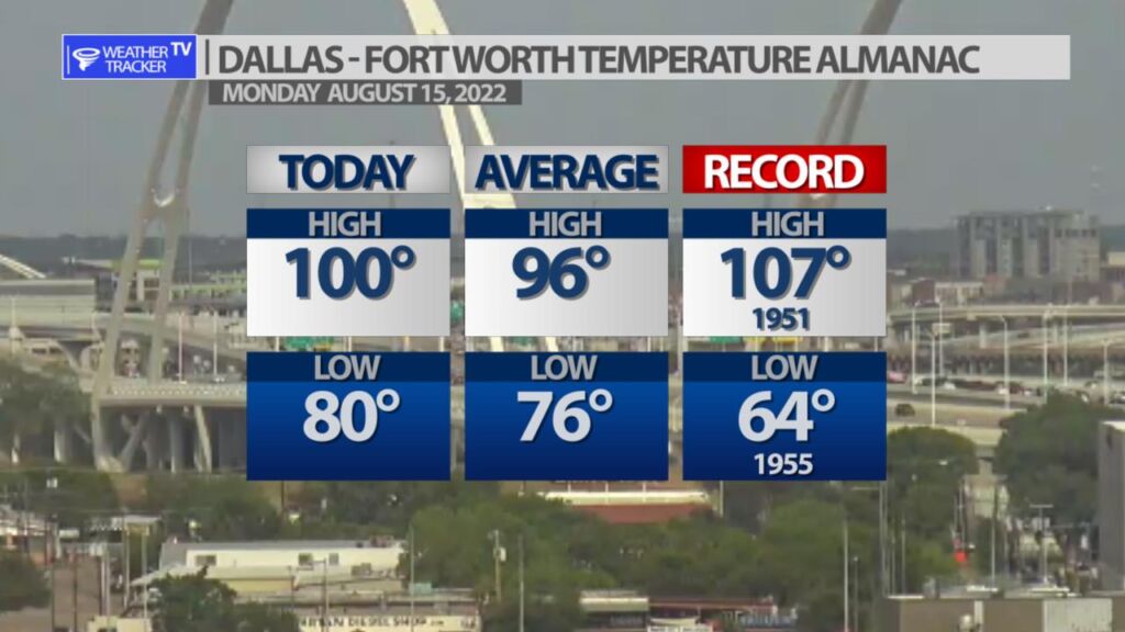
DFW this afternoon Mostly sunny. Hot with highs around 100. South winds 5 to 10 mph. -William


From the National Hurricane Center:
For the North Atlantic Caribbean Sea and the Gulf of Mexico:Central Atlantic Ocean:Cloudiness and showers associated with a broad trough of lowpressure located several hundred miles south-southeast of Bermudaremain disorganized. Environmental conditions are forecast toremain unfavorable, and significant development of this system isnot expected. The disturbance is forecast to move slowlynorth-northwestward or northward during the next couple of days.* Formation chance through 48 hours low near 0 percent.* Formation chance through 5 days low near 0 percent.Forecaster Brown
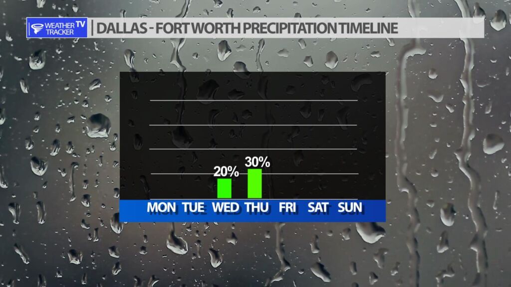
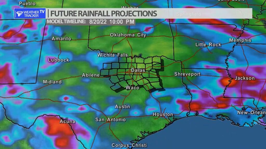
Rain chances return to North Texas Wednesday and Thursday as a summer cold front arrives in the area, and it will be the focus of scattered and storms. The coverage looks pretty spotty now, but this pattern lingers into next week with more off and on rain chances.