
Here’s a look at Live Temperatures across North Texas, Local Radar and the Updated Forecast Map.
DFW this afternoon Partly sunny. Hot with highs around 101. South winds around 5 mph. Heat index values up to 105. -William


Here’s a look at Live Temperatures across North Texas, Local Radar and the Updated Forecast Map.
DFW this afternoon Partly sunny. Hot with highs around 101. South winds around 5 mph. Heat index values up to 105. -William

From the National Hurricane Center:
For the North Atlantic Caribbean Sea and the Gulf of Mexico:Southwestern Gulf of Mexico:A tropical wave currently located over the southwestern CaribbeanSea is forecast to move across Central America during the nextfew days and emerge over the Bay of Campeche, where an area of lowpressure could form on Friday. Some gradual development of thissystem is possible while it moves northwestward over thesouthwestern Gulf of Mexico through the weekend.* Formation chance through 48 hours low near 0 percent.* Formation chance through 5 days low 20 percent.Forecaster Brown/Bucci
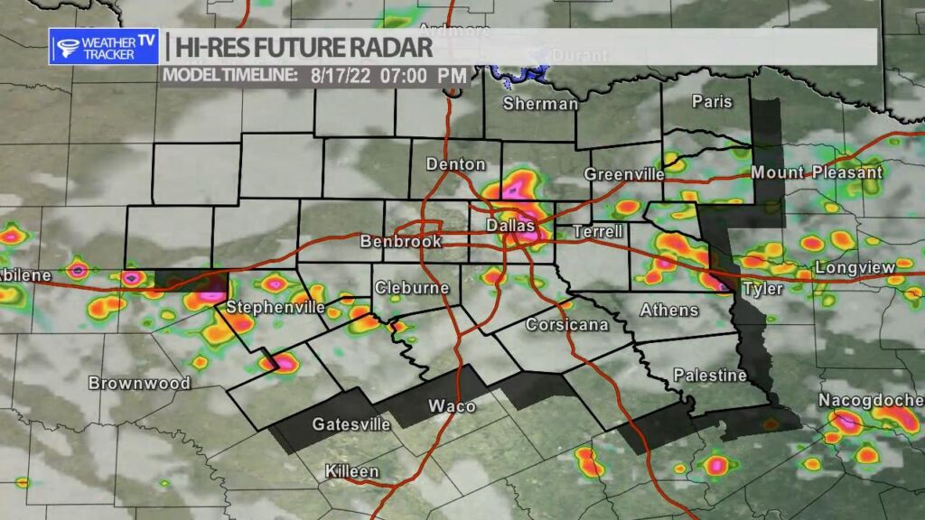
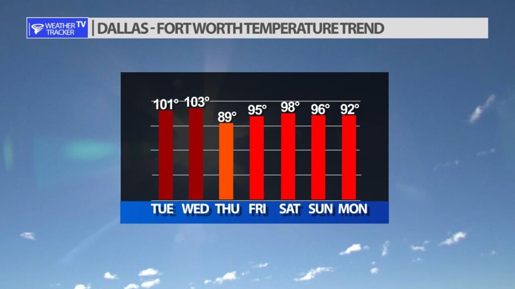
A strong summer cold front arrives in North Texas tomorrow bringing storm chances and less hot temperatures. The front moves into North Texas from Oklahoma as we go through the day on Wednesday. By late day it will be near the I-20 corridor. Storms will develop during peak daytime heating. Any storms that form will have an opportunity of heavy downpours, vivid lightning and gusty wind. Temperatures tend down for Thursday behind the front with highs in the upper 80s.


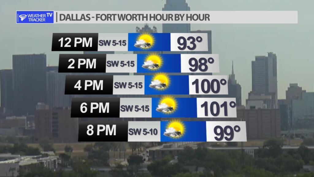
Expect another hot and dry afternoon in the Metroplex with a high around 101.


William’s North Texas Hazardous Weather Forecast for Tuesday:
No hazardous weather is expected at this time.


DFW today Partly sunny. Hot with highs around 101. Southwest winds 5 to 10 mph. -William

Here’s a look at Local Radar and Live Temperatures across North Texas.
DFW the rest of tonight: Partly cloudy. Lows around 80. South winds around 5 mph.
