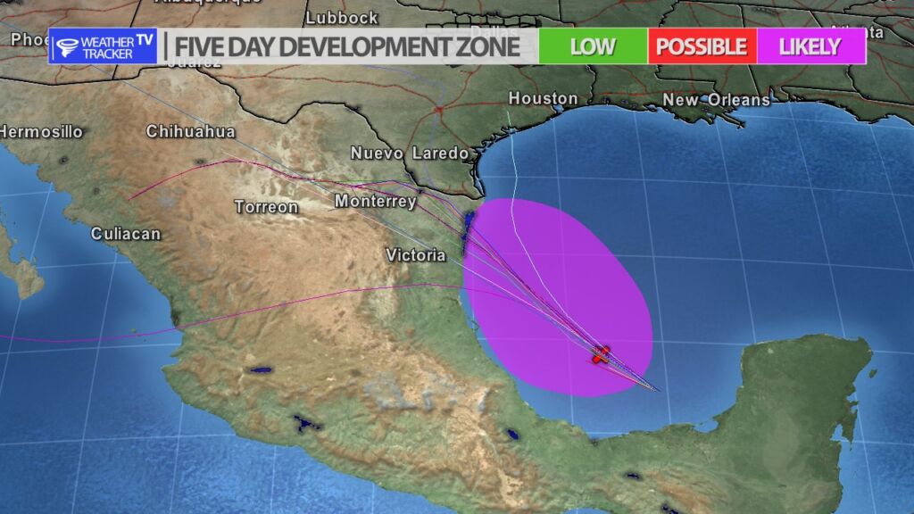
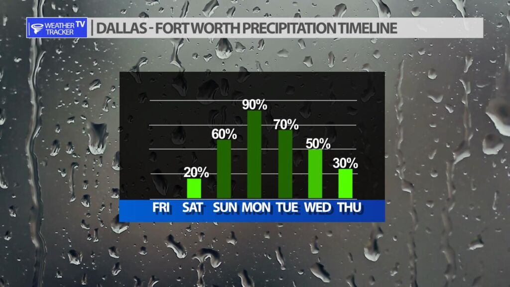
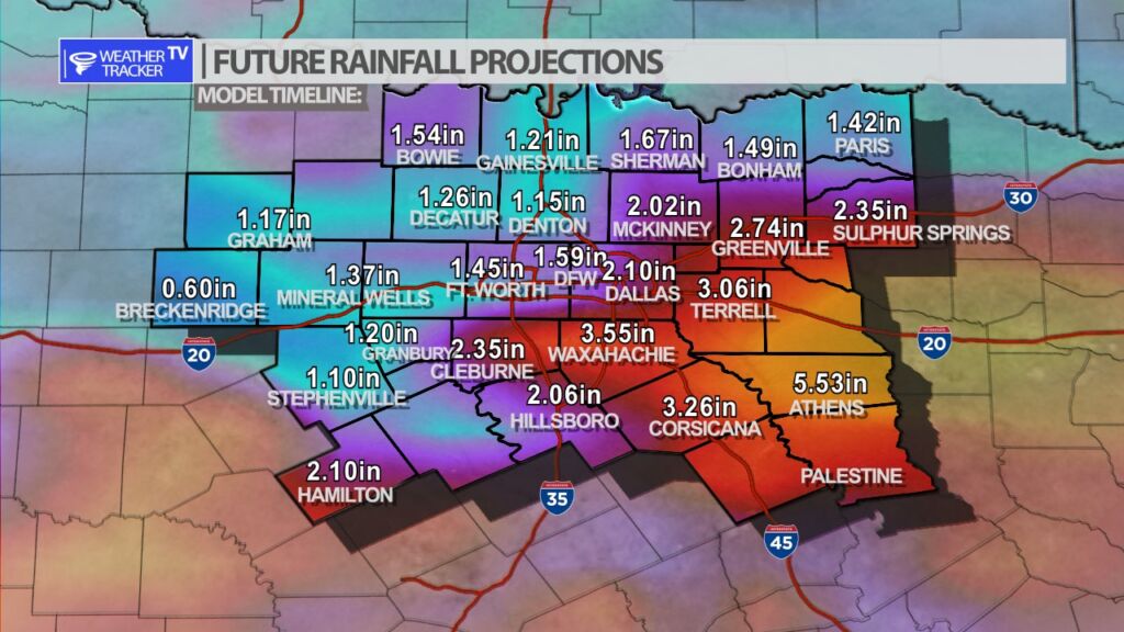
TROPICAL STORM CONDITIONS AND HEAVY RAINFALL EXPECTED IN NORTHEASTERN MEXICO AND SOUTHERN TEXAS THIS WEEKEND
At 1000 PM CDT (0300 UTC), the disturbance was centered near latitude 21.8 North, longitude 95.2 West. The system is moving toward the northwest near 14 mph (22 km/h), and this motion is expected to continue for the next couple of days. The disturbance is expected to reach the coast of northeastern Mexico on Saturday and make landfall there Saturday night.

If you have not already downloaded the Free Texas Weather Tracker TV mobile app – do that now. Search your app store for Texas Weather Tracker TV. Also, add our free Live Channel to your TV through Roku, Apple or Amazon Fire TV streaming players.

Like our forecasts? Love our severe weather coverage? Help support us and local Texas weather coverage. Join our Patreon for $2.99 per month. www.patreon.com/texasweathertrackertv