
DFW today Partly sunny. A 20 percent chance of showers and T-Storms this afternoon. Highs in the upper 80s. Northeast winds 5 to 10 mph. -William
DFW today Partly sunny. A 20 percent chance of showers and T-Storms this afternoon. Highs in the upper 80s. Northeast winds 5 to 10 mph. -William

Here’s a look at Local Radar and Live Temperatures across North Texas.
DFW the rest of tonight: Partly cloudy. Lows in the lower 70s. Northeast winds around 5 mph.


William’s North Texas Hazardous Weather Forecast this Evening:
An isolated T-Storm or two remains possible through this evening. Brief heavy rainfall may be possible, especially with storms across Central Texas. Severe weather is not expected.

DFW tonight Mostly cloudy with a 20 percent chance of showers and T-Storms in the evening, then partly cloudy after midnight. Humid with lows in the lower 70s. Northeast winds around 5 mph. -William


Here’s a look at Live Temperatures across North Texas, Local Radar and the Updated Forecast Map.
DFW this afternoon Partly sunny with a 50 percent chance of showers and T-Storms. Highs in the lower 80s. North winds 5 to 10 mph. -William


From the National Hurricane Center:
For the North Atlantic Caribbean Sea and the Gulf of Mexico:Central Tropical Atlantic:Shower activity remains minimal in association with a tropicalwave located several hundred miles west of the Cabo Verde Islands.Development, if any, of this system is expected to be slow to occurduring the next several days while the system moves westward towest-northwestward at 10 to 15 mph across the tropical Atlantic.* Formation chance through 48 hours low near 0 percent.* Formation chance through 5 days low 10 percent.Eastern Tropical Atlantic:A tropical wave is forecast to move off the west coast of Africa ina couple of days. Environmental conditions could support some slowdevelopment of this system late this week or over the weekendwhile it moves westward at 10 to 15 mph.* Formation chance through 48 hours low near 0 percent.* Formation chance through 5 days low 20 percent.Forecaster Blake/Hogsett


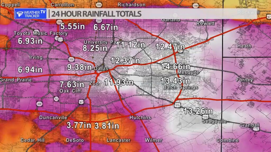
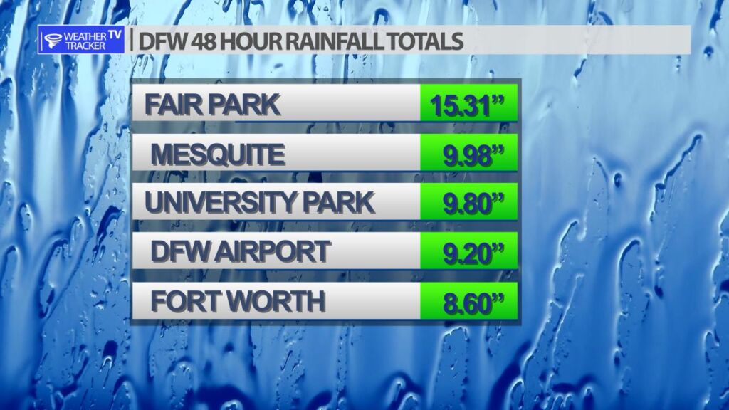
It’s hard to believe that most of these radar estimated rainfall totals happened within a 12 – 18 hour window. Dallas County received the bulk of the heaviest rain and flooding. Radar estimates show 12″ – 15″ of rain.
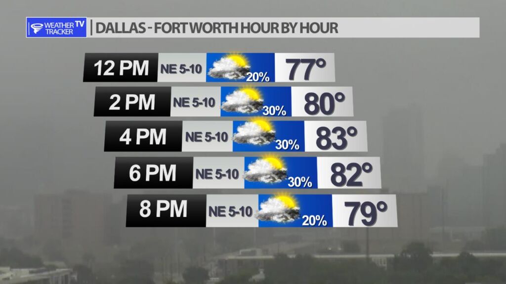
The morning clouds and drizzle will begin to lift this afternoon. Expect a mostly cloudy afternoon with temperatures struggling into the lower to mid 80’s. A few light showers remain possible.