Current Set Up Across the Nation

DFW today Mostly sunny. Highs in the lower 80s. South winds 10 to 15 mph, increasing to 15 to 20 mph this afternoon. -William

The current Burn Ban Map for Texas is posted above.
ELEVATED FIRE THREAT ALONG AND WEST OF I-35 TODAY
…ELEVATED FIRE THREAT ALONG AND WEST OF I-35 TODAY WARM AND BREEZY CONDITIONS WILL COMBINE WITH RELATIVE HUMIDITY DROPPING BELOW 35 PERCENT THIS AFTERNOON TO CREATE ELEVATED FIRE DANGER ALONG AND WEST OF THE INTERSTATE 35 CORRIDOR. EXTREME CARE IS URGED DURING ALL OUTSIDE ACTIVITIES WHERE THERE IS A POTENTIAL FOR GRASS FIRES TO GET STARTED. AVOID OUTSIDE BURNING AND WELDING. DO NOT TOSS LIT CIGARETTE BUTTS OUTSIDE. REPORT WILD FIRES TO THE NEAREST FIRE DEPARTMENT OR LAW ENFORCEMENT OFFICE QUICKLY.

Here’s a look at Local Radar and Live Temperatures across North Texas.
DFW the rest of tonight: Mostly clear. Lows in the mid 50s. South winds 10 to 15 mph.


William’s North Texas Hazardous Weather Forecast this Evening:
Elevated to critical fire danger continues across much of the region through 8 PM, after which RH values will begin to recover through the overnight. The most volatile conditions will be along and west of the Interstate 35 corridor.
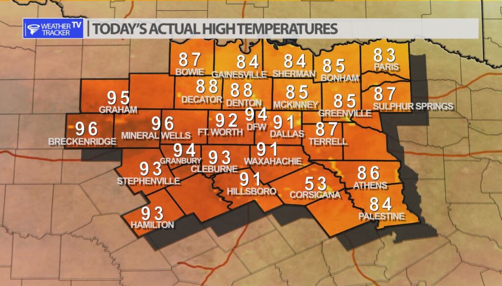
It was a hot afternoon across North Texas with high temperatures averaging 20 degrees above normal in the Metroplex. DFW officially recorded a high of 94. Out in our western counties in Breckenridge and Mineral Wells we saw highs mid 90’s. By the way the record high for today at DFW – is 96 from 1956 – so it was a near miss.
DFW tonight Mostly clear. Lows in the mid 50s. South winds 10 to 15 mph. -William


Here’s a look at Live Temperatures across North Texas, Local Radar and the Updated Forecast Map.
DFW this afternoon Sunny. Highs in the upper 80s. South winds 10 to 15 mph. -William


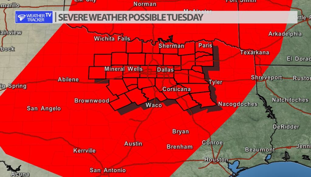
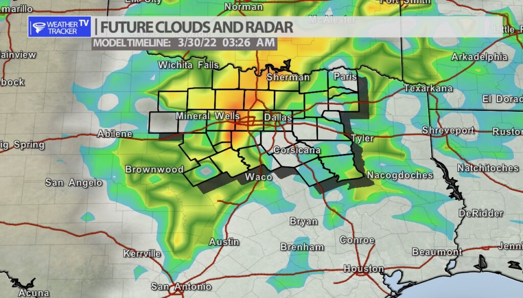
Storms return to the forecast late on Tuesday and into early Wednesday morning. A few showers are possible Tuesday afternoon but the real rain and storm chances hold off until the late evening and into the overnight. Heavy rain is possible but also the opportunity of some severe weather. The parameters look favorable for gusty severe winds ( up to 60 mph) as this line of storms moves from west to east across our area. The latest data shows the line should be approaching the Metroplex and the I-35 corridor after 2 am early Wednesday morning.