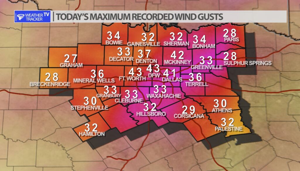
The south winds have blown as we’ve gone through the afternoon. Peak wind gusts across North Texas were in the 30 – 40 mph range with a few gusts near 50 mph officially at DFW.
The south winds have blown as we’ve gone through the afternoon. Peak wind gusts across North Texas were in the 30 – 40 mph range with a few gusts near 50 mph officially at DFW.
DFW tonight Showers and T-Storms after midnight. Some T-Storms may be severe. Breezy with lows around 60. South winds 20 to 25 mph, diminishing to 10 to 20 mph after midnight. Wind gusts up to 35 mph are possible. Chance of rain near 100 percent. -William


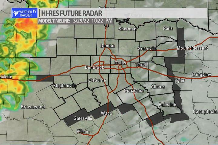
Here’s a look at Live Temperatures across North Texas, Local Radar and the Updated Forecast Map.
DFW this afternoon Cloudy, breezy with highs in the lower 80s. South winds 20 to 25 mph. -William


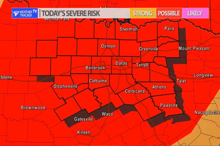
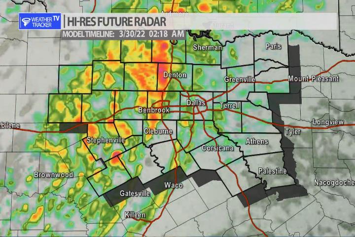
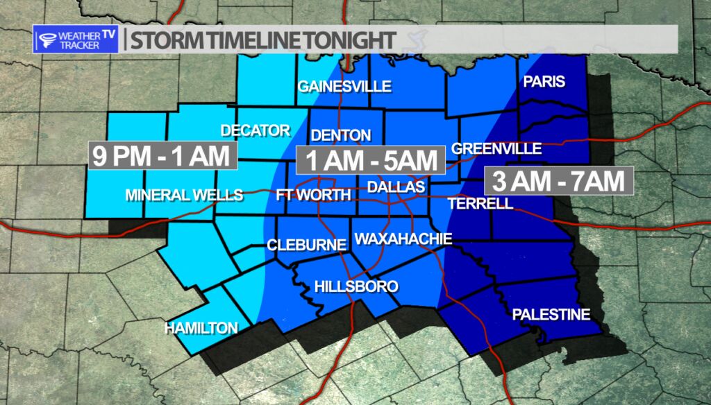
The risk of severe weather returns to North Texas tonight as a strong upper level storm system approaches the area. A dryline will set up out in the Big Country this evening and will be the trigger for storms to form. The initial storms will form into a line as they push into our western counties and then move across North Texas as we go through the overnight. The Metroplex timeline is 1 am – 5 am. Wind is the primary concern with gusts of 65 – 70 mph possible. Hail sizes could range from quarters to half dollars with a few reports of golf balls possible. The tornado probabilities remain low but a couple of tornado warnings are possible. A few quick spin up tornadoes along the leading edge of the line would be the main concern. We’ll have more throughout the day on the mobile app and updates on the channel as well.

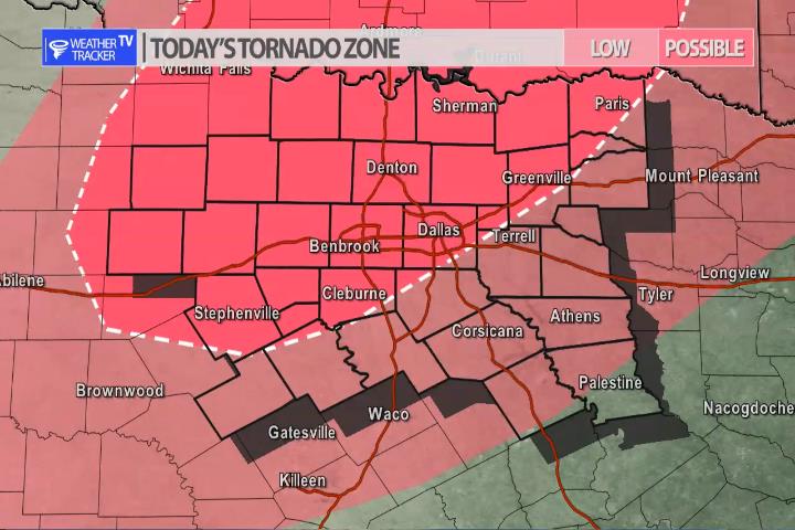
A couple of tornadoes are possible tonight. Mainly quick spin ups along the leading edge of the line.


William’s North Texas Hazardous Weather Forecast for Tuesday:
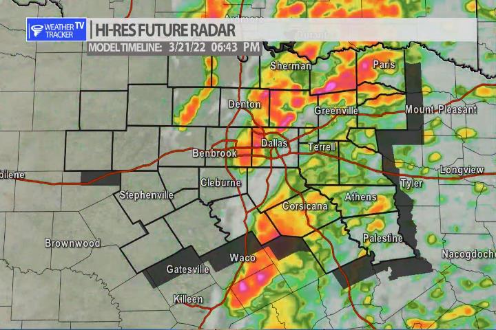
T-Storms are expected to move through most of North and Central Texas overnight. Some of these will be severe with damaging winds and perhaps a few tornadoes.


DFW today Cloudy, windy with highs in the lower 80s. South winds 15 to 20 mph, increasing to 20 to 30 mph and very gusty this afternoon. Wind gusts up to 35 mph are possible. -William

Here’s a look at Local Radar and Live Temperatures across North Texas.
DFW the rest of tonight: Mostly cloudy. Lows in the mid 60s. South winds 15 to 20 mph with gusts up to 30 mph.
