
Current Set Up Across the Nation

DFW today Mostly cloudy with a 20 percent chance of rain, flurries and light sleet this morning, then mostly sunny this afternoon. No sleet accumulation expected. Much cooler with highs in the lower 50s. North winds 10 to 15 mph. -William
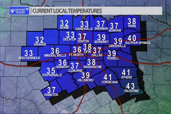
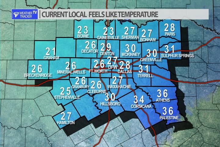
It’s a much colder start to the morning across North Texas with temperatures in the 30’s but a brisk north wind is putting wind chills in the 20’s. You’ll want the winter coat out the door. Highs will top out in the lower 50’s.

Here’s a look at Local Radar and Live Temperatures across North Texas.
DFW the rest of tonight: Showers with a chance of T-Storms. Much cooler with lows around 40. Northwest winds 10 to 20 mph. Chance of rain near 100 percent.


William’s North Texas Hazardous Weather Forecast this Evening:
Showers and T-Storms are expected this evening through tonight. Some of these storms may become strong to severe. The best chances for severe T-Storms will be north and east of the DFW Metroplex. Quarter size hail and gusty winds will be the primary hazards with any strong or severe storms.
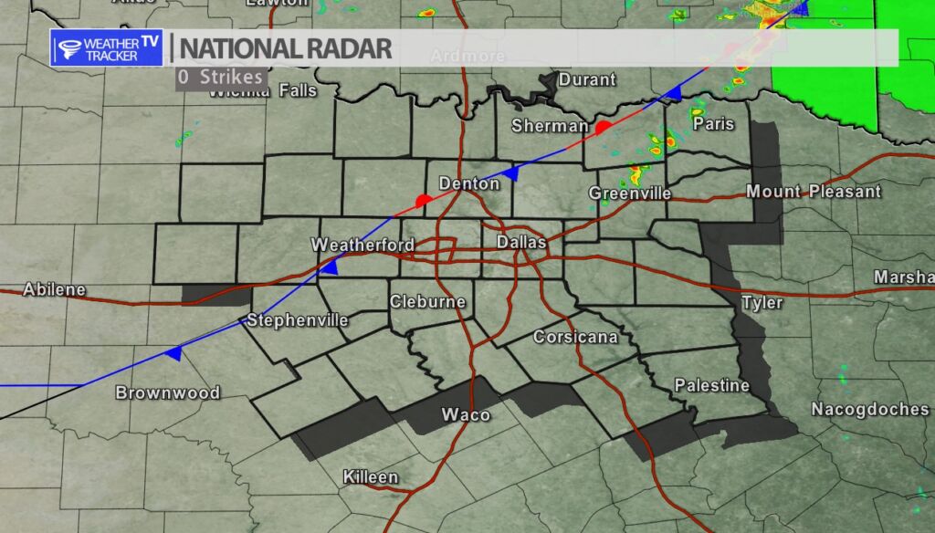
A cold front continues to push through the DFW Metroplex bringing sharply chillier temperatures behind it. Radar remains mostly quiet. The risk of scattered showers and T-Storms continues and they may develop over the next hour – an move southeast through the Metroplex over the next few hours. A lingering low end severe risk continues as well with quarter sized hail and winds to 60 mph being the primary concern.
DFW tonight A chance of T-Storms. Showers. Much cooler. Less humid with lows around 40. West winds 10 to 15 mph, becoming north 15 to 20 mph after midnight. Chance of rain 80 percent. -William

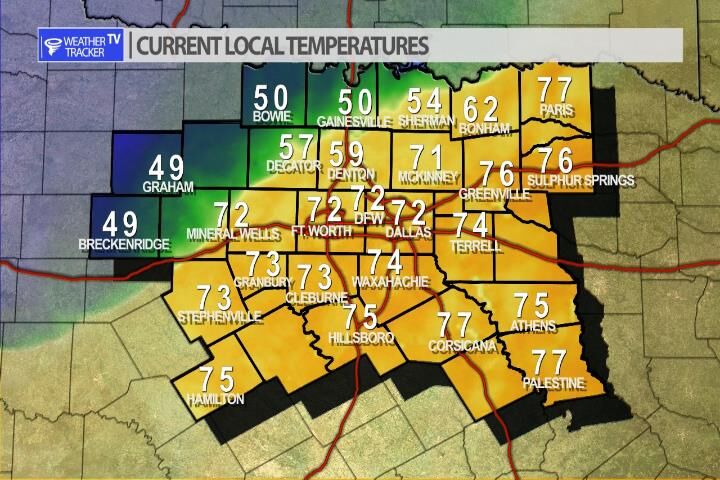
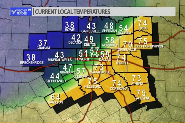
A cold front has essentially stalled in our NW counties this afternoon. A sharp contrast in temperatures can be seen. We’re enjoying the 70’s in the Metroplex but in Bowie it’s currently 50. That cold front will start moving Southeast again this evening and will be the trigger for thunderstorms.

Here’s a look at Live Temperatures across North Texas, Local Radar and the Updated Forecast Map.
DFW this afternoon Mostly cloudy with a 40 percent chance of showers and T-Storms. Highs in the upper 70s. South winds 10 to 15 mph. -William

