DFW tonight Partly cloudy in the evening, then becoming mostly clear. Cold with lows in the lower 30s. Northeast winds around 5 mph, becoming northwest after midnight. -William

DFW tonight Partly cloudy in the evening, then becoming mostly clear. Cold with lows in the lower 30s. Northeast winds around 5 mph, becoming northwest after midnight. -William

Here’s a look at Live Temperatures across North Texas, Local Radar and the Updated Forecast Map.
DFW this afternoon Mostly cloudy with a 50 percent chance of showers. Highs in the mid 40s. North winds 5 to 10 mph. -William


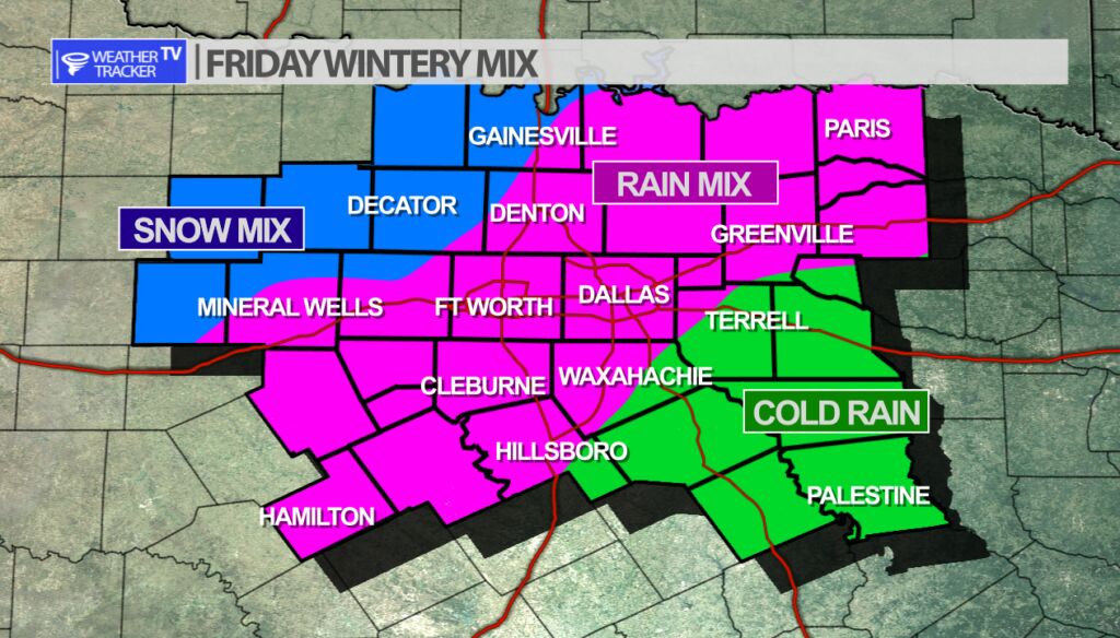
The next cold front and jet stream storm system arrive for North Texas late Thursday into Friday. Chillier air will be in place from the front and lift from the upper level storm system. A chilly precipitation develops across the area. The latest data continues to suggest a cold rain mixed with some sleet and possibly for our northwestern counties – a cold rain mixed with some snow. The way it looks right now – other than wet roads – no travel impacts are anticipated and no accumulation is anticipated. It’s still several days away and the data will continue to change some. I’ll keep you updated with the latest here on the app and on the channel.
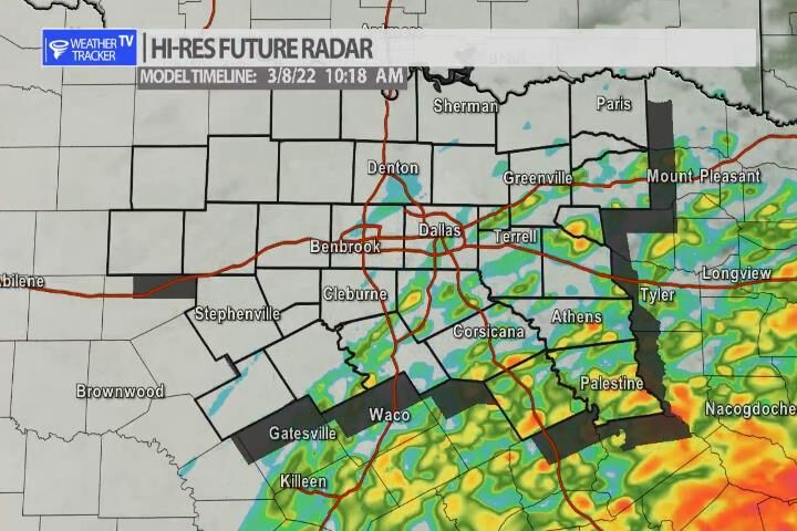
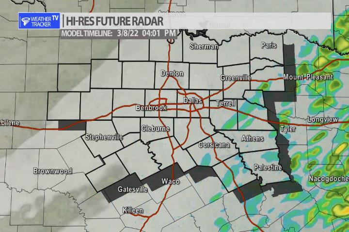
Scattered showers will be possible into the mid afternoon across North Texas. Most of the activity will be very light – mainly making for damp roads. Rainfall amounts in your back yard rain gauges will not be more than a trace or a couple of hundredths of an inch for most.


William’s North Texas Hazardous Weather Forecast for Tuesday:
No hazardous weather is expected at this time.


DFW today A slight chance of sleet this morning. Mostly cloudy with a chance of showers. No sleet accumulation expected. Highs in the mid 40s. Northeast winds 5 to 10 mph. Chance of precipitation 50 percent. -William

Here’s a look at Local Radar and Live Temperatures across North Texas.
DFW the rest of tonight: Mostly cloudy. Cold with lows in the lower 30s. Northeast winds 5 to 10 mph.
