
William’s North Texas Hazardous Weather Forecast this Evening:
No hazardous weather is expected at this time.
William’s North Texas Hazardous Weather Forecast this Evening:
No hazardous weather is expected at this time.

DFW tonight Clear in the evening, then becoming partly cloudy. Cold with lows in the mid 30s. East winds 5 to 10 mph, becoming northeast after midnight. -William


From William Cole: A Wind Advisory has been issued in the Weather Tracker TV DFW coverage area from 9:00 AM Fri until 9:00 PM Friday for Anderson, Bosque, Collin, Cooke, Dallas, Delta, Denton, Ellis, Erath, Fannin, Freestone, Grayson, Hamilton, Henderson, Hill, Hood, Hopkins, Hunt, Jack, Johnson, Kaufman, Lamar, Montague, Navarro, Palo Pinto, Parker, Rains, Rockwall, Somervell, Stephens, Tarrant, Van Zandt, Wise & Young Counties in North Texas.
North winds 15 to 25 mph with gusts up to 45 mph expected.
Stay with William Cole and Weather Tracker TV Dallas – Fort Worth for continuing coverage, online, on our app and on TV. Let’s stay safe together.

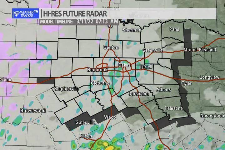
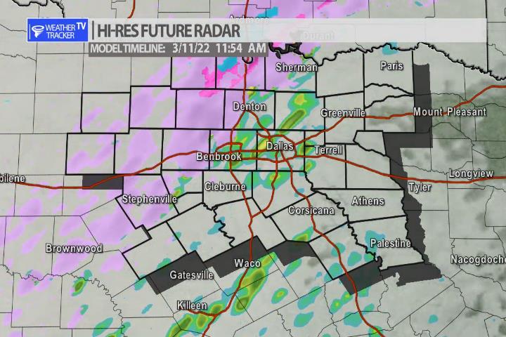
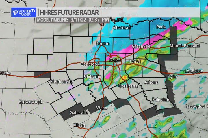
Here’s a look at Live Temperatures across North Texas, Local Radar and the Updated Forecast Map.
DFW this afternoon Sunny. Highs in the upper 60s. Southeast winds 5 to 10 mph. -William


From William Cole: A Winter Weather Advisory has been issued in the Weather Tracker TV DFW coverage area from 6:00 AM Fri until 6:00 PM Friday for Delta, Erath, Hamilton, Hopkins, Hunt, Lamar, Palo Pinto, Parker, Rains & Stephens Counties in North Texas.
Mixed precipitation expected. Sleet and snow accumulations from a tenth to half an inch, and ice accumulations of a light glaze.
Stay with William Cole and Weather Tracker TV Dallas – Fort Worth for continuing coverage, online, on our app and on TV. Let’s stay safe together.


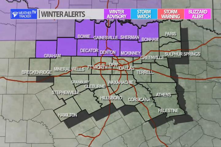
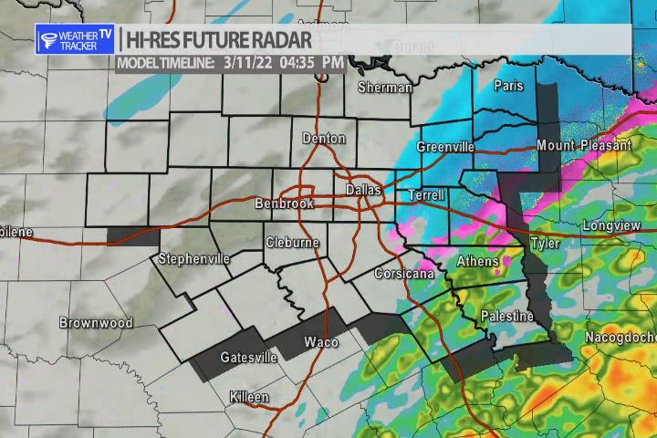
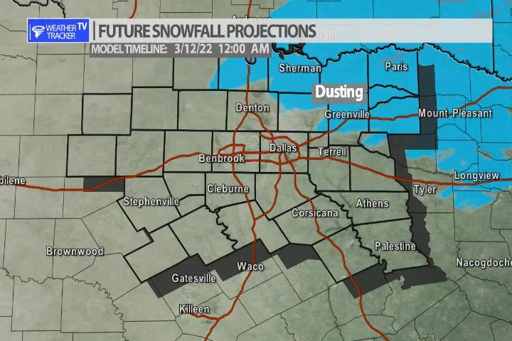
An Arctic cold front arrives in North Texas tonight. A piece of Jetstream energy will also arrive by early tomorrow morning. Light scattered showers are possible and those showers will mix with sleet and some snow as we go through the day. Right now, the latest data continues to show all of the precipitation will be light. Anytime you have wintry precipitation you can never rule our a few slick spots on the bridges and overpasses so use caution on all of the area roads tomorrow. The activity tappers off by Friday evening. No real accumulation is expected, but a dusting may be possible on grassy surfaces near the Red River Valley.


William’s North Texas Hazardous Weather Forecast for Thursday:
No hazardous weather is expected at this time.