DFW Early Friday Afternoon Update

Texas Weather Tracker TV Alert

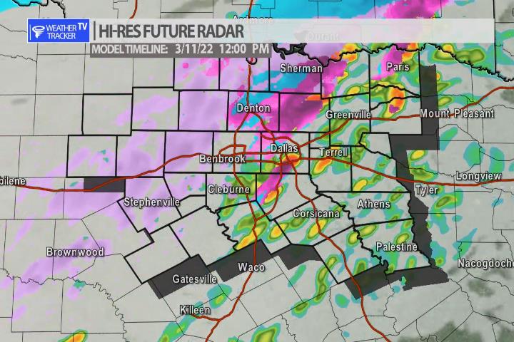
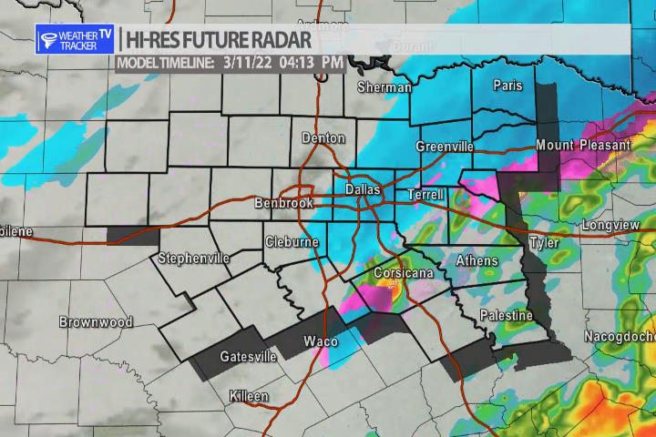
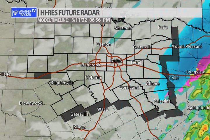
Here’s a look at Live Temperatures across North Texas, Local Radar and the Updated Forecast Map.

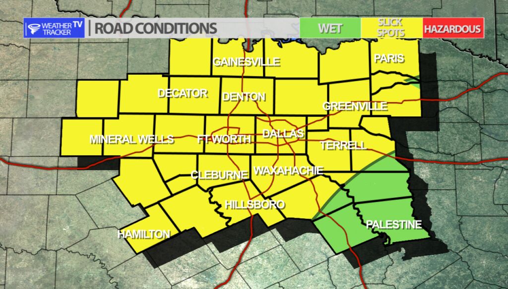
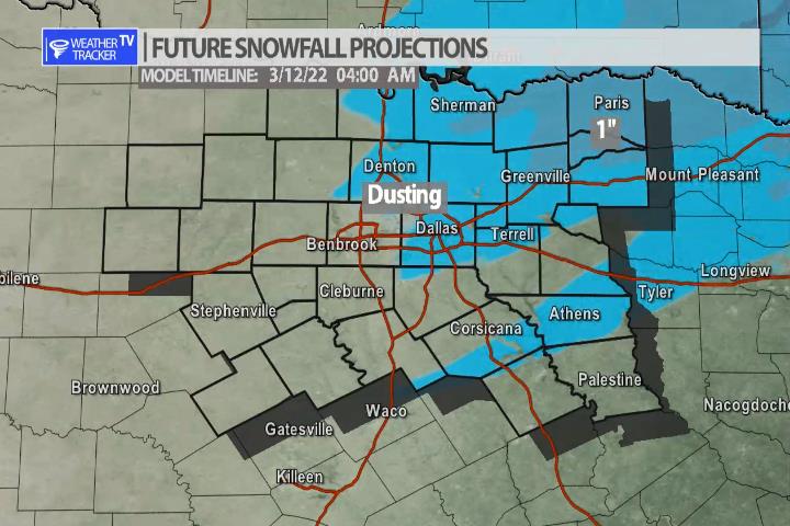
DFW this afternoon Mostly cloudy with showers likely, a slight chance of snow showers, freezing rain likely with a slight chance of sleet. Very light snow or sleet accumulations possible. Additional ice accumulation of trace amounts of an inch. Much colder with highs in the mid 30s. North winds 15 to 20 mph with wind gusts up to 35 mph are possible. Chance of precipitation 70 percent. -William

Texas Weather Tracker TV Alert

Texas Weather Tracker TV Alert

Road Conditions

Road conditions across the area are still being reported as wet – however, still use caution on bridges and overpasses or any elevated surface. A few slicks spots are possible on those if froze precipitation has fallen.

Wintry Weather Today

Wintry Mix Timeline – Noon

A wintry mix is ongoing across North Texas with a mix of rain, sleet and snow. The activity will linger through mid afternoon before it quickly shifts east. A few slick spots will be possible on the bridges and overpasses – do that keep that in mind for your evening commute. A few other locations may be lucky enough to pick up a dusting of snow.

4 pm a quick burst of snow is possible before the activity quickly shifts out of the area.
Activity ends by late afternoon and early evening with clearing skies.
A few locations may be lucky enough to get a quick dusting of snow.

Today’s North Texas Hazardous Weather Forecast

Texas Weather Tracker TV Alert

William’s North Texas Hazardous Weather Forecast for Friday:

Wintry precipitation is expected across a large portion of North Texas and western parts of Central Texas today. Rain will transition briefly to freezing rain in some areas during the morning before transitioning to sleet and snow expected by afternoon.

Friday’s North Texas Forecast

Texas Weather Tracker TV Alert

DFW today Mostly cloudy. A chance of rain this morning, then rain, sleet and snow likely this afternoon. Very light snow or sleet accumulations possible. Trace amounts of ice accumulation possible. Much colder with highs in the mid 30s. North winds 15 to 20 mph. Chance of precipitation 70 percent. Wind chill values as low as 19. -William

27 AM | Winter Weather Advisory until 6:00 PM Friday

Texas Weather Tracker TV Alert

From William Cole: A Winter Weather Advisory has been issued in the Weather Tracker TV DFW coverage area from 6:00 AM Fri until 6:00 PM Friday for Dallas, Hood, Johnson, Rockwall, Somervell & Tarrant Counties in North Texas.

Mixed precipitation expected. Sleet and snow accumulations of a few tenths of an inch and ice accumulations of a light glaze.

Stay with William Cole and Weather Tracker TV Dallas – Fort Worth for continuing coverage, online, on our app and on TV. Let’s stay safe together.