
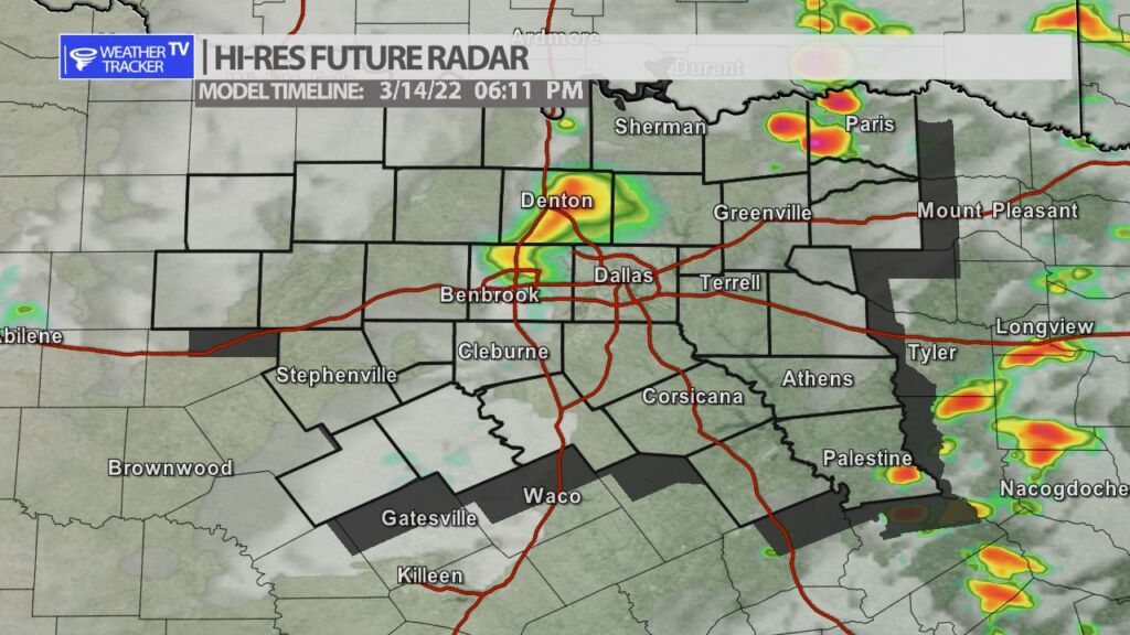
Here’s a look at Local Radar and Live Temperatures across North Texas.
DFW the rest of tonight: Clear late this evening, then becoming partly cloudy. Not as cool with lows in the upper 40s. South winds 10 to 15 mph.

Here’s a look at Local Radar and Live Temperatures across North Texas.
DFW the rest of tonight: Clear late this evening, then becoming partly cloudy. Not as cool with lows in the upper 40s. South winds 10 to 15 mph.

William’s North Texas Hazardous Weather Forecast this Evening:
Critical fire weather conditions are expected across western North Texas this afternoon and early evening, where a Red Flag Warning is in effect. The fire weather threat will remain as far east as the I-35 corridor.

DFW tonight Clear in the evening, then becoming partly cloudy. Not as cool with lows in the upper 40s. South winds 10 to 15 mph. -William


Here’s a look at Live Temperatures across North Texas, Local Radar and the Updated Forecast Map.
DFW this afternoon Sunny. Highs in the mid 60s. South winds 15 to 20 mph. -William


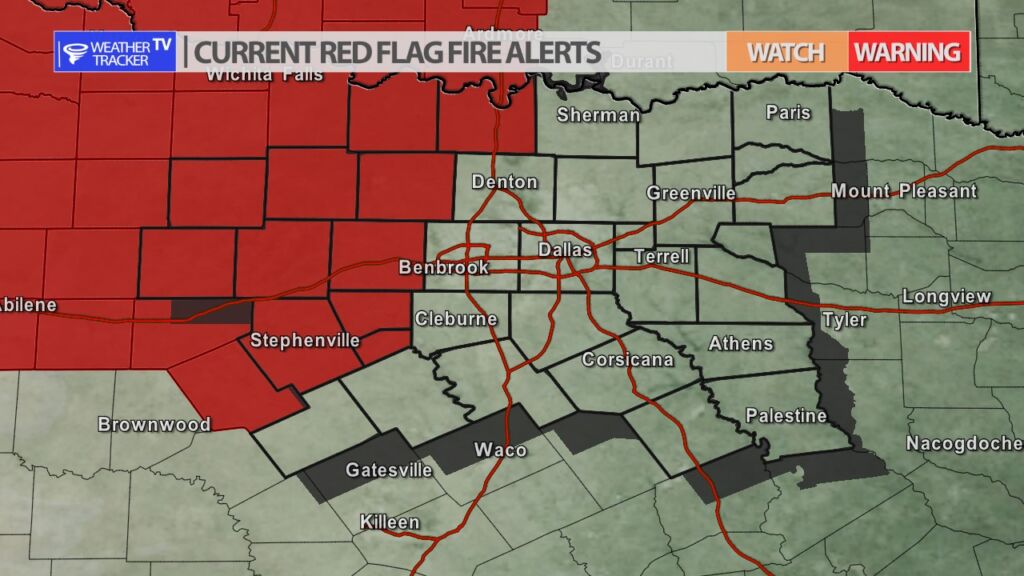
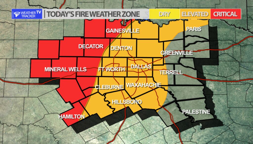
Fire Danger continues today – mainly in our western counties. Gusty south winds, dry vegetation and low humidity will be the trifecta to elevate the fire danger. If a fire were to form it would also have a rapid spread ability with the gusty south winds. Outdoor burning or welding is discouraged today or anything else that could start a fire.
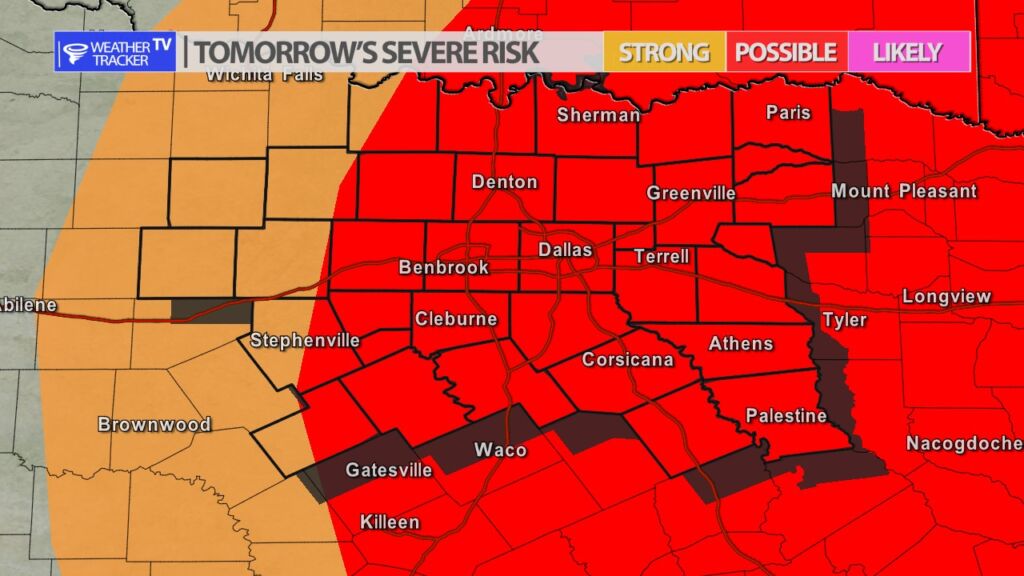
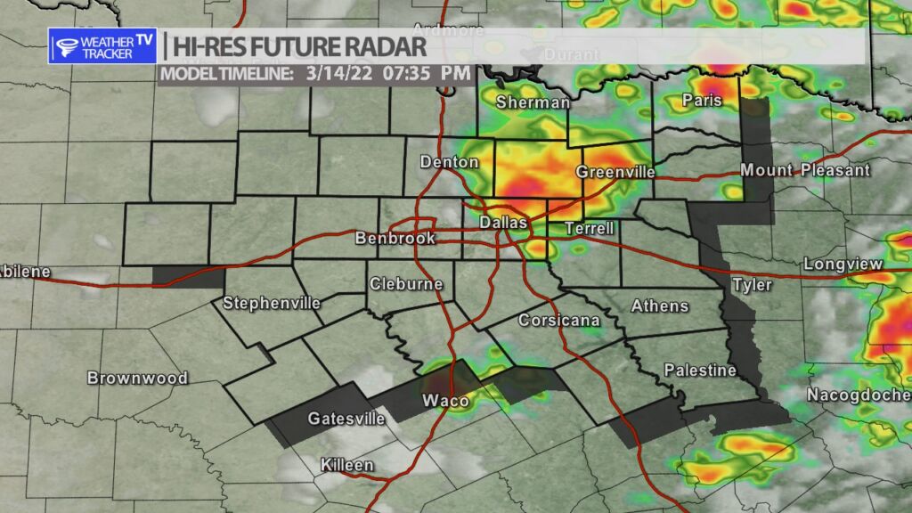
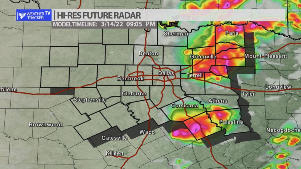
The risk of severe weather returns to North Texas tomorrow by late afternoon and early evening. Gusty south winds today and tomorrow will help to pump the Gulf of Mexico moisture back into the area. At the same time a windy cold front will approach the area by late day tomorrow and a Jetstream storm system will also cross the area. All of that combined gives us the opportunity of early spring T-Storms and a few storms will be strong to severe. Rain and storm chances are essentially from the I-35 corridor to the east with the storm coverage increasing the further east the activity gets. Quarter to half dollar sized hail and winds to 60 mph are the main concerns.


William’s North Texas Hazardous Weather Forecast for Sunday:
Critical fire weather conditions are expected across western North Texas Sunday afternoon and early evening, where a Red Flag Warning is in effect. The fire weather threat will remain far east as the I-35 corridor.