

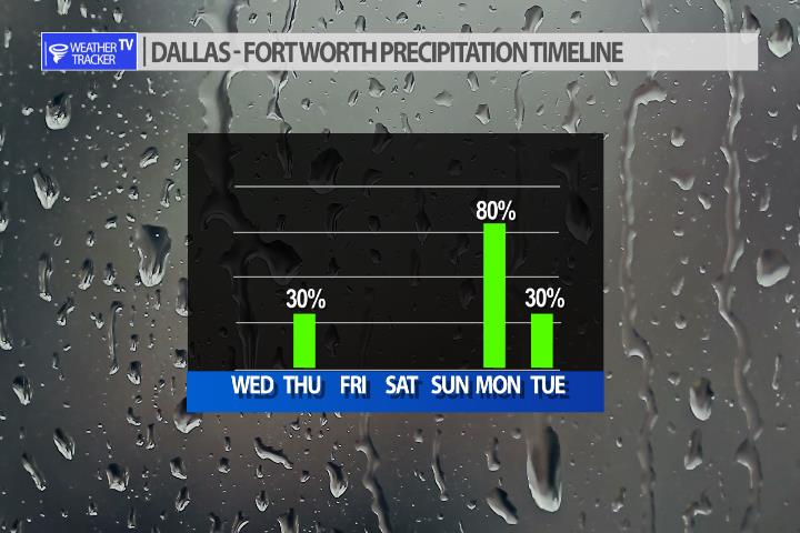
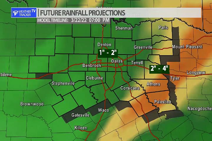
After a weekend that features beautiful five star weather – our next storm system arrives on Monday. This storm system looks very impressive and will also move very slowly across North Texas. Rain and storms are in the forecast, but the newest data is pointing to the chance of heavy rain across the area as well – Monday into early Tuesday. This is still several days away and the data will jiggle around some, but here’s an early look at the latest data.
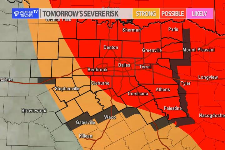
The risk of severe weather is back in the forecast for Thursday. As our next weather maker arrives in the area – isolated to scattered storm chances will develop after 4 pm. Storm chances appear to be from the I-35 corridor to the east. The latest data is pretty spotty with the coverage but any activity that does form could be severe with a quarter to half dollar sized hail threat.


William’s North Texas Hazardous Weather Forecast for Wednesday:
Patchy fog will be possible this morning over parts of East Texas and into the eastern outskirts of the Dallas/Fort Worth Metroplex. Visibility may briefly drop below two miles, but any fog that develops will dissipate a few hours after sunrise.


DFW today Sunny. Highs in the upper 70s. South winds 5 to 10 mph. -William

Here’s a look at Local Radar and Live Temperatures across North Texas.
DFW the rest of tonight: Clear. Lows in the mid 40s. Northeast winds around 5 mph, becoming south.


William’s North Texas Hazardous Weather Forecast this Evening:
Areas of fog will develop generally east of I-35 overnight. The visibility may temporarily fall to less than 1 mile.