
William’s North Texas Hazardous Weather Forecast this Evening:
No hazardous weather is expected at this time.
William’s North Texas Hazardous Weather Forecast this Evening:
No hazardous weather is expected at this time.

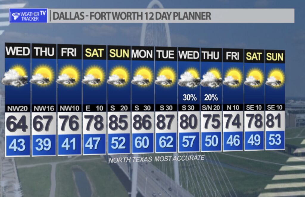
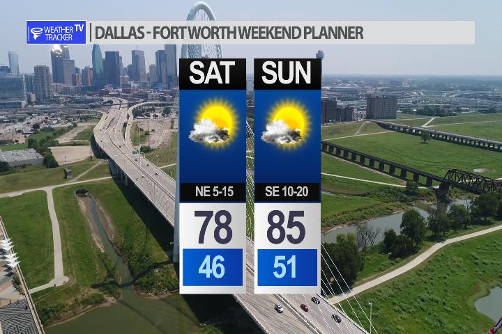
Still a cool afternoon tomorrow but the weekend forecast looks great. 80’s are in the forecast for highs next week.

Monday’s tornado count has jumped up to 10 with at least 11 expected. The NWS in Fort Worth was busy surveying the storm damage today and found the strongest tornado damage near Jacksboro in Jack County just northwest of the DFW Metroplex. That tornado was rated an EF-3 with winds of 140 – 150 mph. There was one fatality reported in Sherwood Shores with 10 injuries.
Possum Kingdom Lake EF-1 95 mph
Jacksboro EF-3 140-150 mph
4 SW Bowie EF-1 95 mph
3 E Bowie EF-1 100 mph
5 E Nocona EF-1 110 mph
River Oaks/NW Ft Worth EF-1 100 mph
Carrollton EF-0 85 mph
Cooke County EF-1 105 mph
S & SE Decatur EF-0 85 mph
N Grayson Sherwood Shores EF-2 130 mph
DFW tonight Mostly cloudy this evening, then clearing. Lows in the lower 40s. Northwest winds 10 to 20 mph. -William


UPDATE: A sixth tornado has been confirmed near Jacksboro. A strong EF-3 with winds of 140 – 150 mph.
The National Weather Service has been surveying storm damage from yesterday’s severe weather event across North Texas and so far they have confirmed 5 tornadoes.
-Southeast of Decatur EF0 (85 mph winds)
-River Oaks / NW Fort Worth EF1 (100 mph winds)
-Possum Kingdom Lake EF1 ( 95 mph winds)
-Near Bowie EF1 (95 mph winds)
-5 miles east of Nocona EF0 (85 mph winds)

Here’s a look at Live Temperatures across North Texas, Local Radar and the Updated Forecast Map.
DFW this afternoon Mostly cloudy. Much cooler with highs in the mid 50s. Northwest winds 15 to 20 mph with gusts up to 30 mph. -William


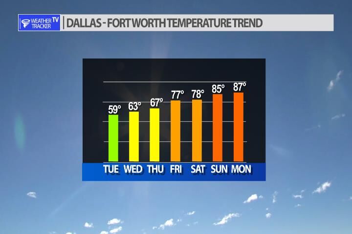
Expect a cooler day across North Texas with a brisk north wind. Temperatures will continue to trend cool over the next few days. A warming south wind returns on Thursday and temperatures begin to take off for the weekend. Mid 80’s for highs by Sunday.
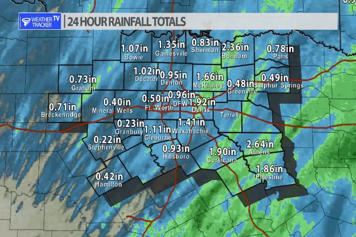
The storms that moved across North Texas yesterday did more than just bring severe weather – they also brought some beneficial rain to the area. This was a good soaker for most of us with rainfall totals averaging .75″ – 1.50″.