
Current Set Up Across the Nation
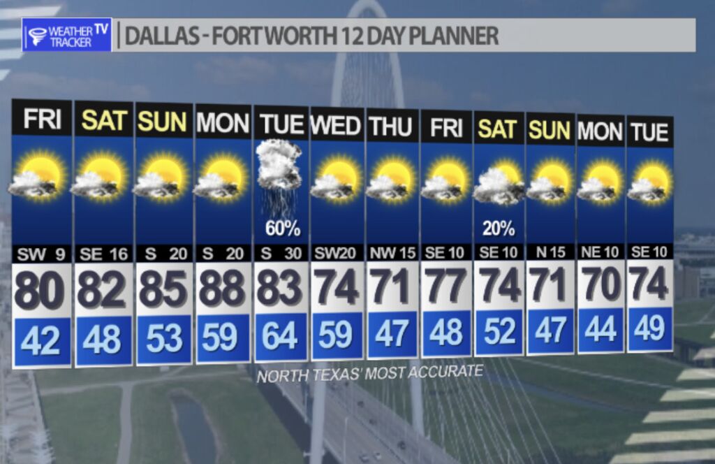
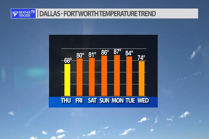
Warm to almost hot this weekend with increasing fire danger. Next chance of rain and storms shows up late Tuesday into Wednesday.
DFW tonight Clear. Lows in the lower 40s. West winds 5 to 10 mph. -William


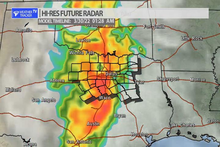
Here’s a look at Live Temperatures across North Texas, Local Radar and the Updated Forecast Map.
DFW -William


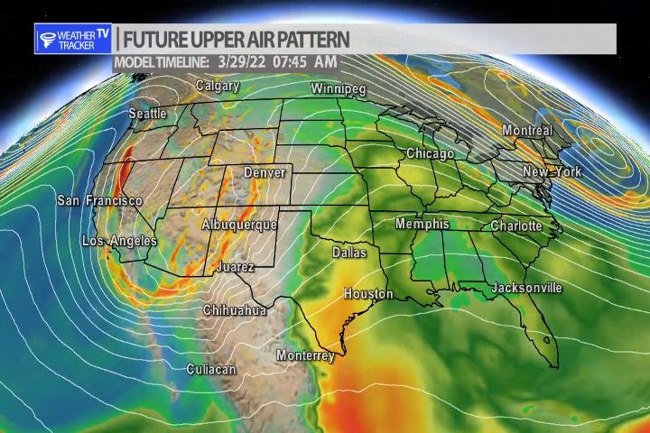
After a warm and dry weekend the chance of rain and storms does return to our North Texas forecast by Tuesday. A surge of Gulf of Mexico moisture arrives just ahead of a Jetstream storm system by late Tuesday afternoon. Storms looks possible late Tuesday into early Wednesday morning. Heavy rain and even severe weather may be in the forecast. This is still several days away so we’ll be sorting out the details as we get closer in time.
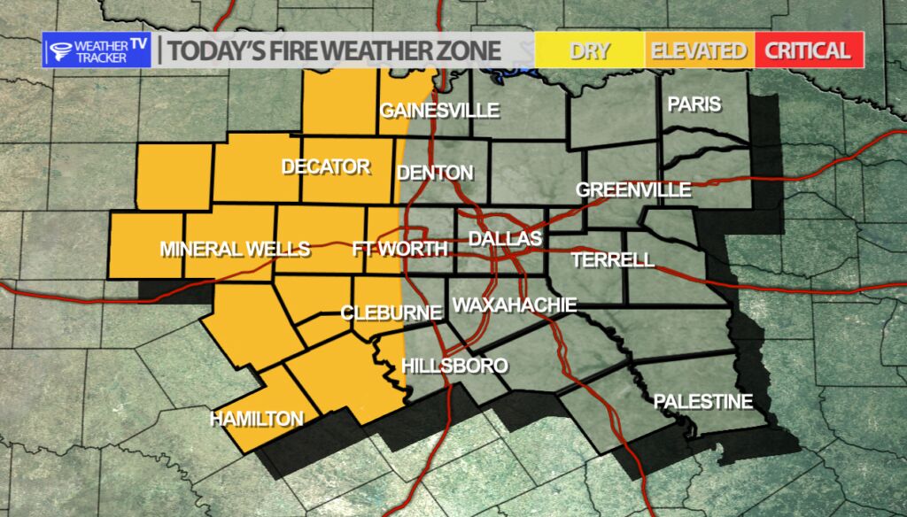
As we begin to head in to the weekend the temperatures will be sharply increasing and the wind will also begin to increase – especially on Sunday. Those are some of the ingredients for fire danger along with all of the dry winter kill vegetation around the area. Fire danger will be elevated but will become critical Sunday in our western counties. We all remember the huge out of control grass fire last week. Anything outdoors that could cause a spark or fire this weekend are discouraged.
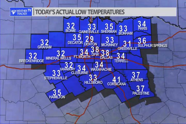
It was a cold start to the morning across North Texas as expected. A few of our local hometowns saw a light freeze – mostly in our western and northwestern counites. No other freezes showing up in the foreseeable future.


William’s North Texas Hazardous Weather Forecast for Thursday:
There will be an elevated threat for wildfires generally west of I-35 this afternoon. Take the necessary precautions to avoid creating sparks and avoid outdoor burning.