Storms Late Tuesday

Future radar early Wednesday morning

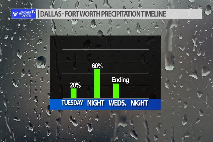
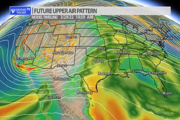
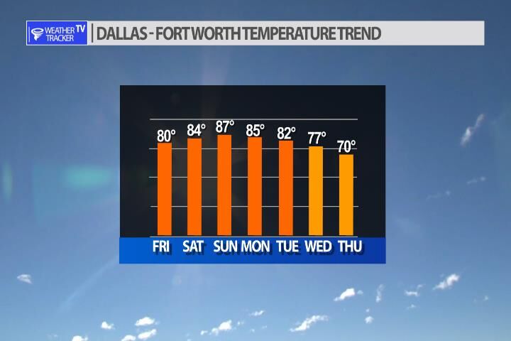
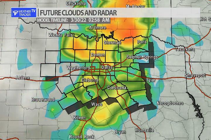
The next weather maker for North Texas is still on track for late Tuesday into early Wednesday. We’ll see a line of storms form in the Big Country and move across North Texas. Heavy rain and severe weather look possible. Right now, the main severe risk appears to be gusty winds up to 60 mph as the line moves through.

Rain chances best late Tuesday into early Wednesday
Next weather maker will tap into a surge of Gulf of Mexico moisture.

Wild Fire Danger Today into the Weekend

Today’s Fire Danger Zone – mostly elevated.

Temperatures in the 80’s, winds becoming gusty – especially on Sunday – and all of the dry dormmate vegetation around the area will continue to aggravate wild fire conditions. Today and Saturday conditions will be elevated but on Sunday with winds becoming breezier in our western counties we’ll have critical conditions develop. Please refrain from outdoor burring this weekend or anything that could cause a spark. If you see smoke call 911 right away.

Temperatures in the mid to upper 80’s this weekend will only add to the fire danger.