Thursday’s North Texas Forecast

Texas Weather Tracker TV Alert

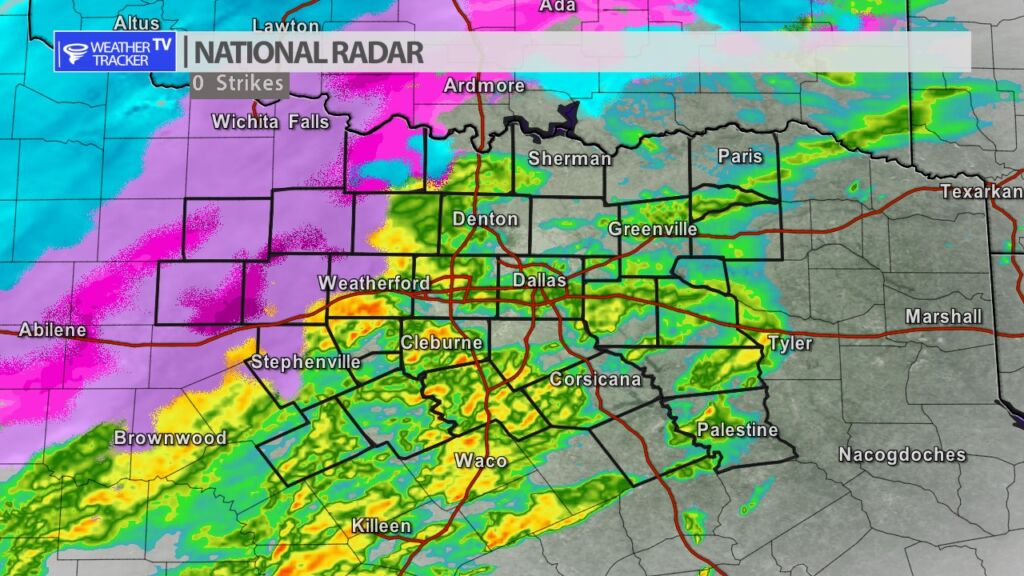
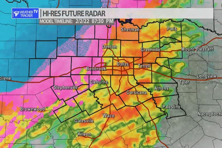
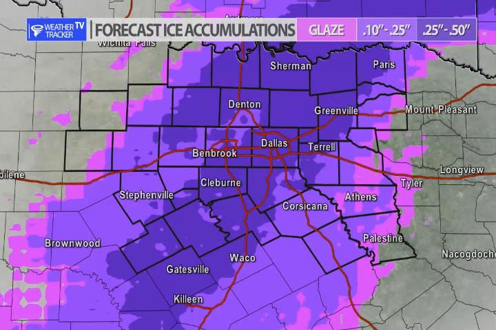
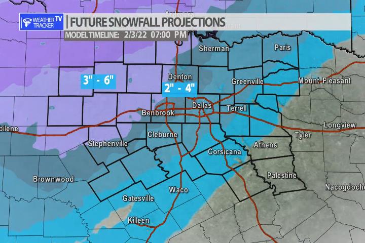
DFW today A slight chance of freezing rain. Snow and sleet this morning, then a chance of snow with a slight chance of sleet this afternoon. Snow and sleet accumulation of 1 to 3 inches. Much colder with highs in the upper 20s. North winds 15 to 20 mph. Chance of precipitation 90 percent. Wind chill values as low as 7 above. -William

North Texas Overnight Update

Texas Weather Tracker TV Alert

Here’s a look at Local Radar and Live Temperatures across North Texas.

DFW the rest of tonight: Rain and freezing rain. Sleet late this evening, then sleet with a slight chance of snow. Precipitation may be heavy at times. Around half an inch of snow and sleet accumulation. Additional ice accumulation of up to one tenth of an inch. Much colder with lows in the lower 20s. North winds 15 to 20 mph. Chance of precipitation near 100 percent. Wind chill values as low as 12.

Texas Weather Tracker TV Alert

4:35 pm Radar Update

4:35 pm Radar

Scattered showers continue in the Metroplex for your evening commute. The ice-line is just to the west where freezing rain is ongoing. As we get deeper into the evening the rain will transition to freezing rain in the Metroplex as the ice-line arrives. Roads will become hazardous quickly – especially elevated surfaces.

DFW Early Wednesday Afternoon Update

Texas Weather Tracker TV Alert

Here’s a look at Live Temperatures across North Texas, Local Radar and the Updated Forecast Map.

DFW this afternoon Cloudy with rain likely. Much cooler with highs in the lower 50s. Temperatures falling into the lower 40s late. North winds 10 to 15 mph. Chance of rain 70 percent. -William

Texas Weather Tracker TV Alert

Texas Weather Tracker TV Alert

9:45 am Winter Storm Update

The forecast continues to hold for a winter storm developing across North Texas later today and continuing tonight and into tomorrow. The data overnight has not changed much – rain still begins by late afternoon in the Metroplex. The rain then changes over to a freezing rain. Bridges and overpasses will quickly glaze and become extremely hazardous. The best plan is to be where you are going to be for the next 36 hours by early evening. Freezing rain continues through overnight with some sleet also possible. Tomorrow morning the latest data continues to show a ribbon of snow moving through DFW with snow and sleet totals of 2″ – 4″ possible on grassy surfaces.

The take a way points – travel will be nearly impossible tonight and Thursday. Power outages will possible – mainly from ice accumulations on tree limbs that break and pull down power lines. Power outages could be for an extended period of time. Make sure you have the supplies you and your family need to ride out this storm for 36 – 48 hours. Slip and fall injuries’ are very common during ice storms – most are preventable by staying off of icy surfaces.

Winter Storm Warning for all of North Texas.
Precipitation begins as rain but a fast change over to freezing rain happens around the evening commute timeframe.
Significant glazing is likely with power bumps and outages possible.
Accumulating snow and sleet is possible to top it all off.