
North Texas is in for another hot, mostly sunny Sunday across the Dallas–Fort Worth Metroplex. Afternoon highs will reach the mid-90s with light south winds. A few isolated showers or thunderstorms may develop this afternoon, but most neighborhoods will stay dry. An Ozone Action Day is in effect, so try to limit activities that add to air pollution during the hottest part of the day.
Tonight stays warm and partly cloudy, with lows in the lower to mid-70s. A stray shower or thunderstorm is possible this evening, with a slightly better chance after midnight, especially east of Dallas.
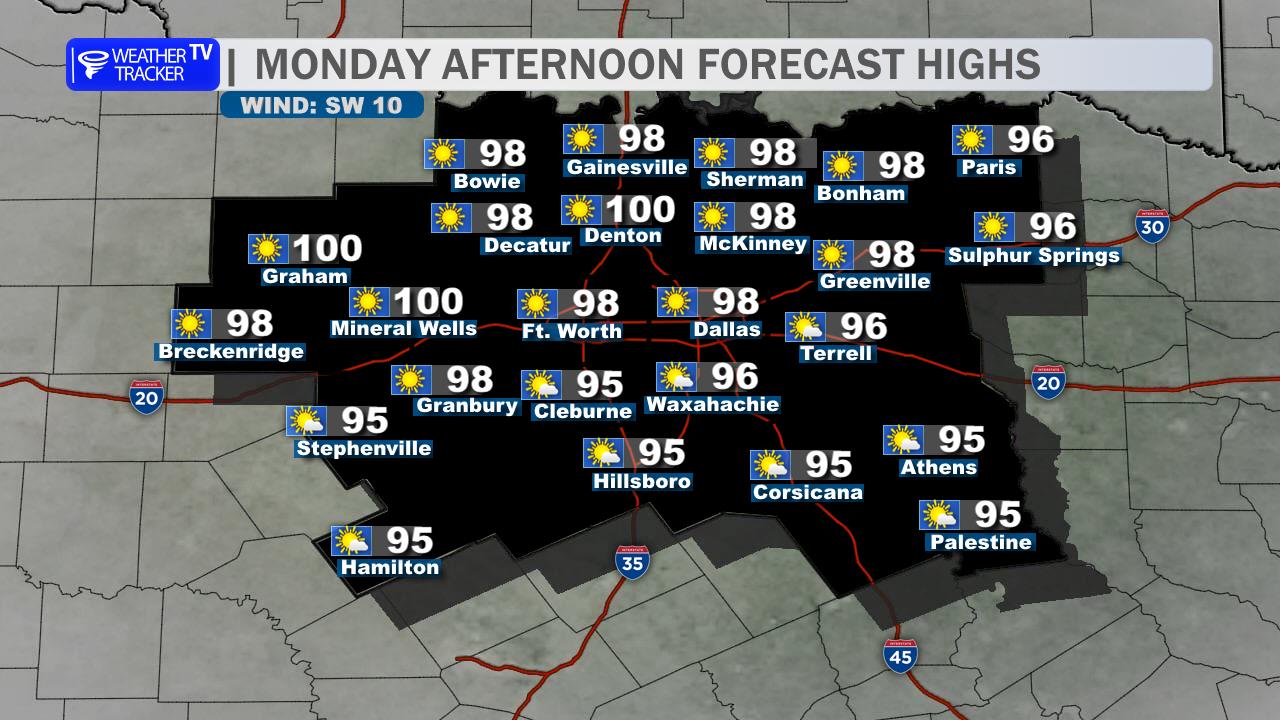
Monday brings more sunshine, another afternoon in the mid-90s, and only a slim chance for a pop-up storm. Tuesday stays hot before rain chances begin increasing late Tuesday night. More widespread showers and a few thunderstorms are expected Wednesday into Thursday, along with a welcome cooldown into the 80s. Locally heavy rain may become a concern later in the week.
Stay with William Cole & Weather Tracker TV.
Let’s stay safe together.
Today

Today- Hourly

Today – Precipitation

Tonight

Tomorrow
You must be logged in to post a comment.