
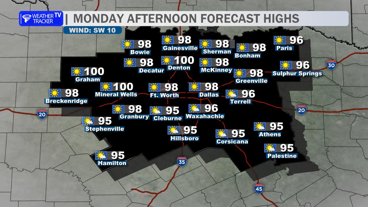
Hot summer weather continues across the Dallas-Fort Worth Metroplex today with plenty of sunshine and highs climbing into the upper 90s. A few spotty afternoon thunderstorms could pop up, mainly east of DFW, but most neighborhoods will stay dry. If a storm does manage to develop, expect brief downpours, lightning, and a quick burst of gusty wind.
Tonight, any isolated evening storm chance fades away fairly quickly, leaving partly cloudy to mostly clear skies overnight. Lows will settle into the mid 70s, so it will stay warm and a little muggy.
Tomorrow looks even quieter with mostly sunny skies and highs again pushing into the upper 90s. South winds stay light, and rain chances are minimal to near zero for most of the Metroplex. The hotter stretch continues through late week with afternoon temperatures flirting with 100 degrees and heat index values climbing closer to 105 by the weekend.
If you’re spending time outside, take the heat seriously and keep an eye out for an isolated storm this afternoon.
Stay with William Cole & Weather Tracker TV.
Let’s stay safe together.
Today

Today- Hourly

Today – Precipitation

Tonight

Tomorrow
You must be logged in to post a comment.