
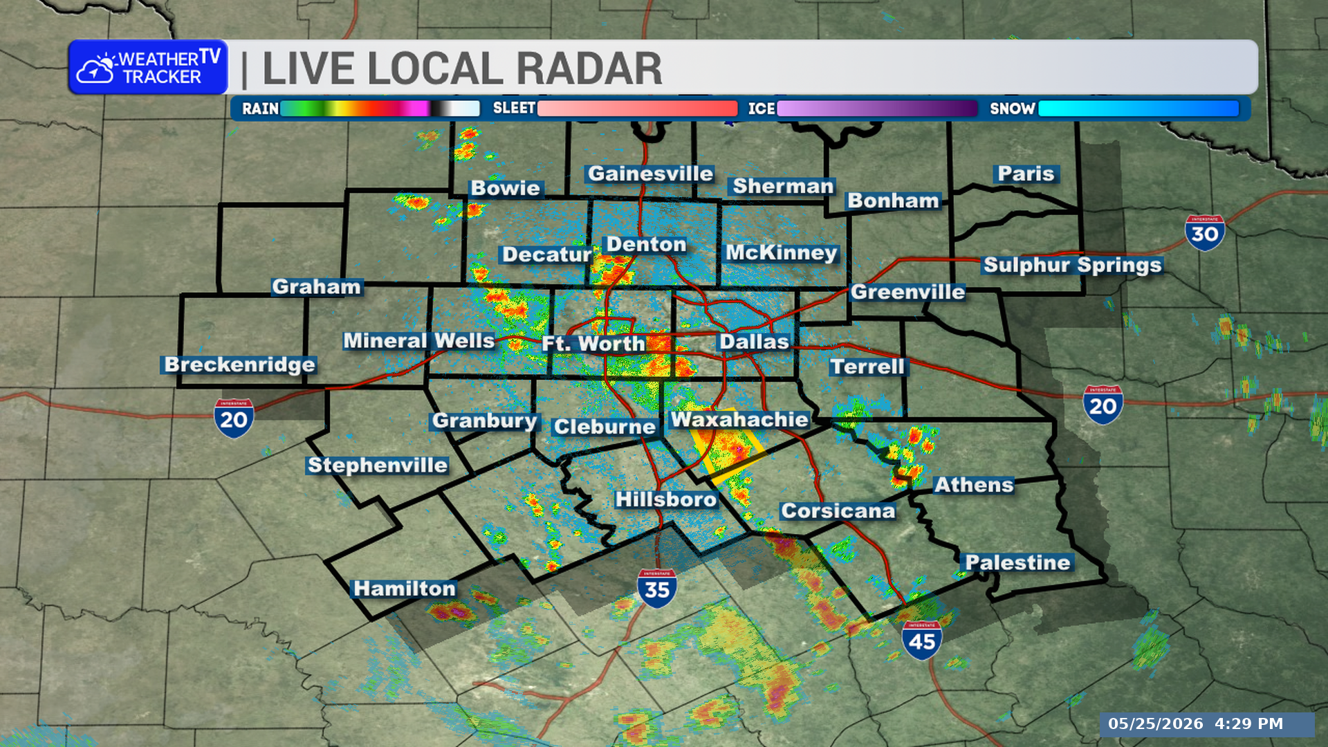
A strong thunderstorm is affecting parts of North Texas this evening. The storm is expected to impact southeastern Johnson and north central Hill Counties through 6:30 PM, with gusty winds the main concern.
**Timing:**
– At 5:59 PM, Doppler radar was tracking a strong thunderstorm near Itasca, or 13 miles north of Hillsboro
– The storm was nearly stationary
– The storm will impact portions of southeastern Johnson and north central Hill Counties through 6:30 PM
– Itasca could be affected around 6:05 PM
**What to Expect:**
– Wind gusts up to 50 mph
– Locations impacted include Itasca, Parker, and Sand Flat
– This includes Interstate 35W between mile markers 8 and 20
**Potential Impacts:**
– Gusty winds could knock down tree limbs
– Unsecured objects could be blown around
**What to Do Now:**
– If you are outdoors, consider seeking shelter inside a building
Stay with William Cole and Weather Tracker TV.
Let’s stay safe together.
You must be logged in to post a comment.