Good Sunday morning, North Texas!
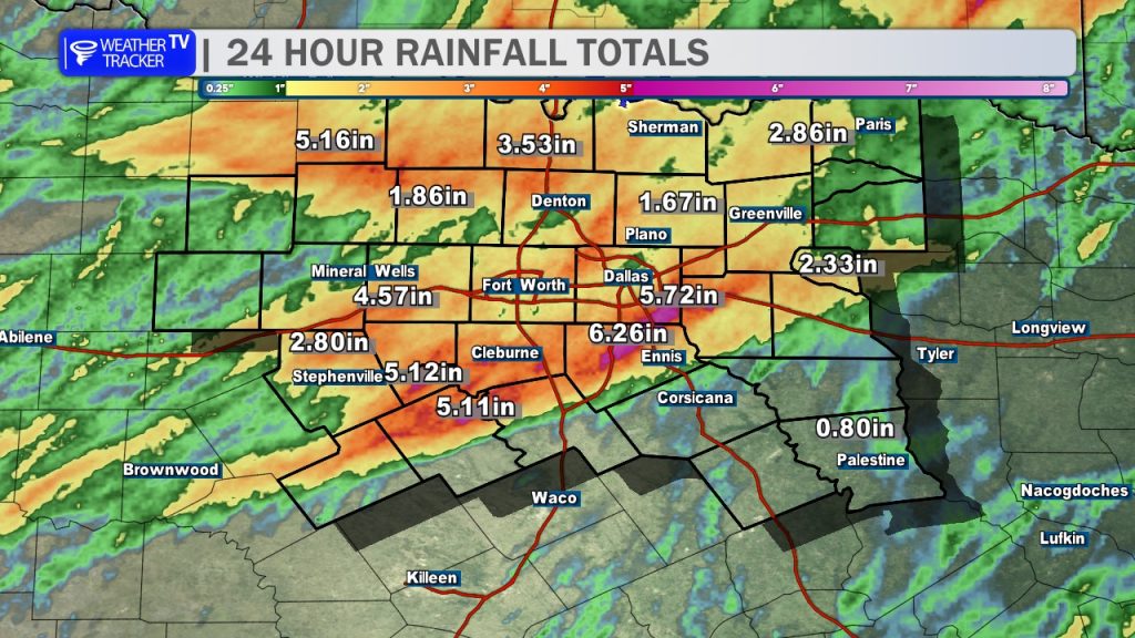
It’s a wet start for some of you as pockets of heavy rain continue to track across the area, mainly north of Highway 380. Because our soils are already completely saturated from yesterday’s downpours – with some areas picking up over 5 inches of rain – flash flooding remains our primary concern through the morning hours.
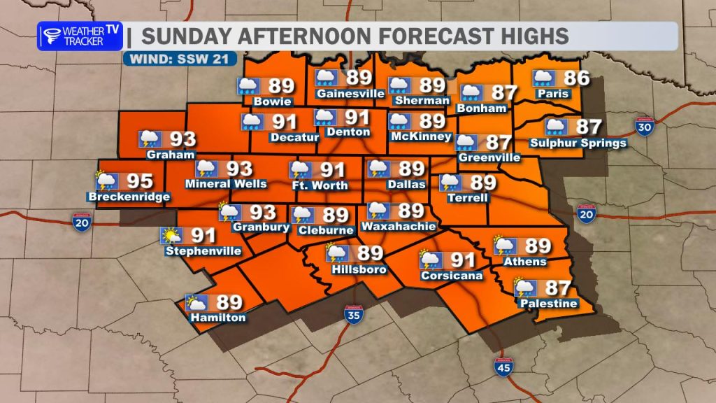
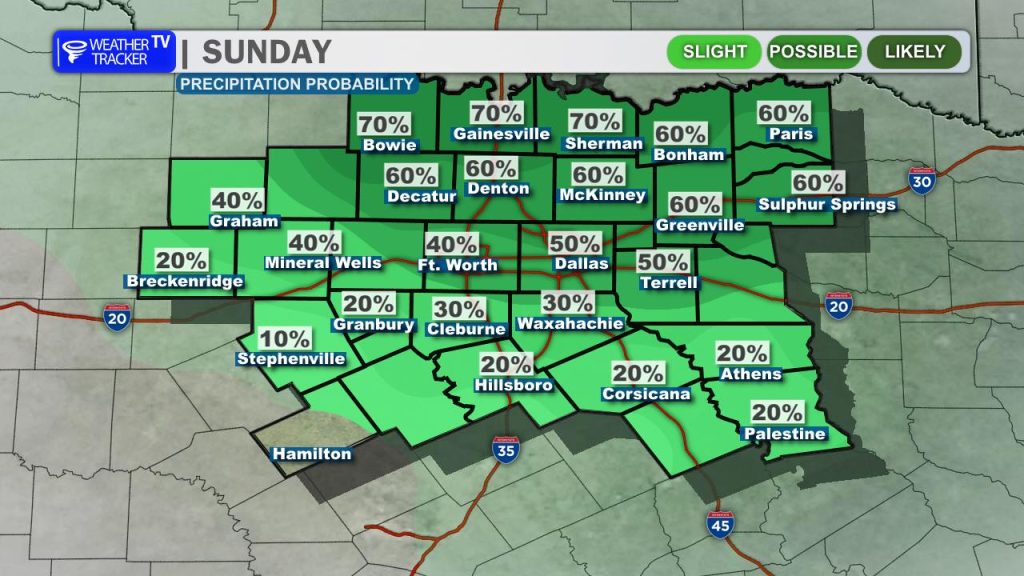
As we head into the afternoon, our slow-moving upper-level storm system will finally begin to lift northeast out of the region. This will push the remaining rain and storm chances primarily east and northeast of the Metroplex. Expect a sharp temperature contrast today across North Texas: areas east of DFW under clouds and rain will stay in the 80s, while locations to our west see afternoon clearing and jump quickly into the mid-90s.
Rain chances officially come to an end tonight, clearing the way for intense summer heat and high humidity to become the big story for the week ahead. A powerful subtropical ridge will build directly over Texas tomorrow, acting like a lid on the atmosphere and turning up the thermostat.
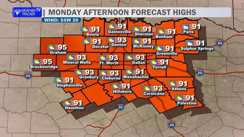
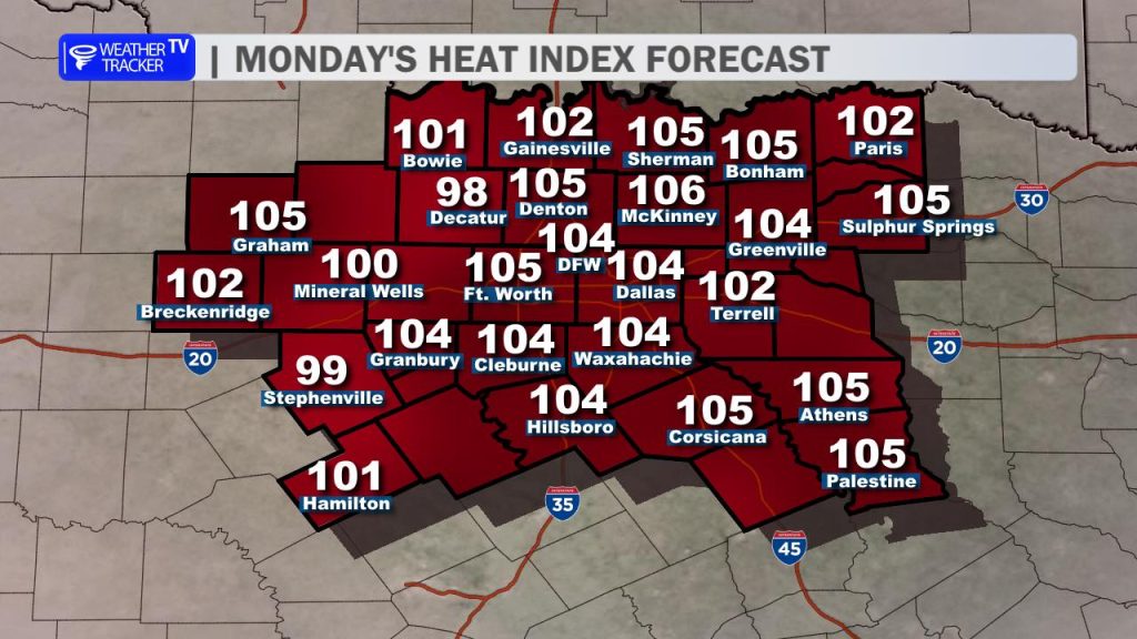
On Monday, air temperatures across North Texas will climb well into the mid-90s. When you combine that heat with dewpoints pooling in the 70s, it is going to feel incredibly oppressive. Expect “feels-like” temperatures or heat indices to run between 100° and 105° all afternoon.
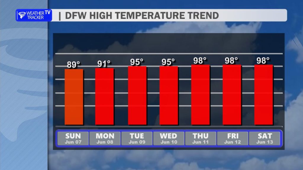
You will definitely want to practice heat safety if you have outdoor plans this week, as these high heat indices are here to stay through the upcoming weekend. To make matters worse, ambient air temperatures will continue to build each afternoon, with mid to upper 90s becoming likely by late next week. Stay cool and stay hydrated, North Texas!
You must be logged in to post a comment.