Good Saturday morning, North Texas!
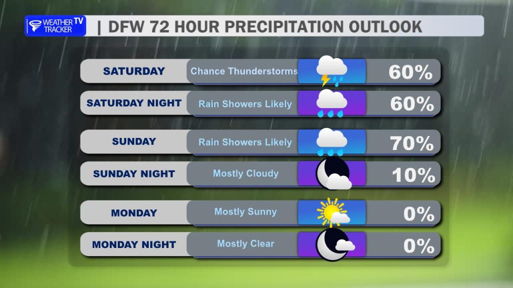
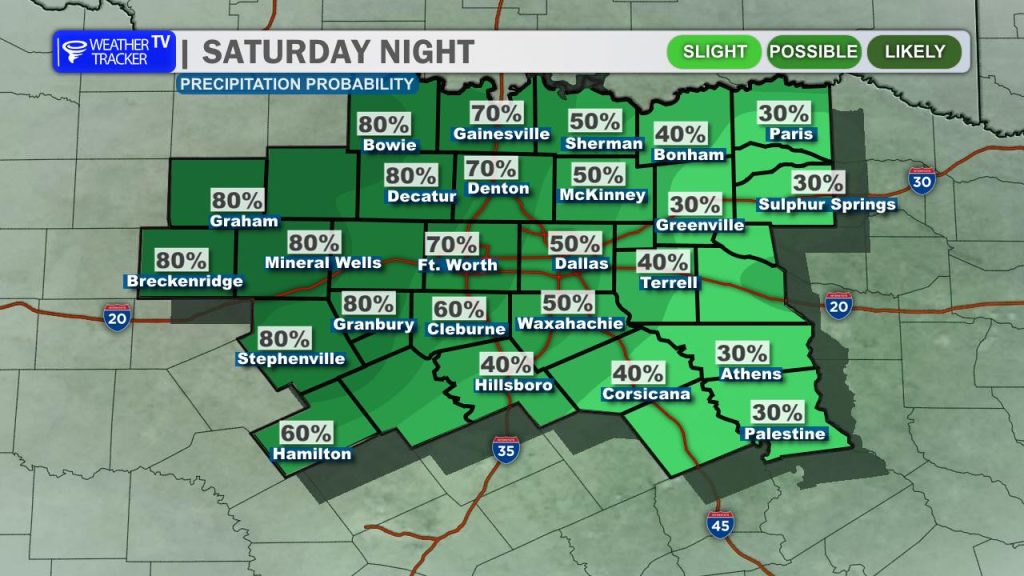
Get ready for a wet weekend ahead. While it won’t be a total washout every single minute, several waves of rain and thunderstorms are expected through tomorrow. A slow-moving upper-level low-pressure system is currently crawling out of the High Plains and West Texas. Because it is lumbering so sluggishly across the region and tapping into deep Gulf moisture, rain and storm chances will linger straight through Sunday evening.
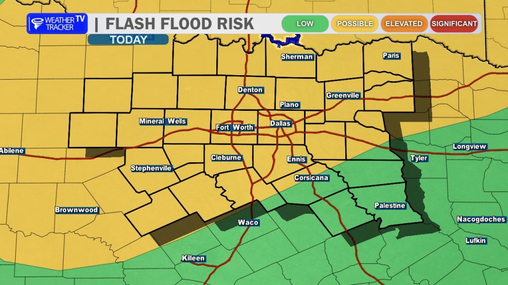
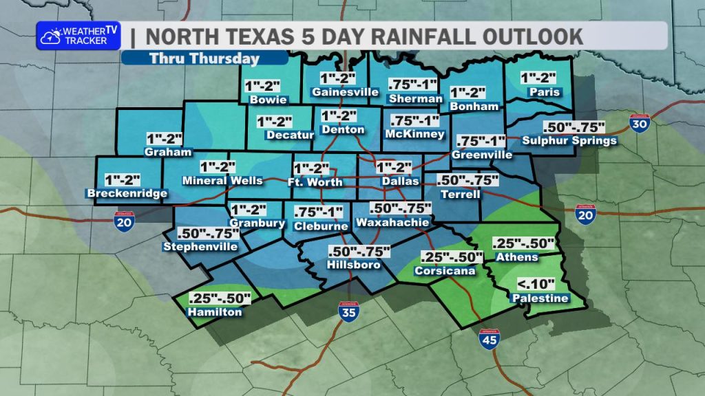
There is a growing potential for too much rain. A Flood Watch has been issued for the DFW Metroplex and areas to the north and west. While widespread totals of 1 to 2 inches are expected, the slow movement of these storms means we could see isolated, locally higher amounts between 3 and 6 inches, which raises the flash flooding threat.
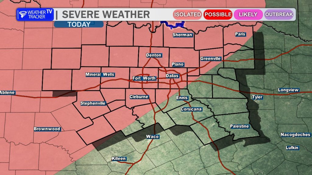
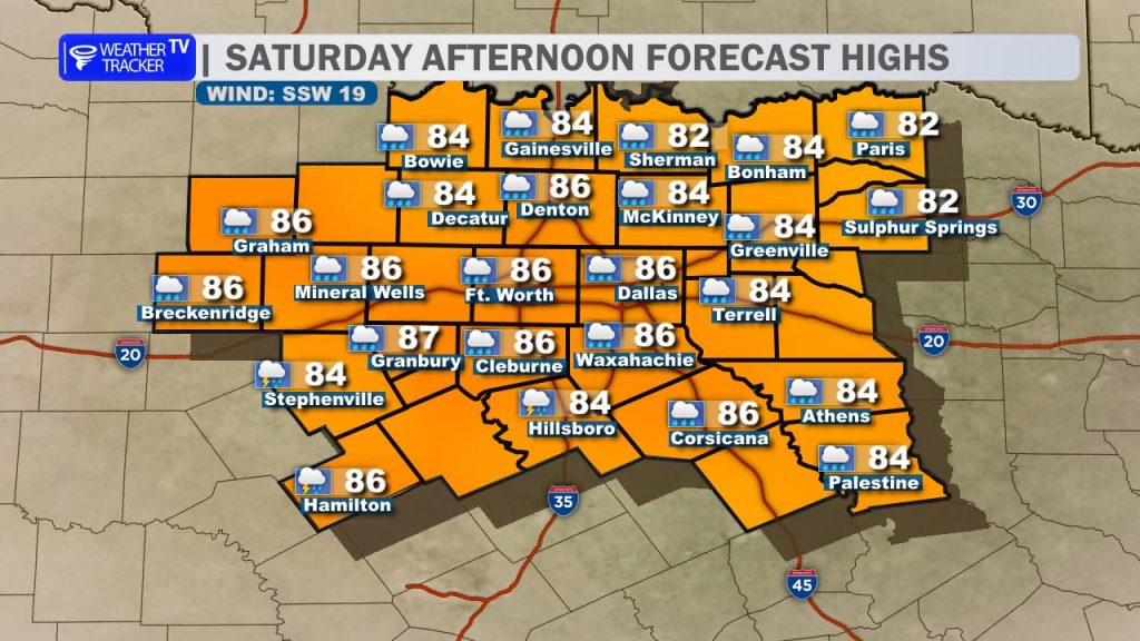
Additionally, there is a low but non-zero risk for a few severe storms late this afternoon and into tonight. If a stronger storm manages to develop, quarter-sized hail and damaging downburst winds up to 60 mph will be the primary concerns. Otherwise, expect on-and-off rain today with afternoon highs topping out in the mid-80s.
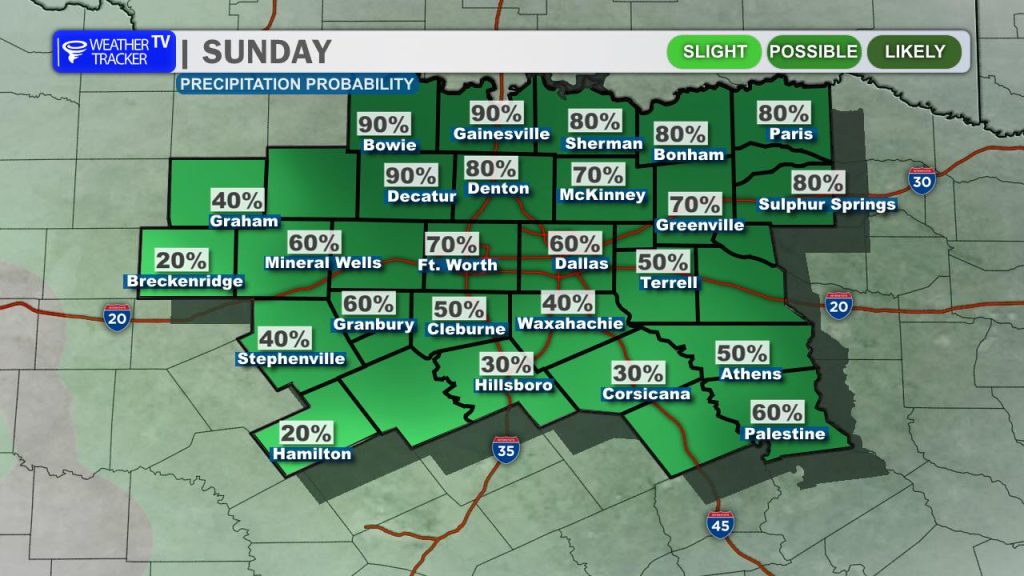
Rain and embedded thunderstorm chances will persist overnight and through the first half of Sunday. However, the system’s trough axis will finally begin tracking east by Sunday afternoon, allowing skies to gradually clear from west to east.
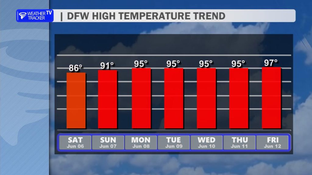
By Monday, the weather pattern changes dramatically. High pressure quickly builds over Texas, completely shutting off our rain chances and sending temperatures climbing into the mid-90s. Because of all the recent rainfall, trapped boundary-layer moisture will send humidity levels soaring. We are looking at our first extended stretch of afternoon heat index values pushing near or above 100°. Heat safety will quickly become a real priority as we head into next week, so enjoy the cooler 80s this weekend while you can!
You must be logged in to post a comment.