Good Monday morning, North Texas!
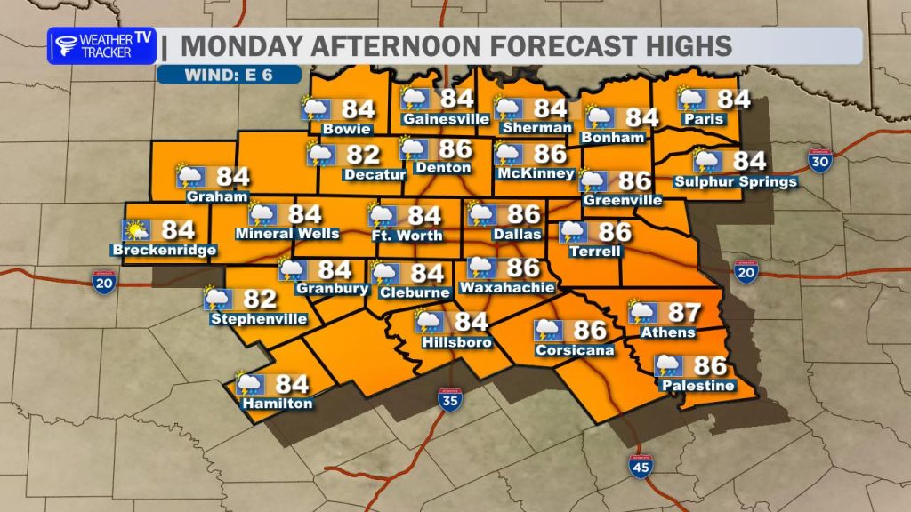
Expect another very warm and humid Memorial Day afternoon with highs in the mid-80s, thick humidity, and a light south breeze. If you are heading out to area lakes today, the chop will be light and water conditions look good—just keep an eye on the sky.
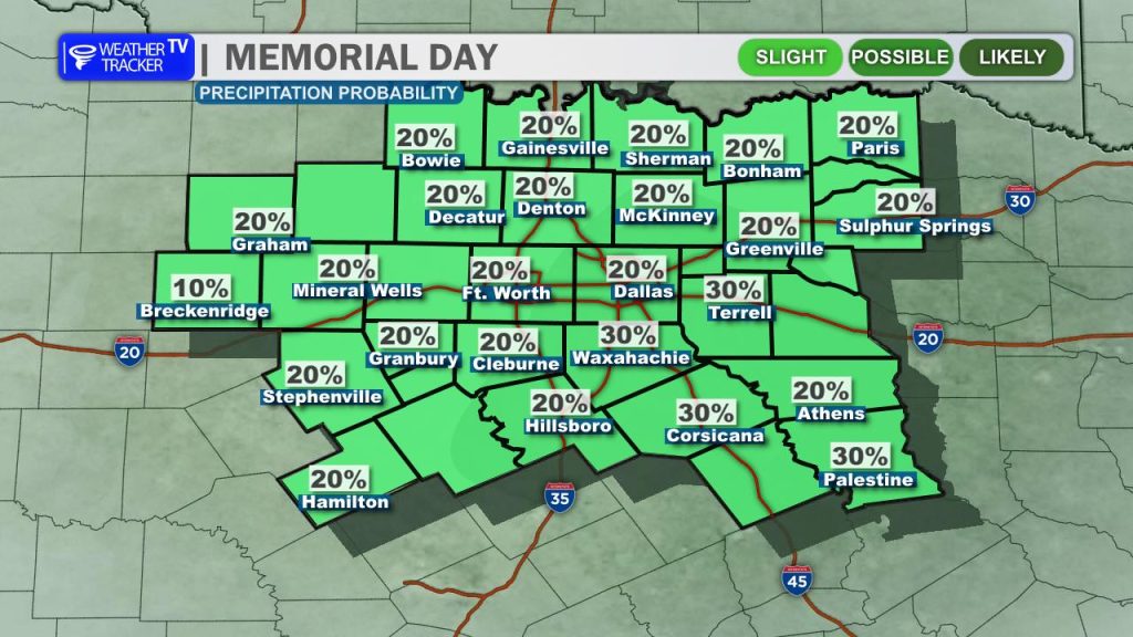
It will be another one of those days where scattered thunderstorms may develop during peak heating late this afternoon and early evening. The overall severe risk today is low, but similar to yesterday, weak atmospheric steering winds mean we are looking at slow-moving “pulse” storms. As these storm cores collapse, they can trigger gusty downburst winds capable of prompting a few warnings. Vivid lightning and brief, heavy downpours will also be a primary concern. Remember: if you hear thunder while outside, seek shelter immediately.
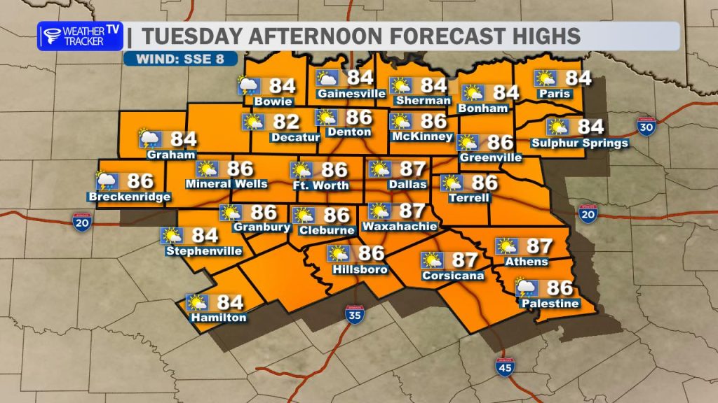
Any evening storms will fade away after sunset, leaving a quiet, sticky night. Tuesday afternoon also looks warm and humid with highs back in the mid-to-upper 80s. During the day Tuesday, storm chances remain quite low and isolated.
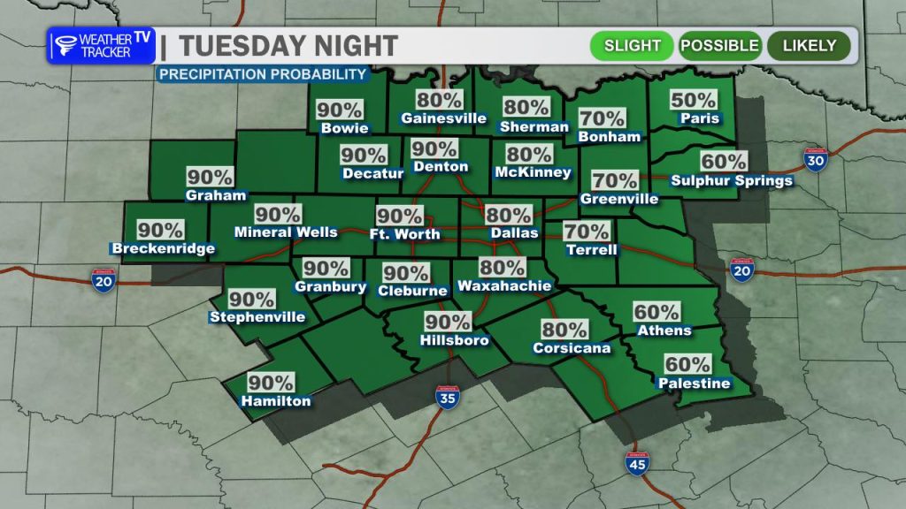
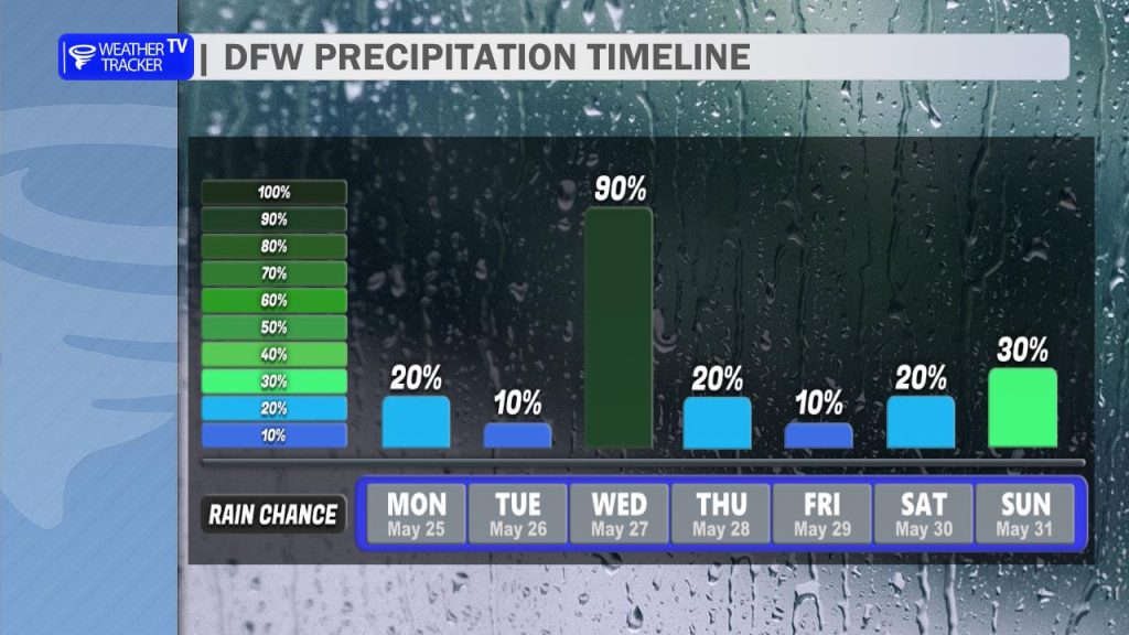
However, our attention turns to Tuesday night into Wednesday as our next, more organized upper-level disturbance moves through from the west. This system will bring a widespread chance of rain and an organized cluster of storms into the region. While the overall severe risk looks low, the opportunity for flooding will increase significantly. Because our soils are already completely saturated from weekend rains, locally heavy rainfall by mid-week could quickly lead to renewed flooding issues, especially across Central Texas.
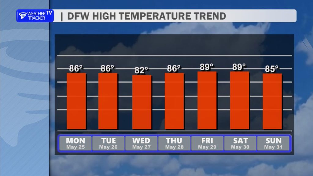
The remainder of the workweek ahead looks to stay warm and humid with highs in the 80s each day and lingering, daily chances for rain and storms as an unsettled pattern stays parked over the Lone Star State.