
A Severe Thunderstorm Warning is in effect for parts of North Texas through 5:45 PM. This warning includes east central Hill County and southwestern Navarro County.
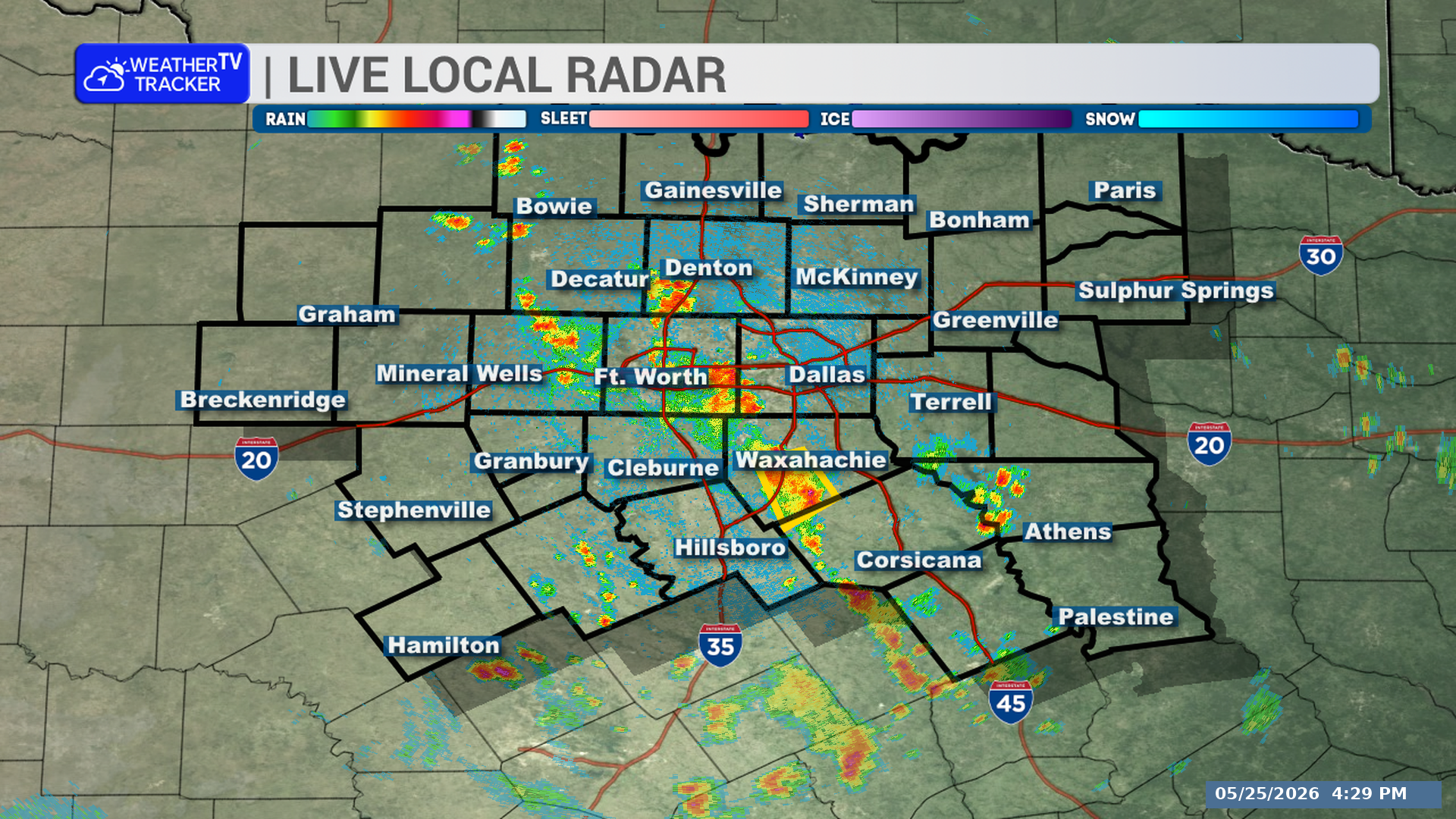
**Timing:**
– In effect until 5:45 PM
– At 4:48 PM, the storm was located over Navarro Mills Lake, or about 16 miles southwest of Corsicana, moving west at 10 mph
– The storm will be near Dawson and Navarro Mills Lake around 4:55 PM
**What to Expect:**
– 60 mph wind gusts
– Quarter-size hail
– Continuous cloud-to-ground lightning
**Potential Impacts:**
– Hail damage to vehicles is expected
– Wind damage to roofs, siding, and trees is expected
– High winds and waves can capsize boats on or near Navarro Mills Lake
**What to Do Now:**
– Get inside a sturdy structure
– Stay away from windows
– Move indoors immediately if you hear thunder or see lightning
– If you are on or near Navarro Mills Lake, get away from the water and move indoors or into a vehicle
– Do not stay on the water during this thunderstorm
Stay with William Cole and Weather Tracker TV.
Let’s stay safe together.
You must be logged in to post a comment.