Good Sunday morning, North Texas! We are looking at a beautiful finish to the weekend as calm conditions prevail across the region.
Today’s Forecast: Sunday, May 3
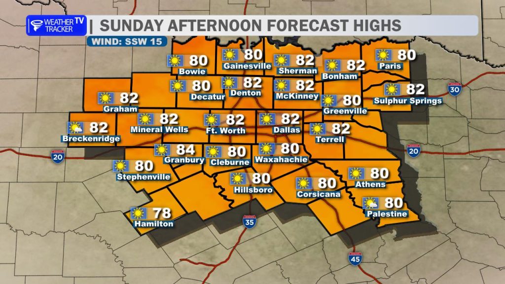
Expect a fantastic afternoon with plenty of sunshine.
- High Temperatures: Most of North Texas will see afternoon highs pushing into the low 80s, with Dallas-Fort Worth specifically reaching around 83°.
- Winds: A southwesterly breeze will pick up through the day, sustained at 12–15 mph with occasional gusts reaching between 20 and 25 mph.
Looking Ahead: The Work Week
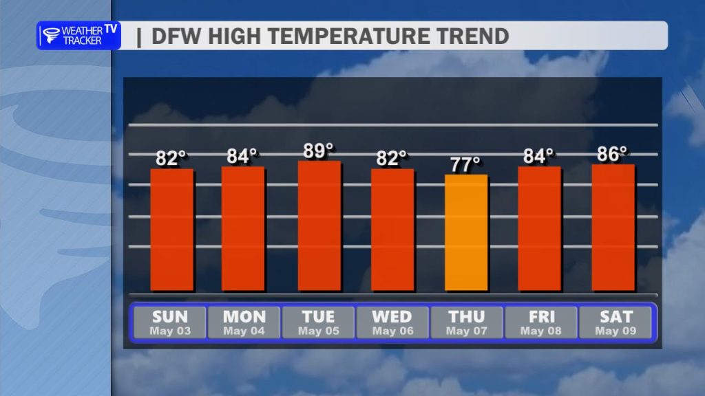
The warming trend continues into early next week as a southwesterly flow established overhead.
- Monday: Highs will remain in the low 80s under increasing cloud cover.
- Tuesday: This will likely be the warmest day of the week, with highs climbing into the mid-to-upper 80s across the Metroplex.
Storm Chances and Mid-Week Cold Front
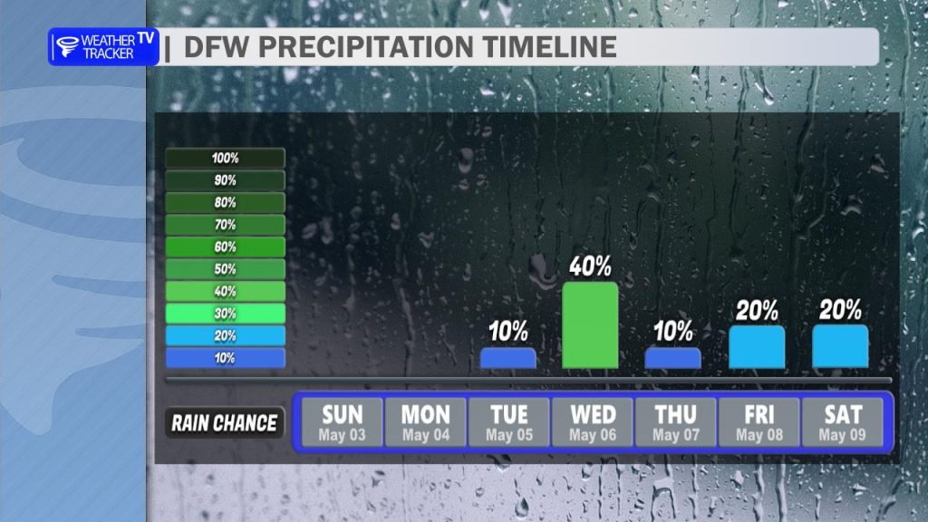
Our attention then shifts to a cold front and an associated dryline arriving late Tuesday into Wednesday.
- Timing: Isolated storms may initiate late Tuesday afternoon, but a stronger “cap” (a layer of warm air aloft) may limit initial coverage. A better chance for scattered showers and thunderstorms arrives Tuesday night through Wednesday morning as the front moves through.
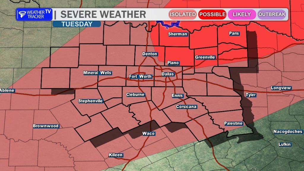
- Severe Potential: The Storm Prediction Center has highlighted a risk for severe weather during this window. While confidence in coverage is still evolving, any storms that do develop will carry a risk of large hail and damaging winds.
- Cool Down: Behind the front, we’ll see a notable drop in temperatures. Highs on Thursday are expected to hover in the low 70s, providing a brief but pleasant break from the 80-degree heat.
We will continue to monitor the timing and strength of Tuesday night’s front – stay tuned for updates as the data becomes clearer. -William