Good Saturday morning, North Texas! After an active stretch that kept us all on our toes – including those confirmed tornadoes in Mineral Wells and Rio Vista earlier this week – we have finally earned ourselves a much-needed breather.
A Crisp Start to a Gorgeous Day
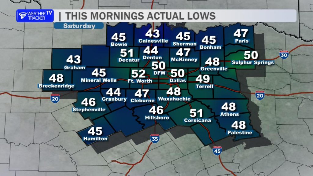
It was a noticeably “jacket-required” start to the morning. Thanks to a post-frontal airmass and high pressure settling in, we saw clear skies and very dry air allow temperatures to tumble. While the Metroplex stayed in the low 50s, many of our rural hometowns dipped into the mid-to-upper 40s around sunrise.
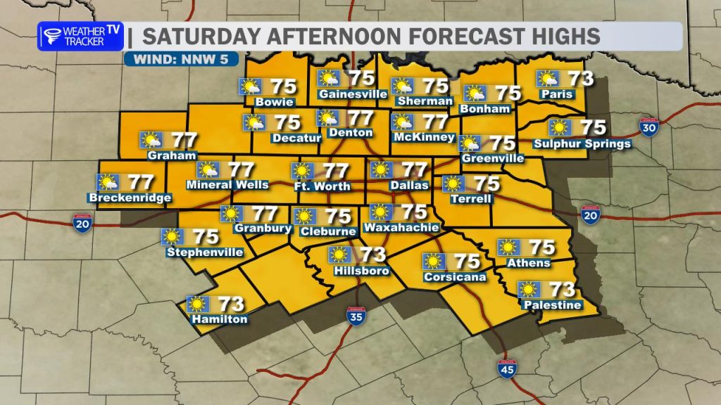
Expect a stellar afternoon ahead. With dewpoints lingering in the 40s, it will feel incredibly comfortable.
- Sky: Abundant sunshine.
- Winds: Light and variable, generally under 10 mph.
- Highs: Topping out in the mid-70s across the region.
Sunday: The Pick of the Week
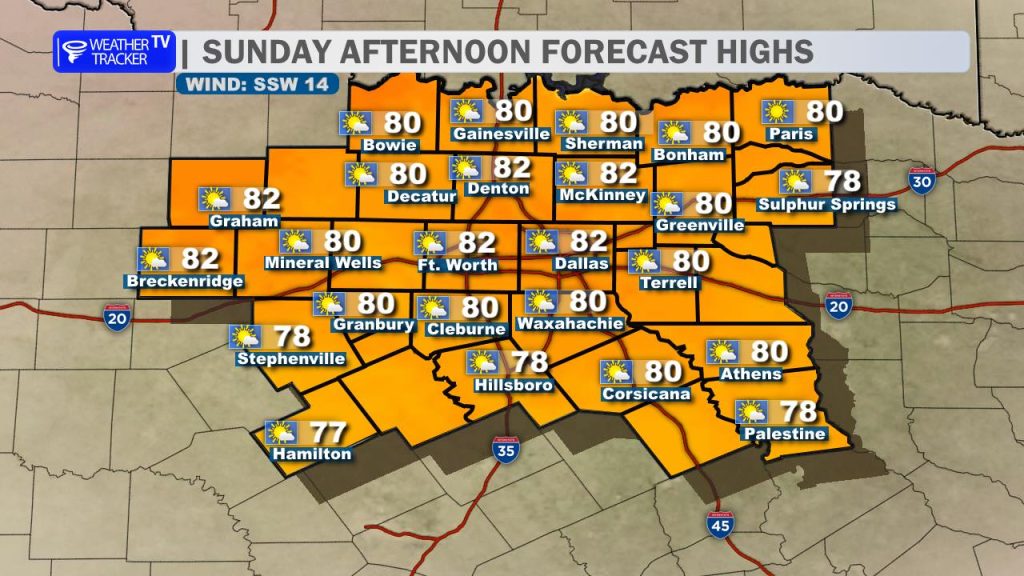
Tomorrow looks like a total “keeper.” We’ll start cool again in the 50s, but as the surface high slides east, southerly winds will redevelop. This return flow will begin to nudge our moisture levels back up and push our afternoon highs into the lower 80s. If you have outdoor plans, Sunday is the day to take advantage of them.
Looking Ahead: The Heat and the Next Storm Threat
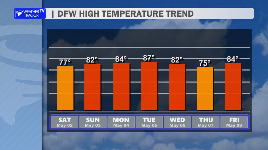
The warming trend accelerates as we head into the new work week. By Monday, breezy south winds (15-25 mph) will bring back that familiar Gulf humidity, pushing highs into the mid-to-upper 80s.
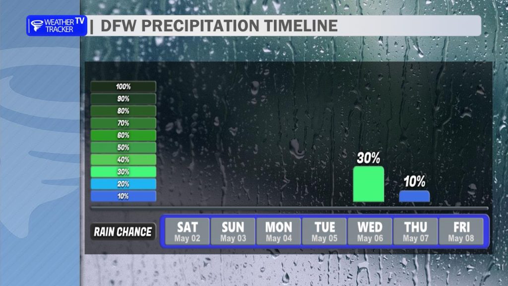
The Next Storm Window: We are keeping a close eye on the Tuesday night through Wednesday timeframe.
- The Setup: A southern stream shortwave merging with a Plains trough will send a cold front and dryline toward North Texas.
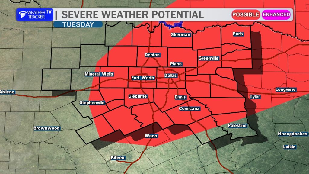
- The Risk: The Storm Prediction Center has already highlighted a 15% risk area (equivalent to a Slight Risk) across parts of North Texas for Tuesday.
- Timing: While the daytime Tuesday currently looks capped and dry, isolated storms could fire along the dryline after sunset, with better coverage expected Wednesday as the front slides through.
We’ll be tracking the evolution of this next system all weekend long. For now, put the rain gear away and enjoy the sunshine!
Follow us through the weekend for the latest timing and risk levels for next week’s storms.