Happy Friday North Texas!
We are finally turning the corner on this active weather pattern as we head into the first weekend of May. While we aren’t completely done with the rain just yet, the finish line is in sight.
Today: One Last Push of Moisture
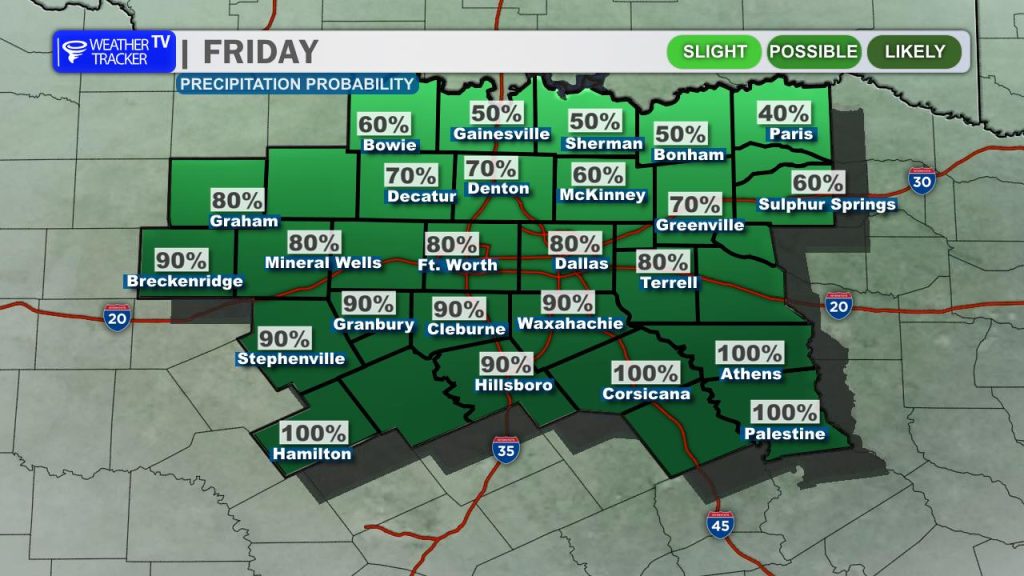
The final wave of this system is moving through today, keeping rain chances in the forecast through the afternoon. The heaviest and most consistent rain has shifted into our southern counties and Central Texas, but scattered showers will persist across the Metroplex through early evening.
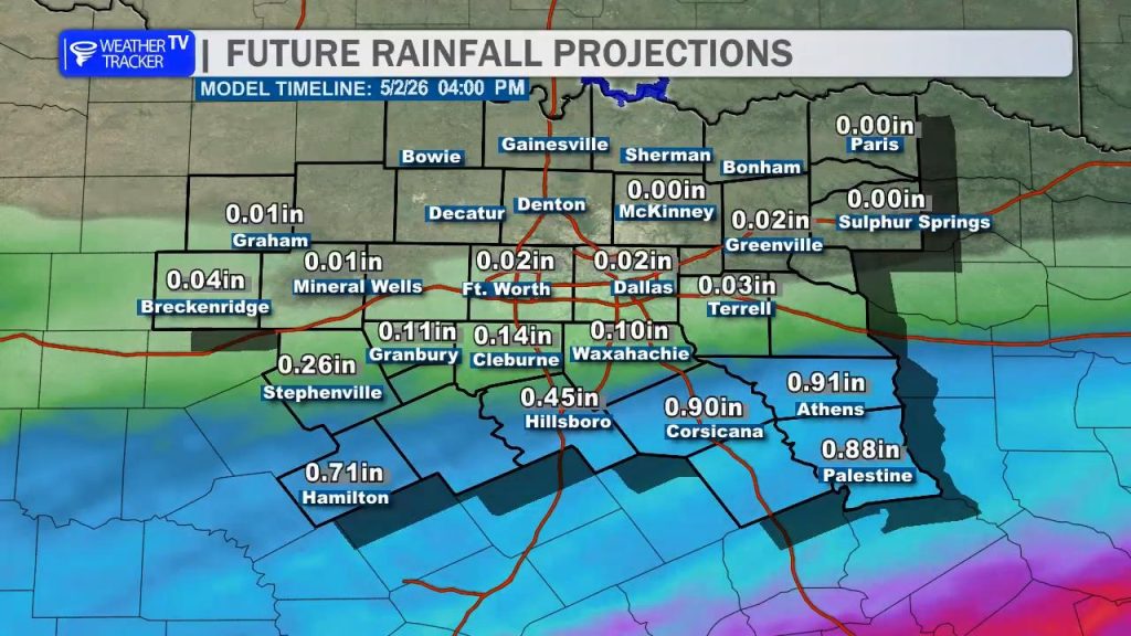
- Rainfall Totals: Most of the area can expect an additional 0.10″ to 0.25″, though areas south of I-20 could see totals closer to 0.50″ before the system exits.
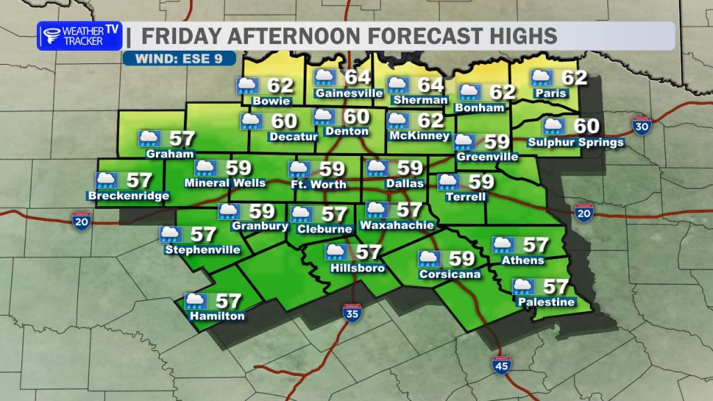
- Temperatures: Between the cloud cover and the northwesterly breeze, it’s going to stay quite cool for early May. Expect afternoon highs to struggle, topping out in the low to mid-60s.
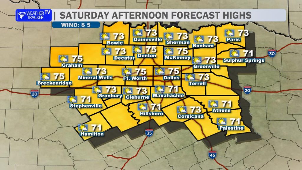
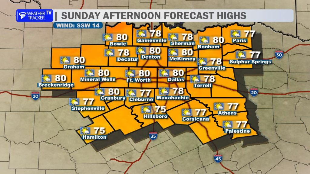
The Outlook: A Stellar Weekend
The clearing trend begins tonight as the upper-level trough finally kicks eastward. By late evening, we should see the back edge of the clouds breaking up, setting the stage for a significant pattern shift.
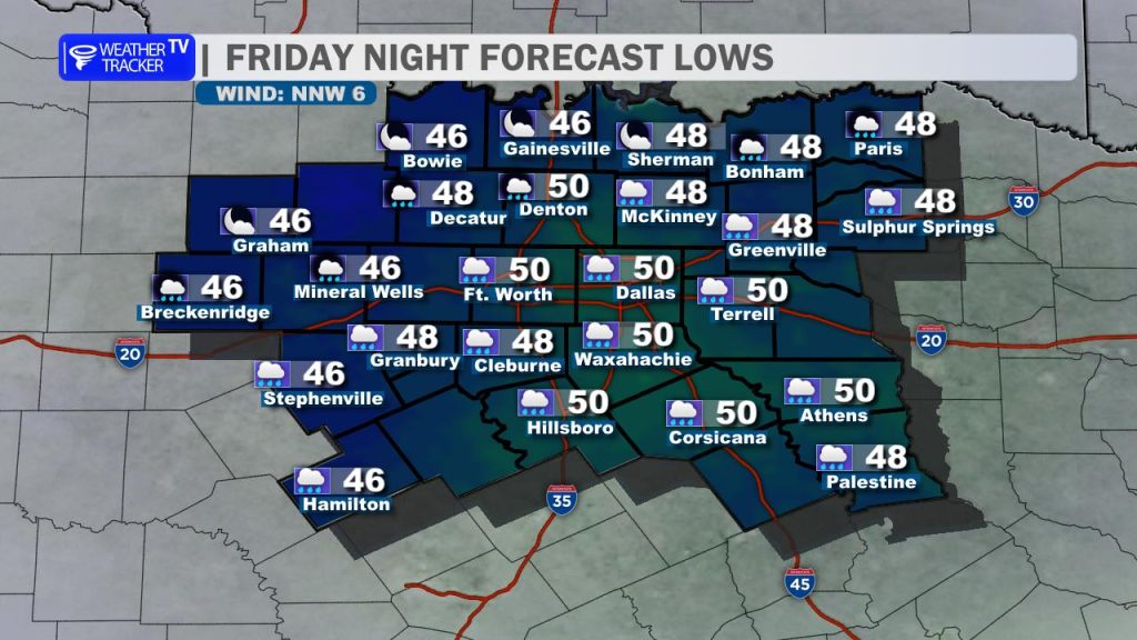
- Tonight: Skies will clear and winds will light up, allowing for a crisp night. We’ll drop into the upper 40s and low 50s by daybreak Saturday.
- Saturday: This looks like the “pick of the week.” With full sunshine and a light breeze, highs will rebound beautifully into the mid-70s.
- Sunday: The warming trend continues as southerly flow returns. Expect a mixture of sun and few passing clouds with highs reaching the low 80s.
Looking Ahead: Next Week
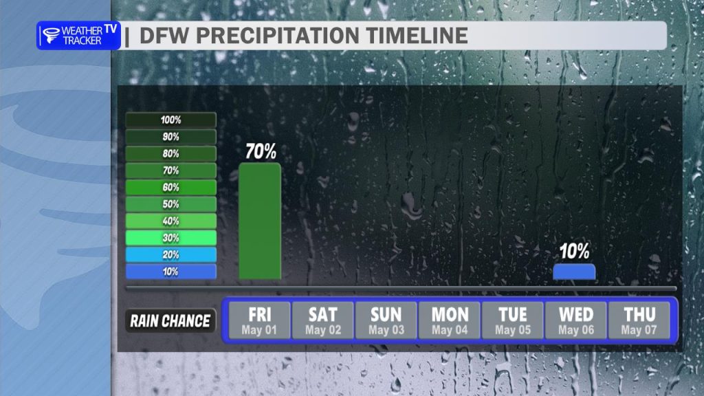
The dry spell looks to hold firm through Monday. Our next opportunity for rain and storms likely won’t arrive until Tuesday or Wednesday of next week as the next shortwave approaches the Plains with possible T-Storm chances.