Good Tuesday morning, North Texas!
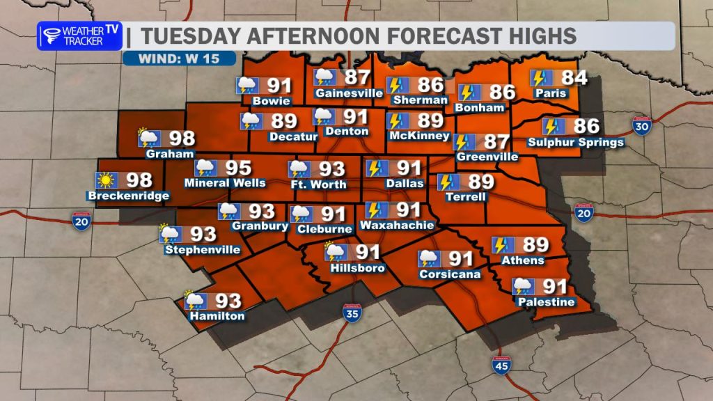
We are tracking a volatile and high-impact weather setup today. It will be another hot and humid day with highs climbing into the 90s, and our western-most counties may even reach the upper 90s. This extreme heat, combined with dewpoints in the low-to-mid 70s, is fueling an atmosphere with extreme instability.
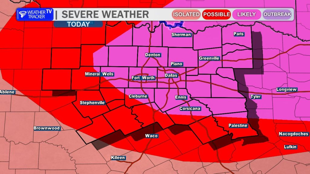
The Severe Threat Breakdown:
- Ongoing Activity: We are already monitoring severe weather this morning. A Severe Thunderstorm Watch is in effect until 1 PM for our Red River and northwestern counties, where large hail remains the primary concern.
- The Main Event: The focus shifts this afternoon as a cold front begins to sag south from Oklahoma. Combined with a surge of jet stream energy and peak daytime heating, scattered to widespread severe storms are expected to ignite along this boundary.
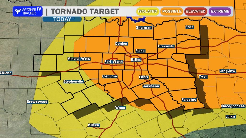
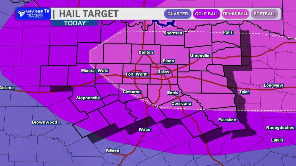
- Primary Hazards: This setup is primed for very large, destructive hail (exceeding 3–3.5 inches) and damaging wind gusts up to 65 mph. While low-level wind shear is slightly veered, the sheer magnitude of the instability means a tornado warning or two cannot be ruled out.
Timing for the DFW Metroplex:
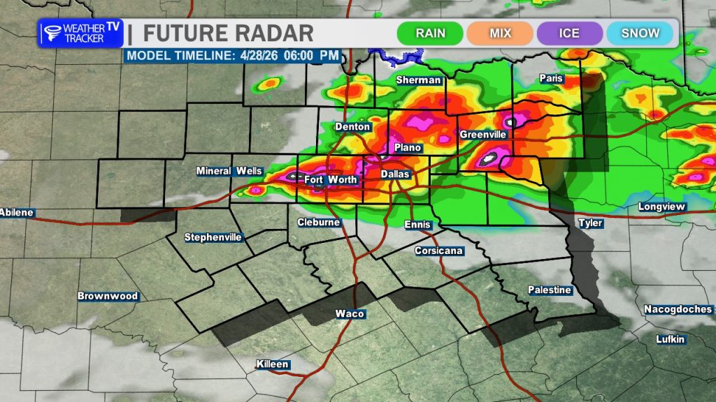
The most intense development is expected to coincide with the evening commute. We are highly concerned about the potential for very large hail impacting traffic.
Plan Ahead: If your schedule allows, please make arrangements to be off the roads during the late afternoon and evening hours. If you must be out, prioritize sheltering your vehicle. Storm activity will continue to push south through the late evening, moving out of the DFW area and impacting our southern counties before gradually diminishing overnight.
Stay weather-aware, keep your eyes on the radar, and have multiple ways to receive warnings today. -William