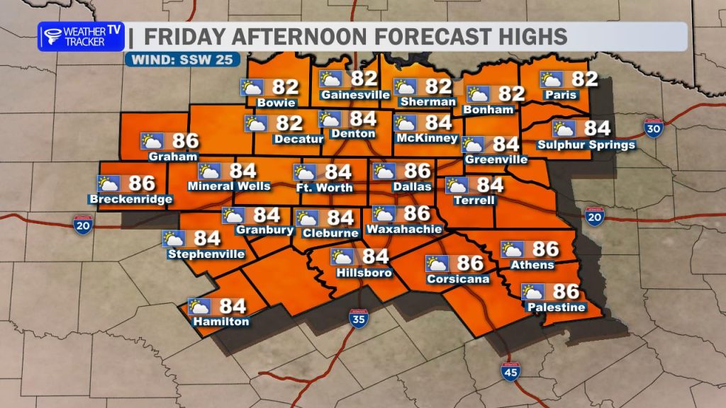
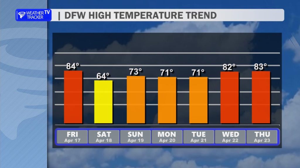
Happy Friday, North Texas! It’s another cloudy and mild start to the morning across the Metroplex. While we are starting with a thick deck of clouds, expect a mix of sun and clouds by the afternoon as temperatures climb rapidly into the low to mid-80s area-wide.
The Gusty South Wind
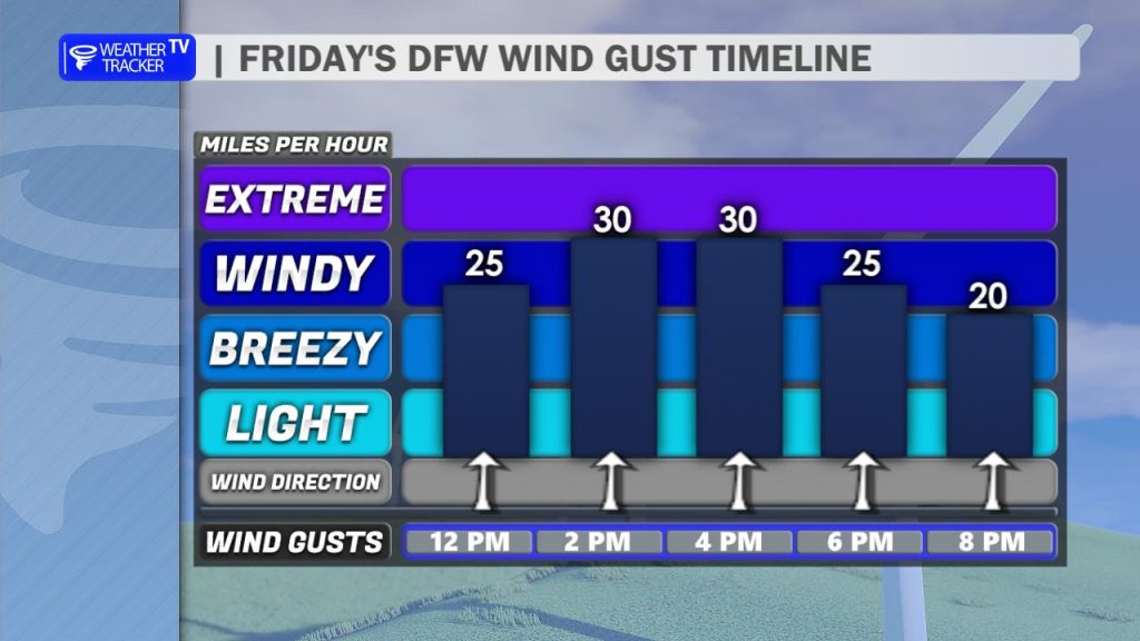
The big story today—aside from the heat—will be the wind. A deepening low-pressure system to our north will ramp up our southerly flow. Expect a breezy afternoon with sustained winds between 15–20 mph and peak gusts potentially exceeding 30 mph. If you’re out on the area lakes or driving a high-profile vehicle, keep a firm grip on the wheel!
Tonight: The Timing on the Front
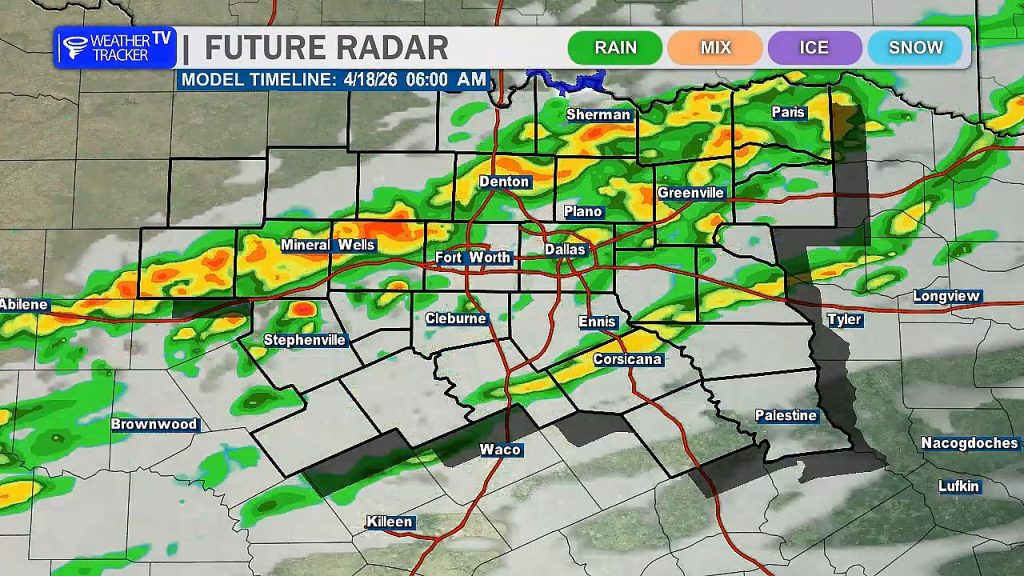
Our eyes are fixed on a powerful cold front currently diving south out of Kansas.
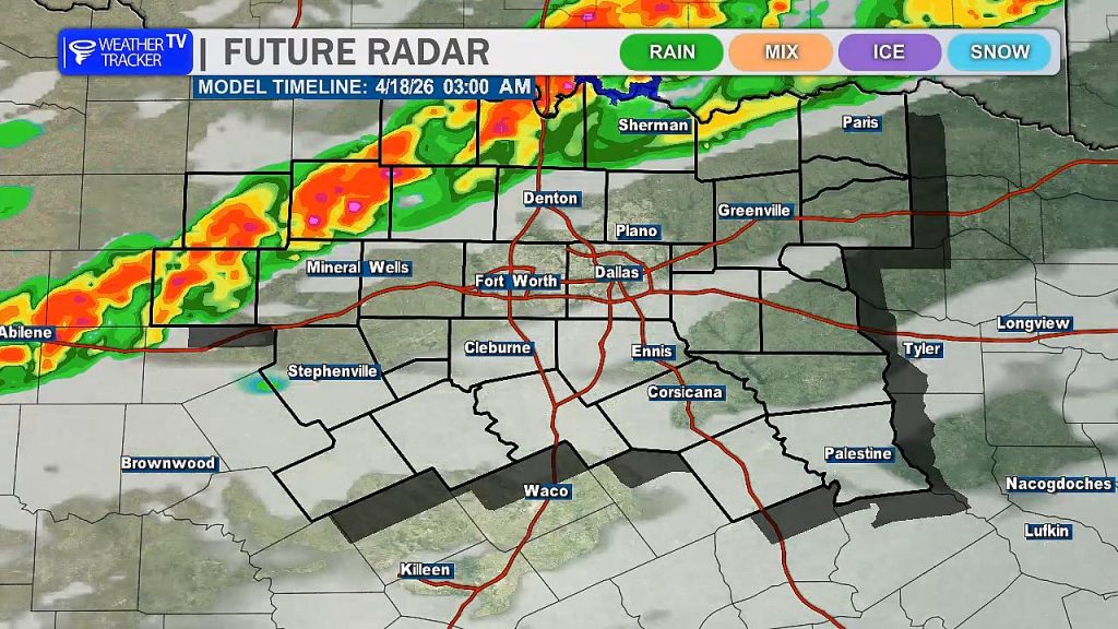
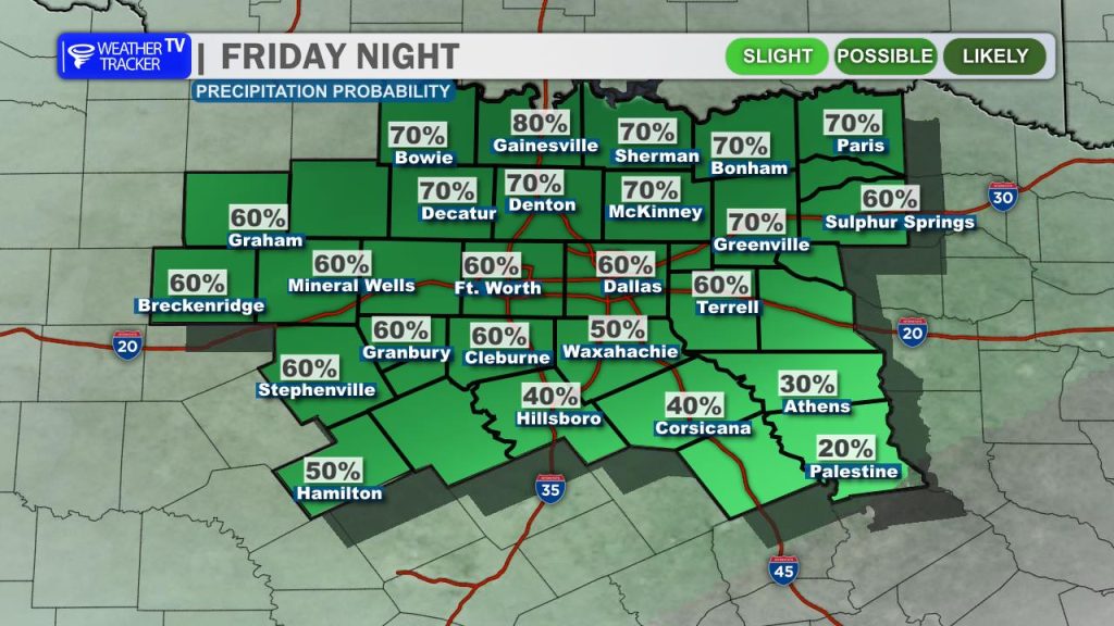
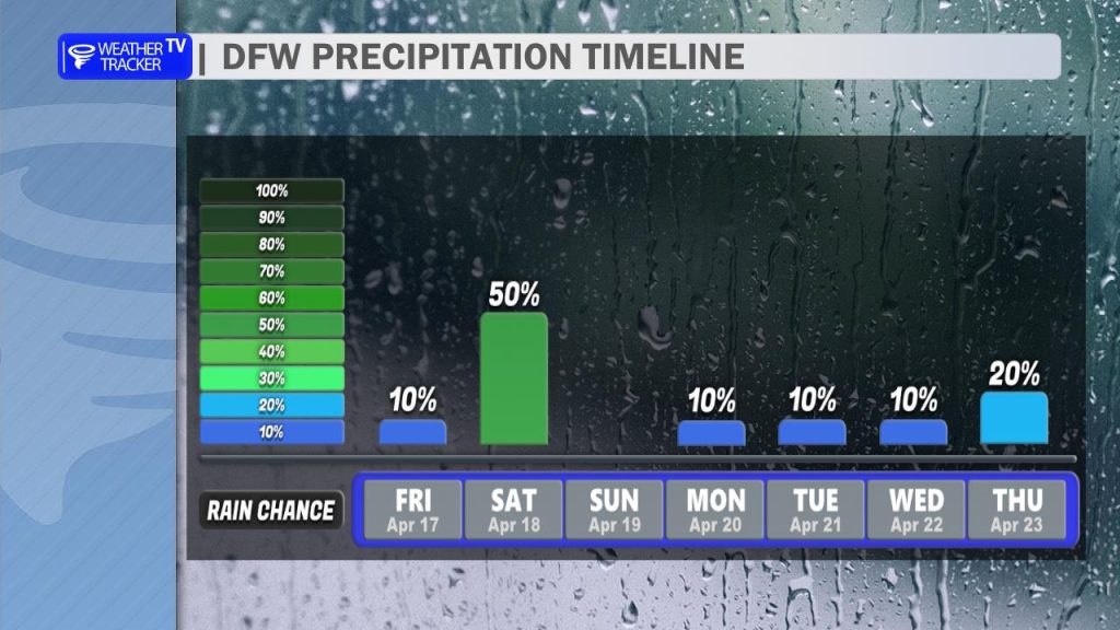
- The Arrival: The front is progged to reach our northwestern counties around 1 AM to 2 AM and sweep through the DFW Metroplex between 3 AM and 6 AM. * The Threat: A line of showers and thunderstorms will accompany the boundary. While the overall severe risk is on the lower end, a few storms could become “robust.” Our primary concern will be damaging wind gusts up to 60 mph and perhaps some small hail.
- Lingering Rain: Expect showers and isolated thunderstorms to linger, especially south of I-20, through Saturday afternoon.
Saturday: A Sharp Saturday Shock
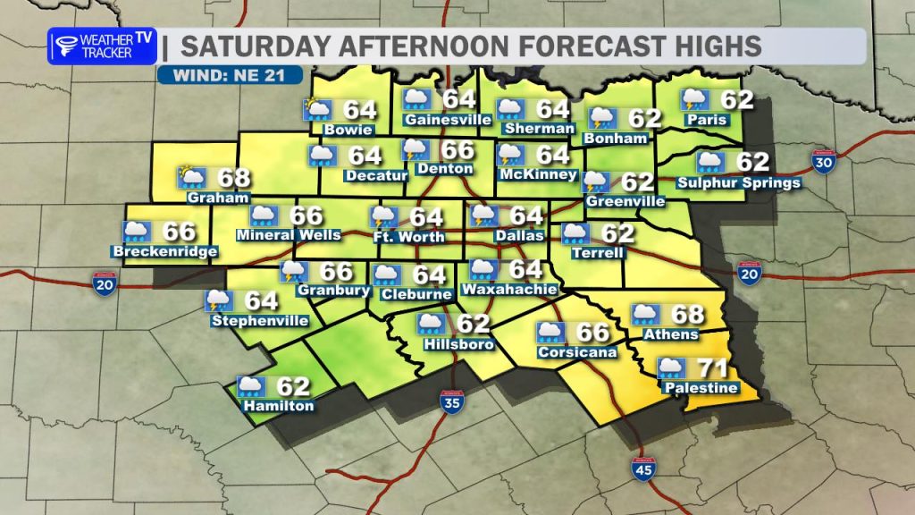
Saturday is going to be a completely different story. We trade the 80s for a brisk north wind and highs struggling to leave the 60s. It’s going to be a damp, chilly day—a perfect excuse to stay inside.
The Extended Look
- Sunday: We start the morning on a chilly note with lows in the 30s and 40s. However, we’ll rebound nicely for a comfortable, partly cloudy afternoon with highs back in the upper 60s to near 70.
- Next Week: Highs will hold in the 70s to start the week before rebounding into the 80s by Wednesday. We are keeping an eye on some slight shower chances (10–20%) early in the week, but nothing meaningful is expected at this time.
You must be logged in to post a comment.