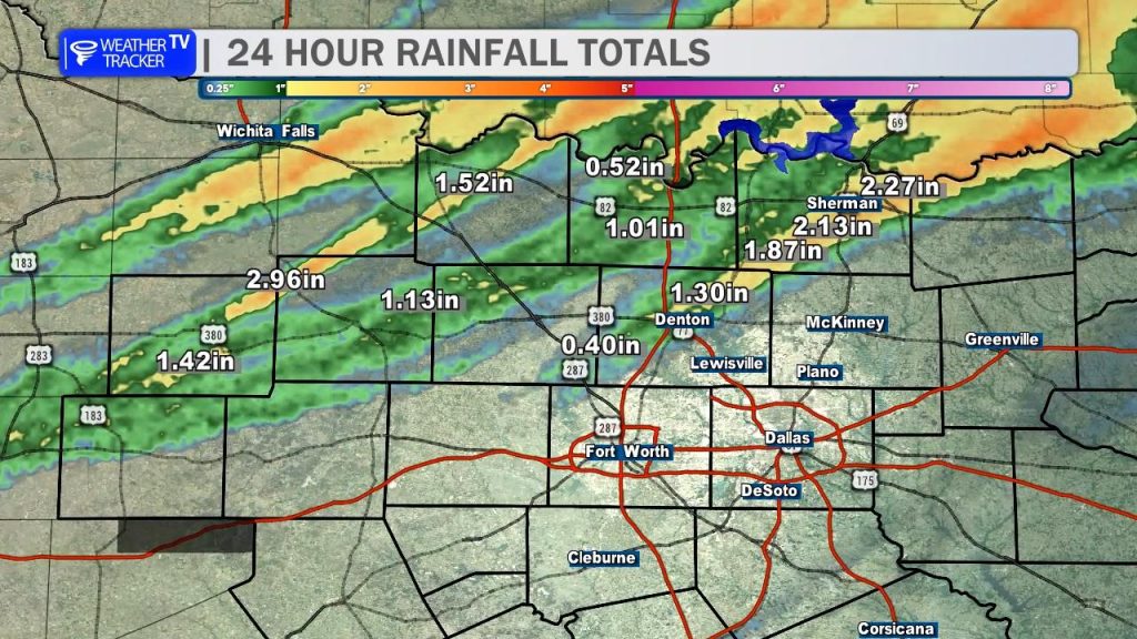
Good Thursday morning, North Texas! We are cleaning up after a very active Wednesday evening. While much of the Metroplex stayed dry, our western and northern counties took the brunt of the action. Radar estimates and ground reports confirmed hail larger than golf balls in our western counties, and rainfall was generous – many spots picked up a solid 1″ to 3″ of rain. Denton County saw some great totals, though the rest of the DFW area mostly saw spotty, light showers.
Today & Friday: Turning Up the Heat
If you thought the last few days were muggy, hold on to your hat. Today will be warmer, more humid, and definitely breezy.
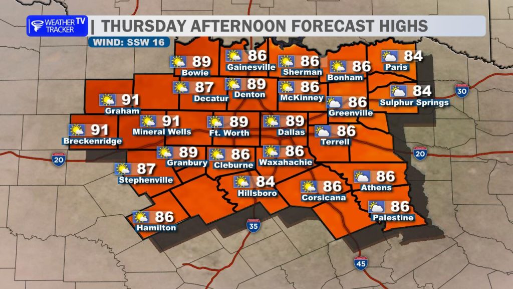
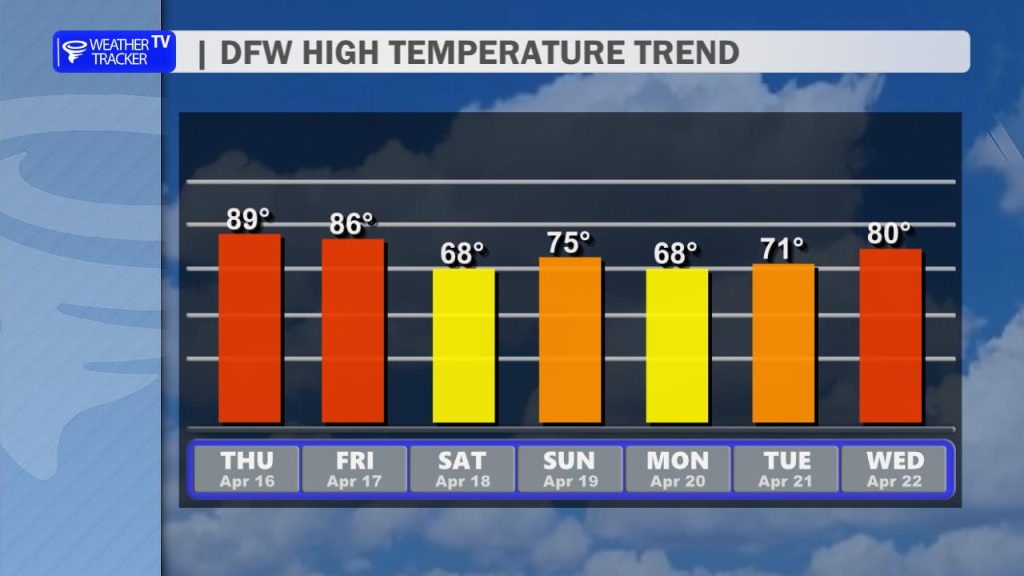
- The Highs: Expect temperatures to push into the upper 80s, with some spots hitting 90°.
- The Dryline: We are watching the West Texas dryline again this evening. While a “cap” (warm air aloft) should keep most of us dry, there is a slim 10% chance of a stray thunderstorm breaking through in our far western counties.
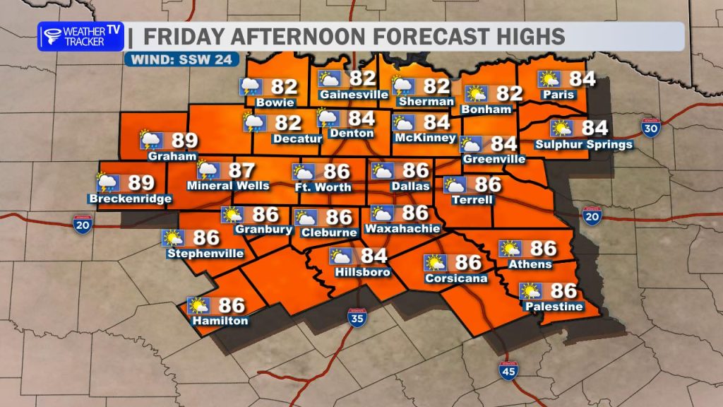
- Friday: Expect a “carbon copy” of today—hot, breezy, and humid with highs in the mid-to-upper 80s.
The Weekend “Shock”: Saturday’s Cold Front
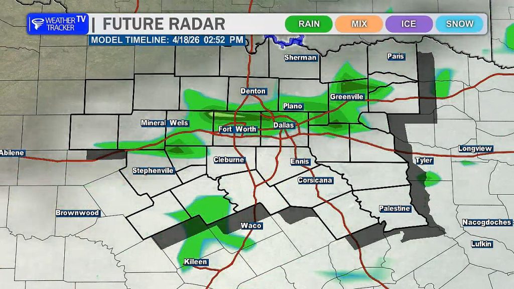
Saturday is a completely different story. A fast-moving, powerful cold front will sweep across North Texas on Saturday morning, and it’s going to bring a big reality check.
- The Timing: Expect a line of showers and thunderstorms to accompany the front Saturday morning.
- The Threats: While the overall severe risk is low, we are watching for a marginal risk of gusty winds as the line pushes south. Some small “post-frontal” hail isn’t out of the question either.
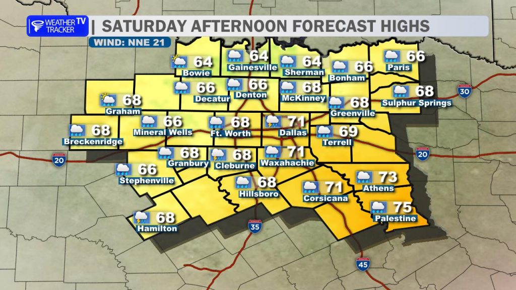
- The Temperatures: Say goodbye to the 80s. Temperatures will crash into the 60s behind the front and stay there all afternoon, made to feel even cooler by a brisk north wind.
Looking Ahead: An Active Pattern Returns
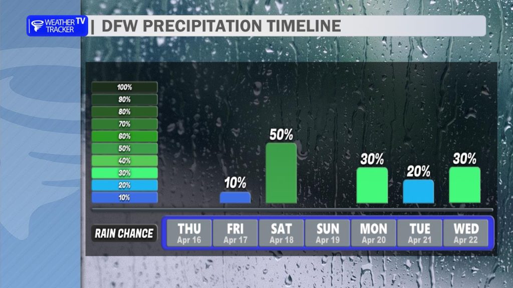
The front clears out the heat, but it doesn’t totally clear the radar. We are tracking scattered rain chances returning early next week. While we aren’t expecting severe weather with that early-week activity, another round of more significant rain and storm chances is already showing up for the following weekend.