Happy Wednesday, North Texas! Today is another Weather Ready Day. While we aren’t expecting a widespread outbreak, we are closely monitoring a few scattered storms that could turn severe late this afternoon and evening.
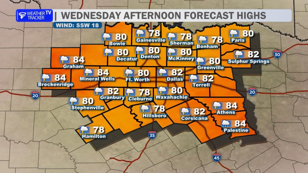
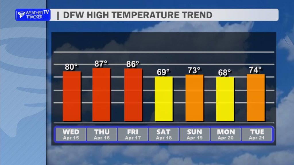
The Setup Today: It will be another breezy and humid afternoon with highs for most of the Metroplex topping out near 80°. The primary focus for storm development is just to our northwest. As daytime heating peaks, we expect a few thunderstorms to “fire” off the dryline – a boundary separating moist and dry air.
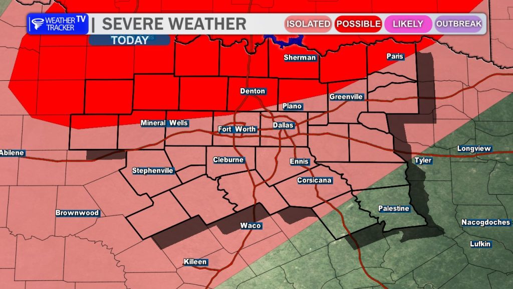
Primary Threats: Because of a “cap” (a layer of warm air aloft that acts like a lid), these storms will remain isolated. However, any cell that manages to break through that cap will have significant energy to work with. The main concerns with these isolated supercells include:
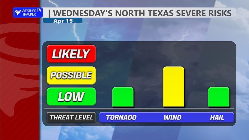
- Damaging wind gusts up to 60 mph.
- Large hail up to the size of golf balls.
- Tornado Threat: While the overall risk is low, it is not zero.
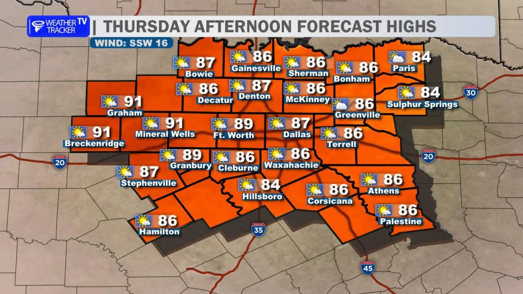
The Extended Outlook: We’ll catch a breather on Thursday as the active weather pauses, though it will stay warm with highs in the 80s (and even near 90° in our western counties).
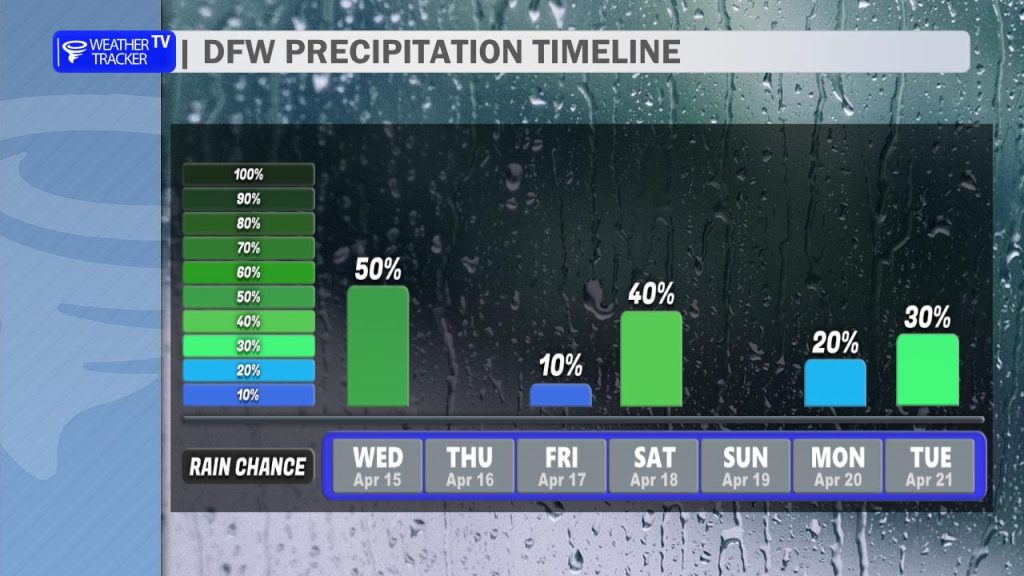
Our next big weather maker arrives Saturday morning. A fast-moving cold front will bring a line of storms through the region, some of which could be severe with a damaging wind threat. Behind that front, you’ll definitely feel the change – Saturday will be much cooler with afternoon highs struggling to leave the 60s area-wide.