Active Weather Returns: A Conditional Threat for North Texas
Good Tuesday morning, North Texas! We are tracking another stretch of active weather as we head into this evening and Wednesday. However, there is a big catch: this entire setup is conditional. In the weather world, that means the ingredients are there, but they aren’t guaranteed to mix.
The Setup for Today
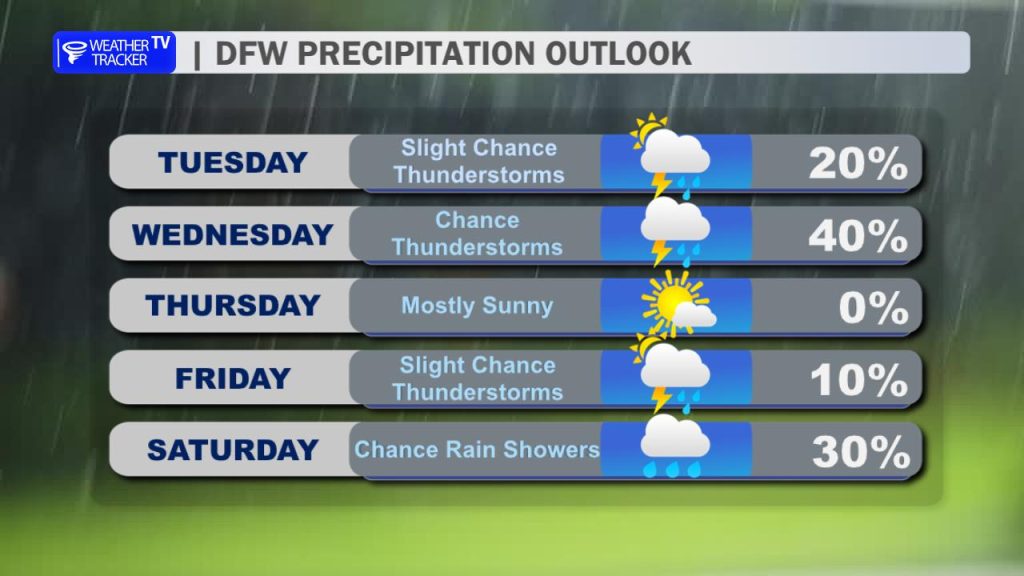
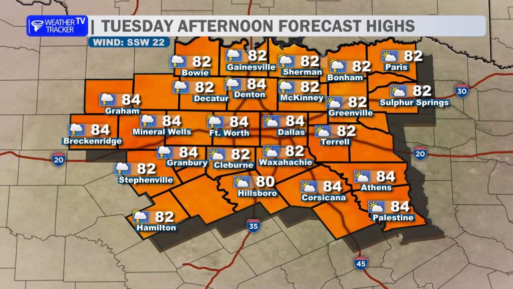
Expect a very warm and humid Tuesday with highs climbing into the mid-80s. If you’re heading out this morning, you’ll notice plenty of cloud cover and a “soupy” feel to the air. Those breezy south winds (gusting up to 25–30 mph) will help push those clouds out, giving way to some afternoon sun.
The Evening & Tonight: Watching the West
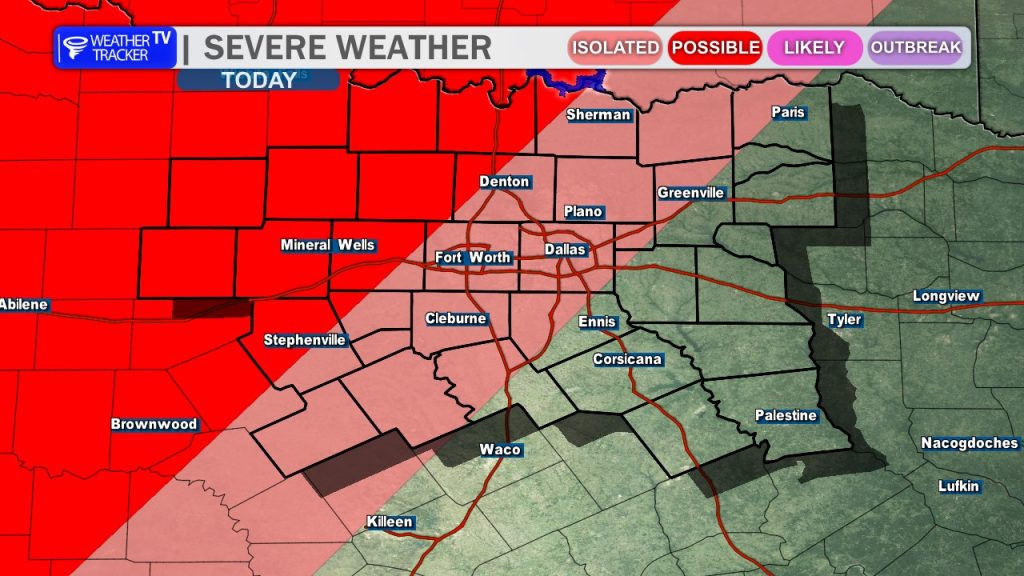
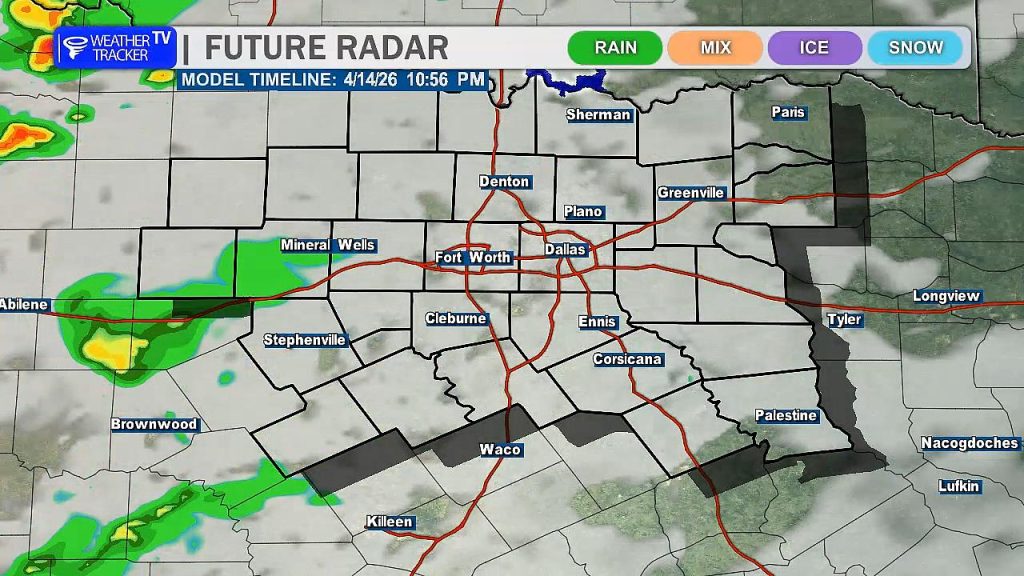
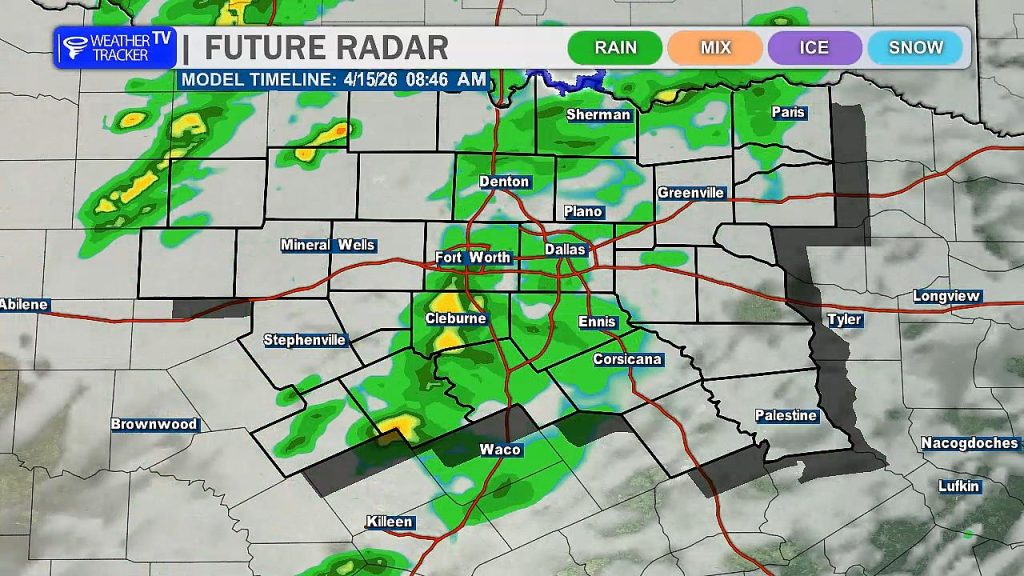
While most of the Metroplex stays dry this afternoon, our eyes will be fixed on the West Texas dryline.
- The Development: Storms are expected to fire up near the Big Country late today.
- The Trek: These storms will try to move east toward our western counties this evening.
- The “Cap”: Latest data suggests a “cap” (a layer of warm air aloft) might weaken these storms as they approach. However, if a storm can break through, it could quickly become severe with large hail and damaging winds being the primary concerns.
- Overnight: Additional activity moving out of the Concho Valley could spill into North Texas toward daybreak. Plan for a potentially wet Wednesday morning commute.
The Wednesday Wrinkle: A Forecasting Puzzle
Tomorrow afternoon is where the forecast gets tricky. Think of it like a puzzle:
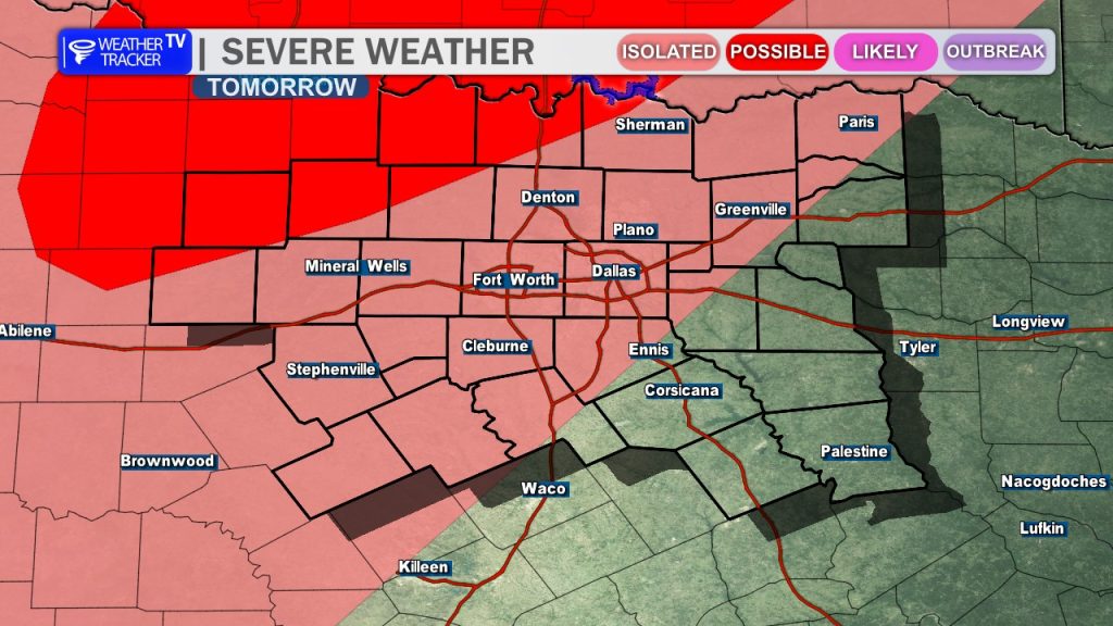
- Scenario A: If we get widespread rain and thunderstorms Wednesday morning, the atmosphere will be “worked over.” This would stabilize the air and significantly lower our chances for severe weather later in the day.
- Scenario B: If the morning stays dry or the rain is very minimal, the sun will go to work. This would prime the atmosphere, making it quite unstable and setting the stage for scattered severe storms Wednesday afternoon.
Bottom Line
We aren’t looking at a “guaranteed” event, but the potential is high enough that you’ll want to stay weather-aware. We will be tracking the timing of these morning showers closely, as they hold the key to how our Wednesday afternoon behaves.