Easter Weekend Forecast: Active Friday, Beautiful Sunday
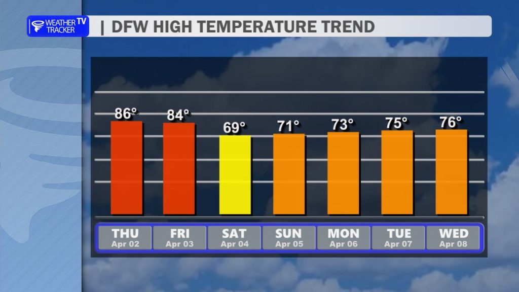
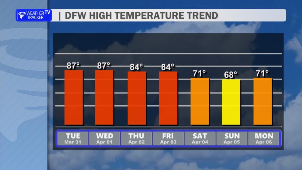
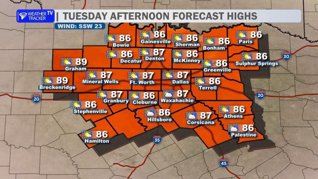
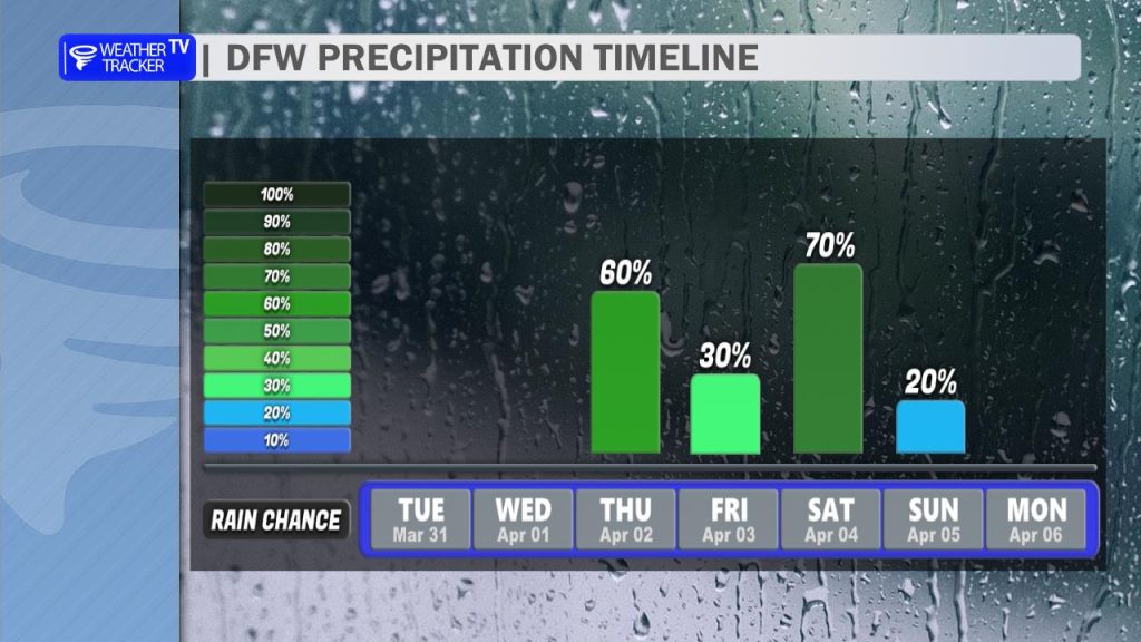
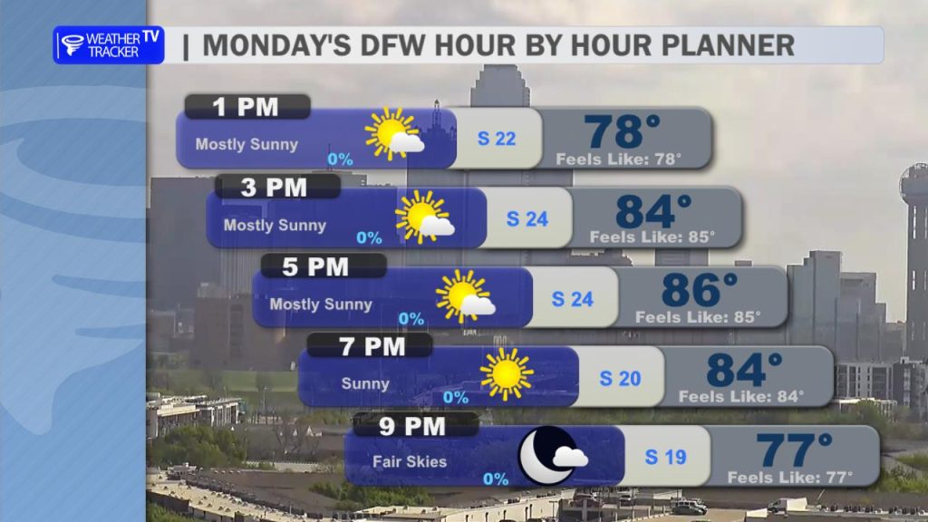
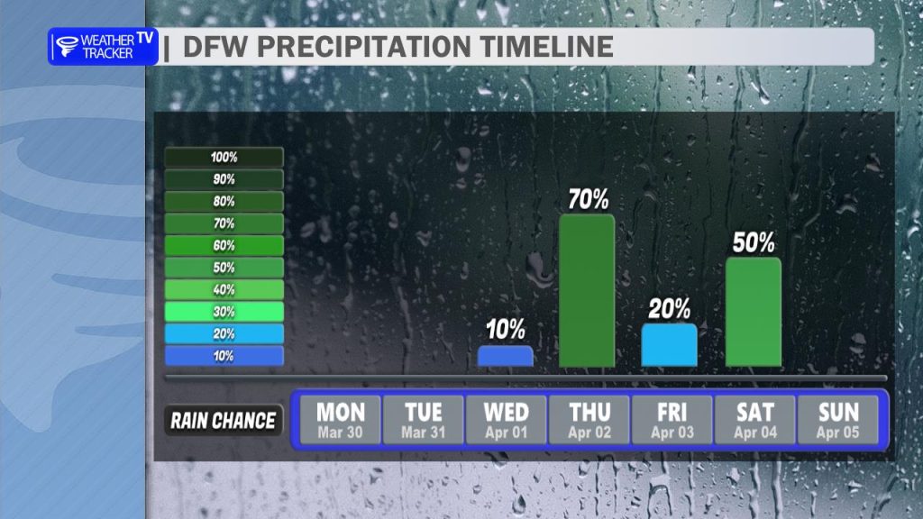
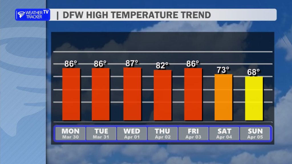
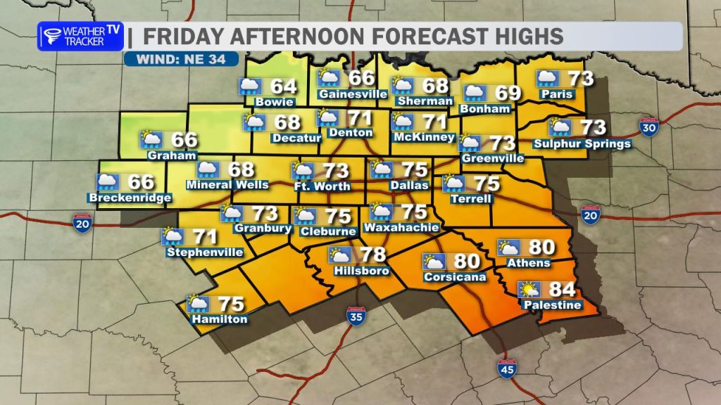
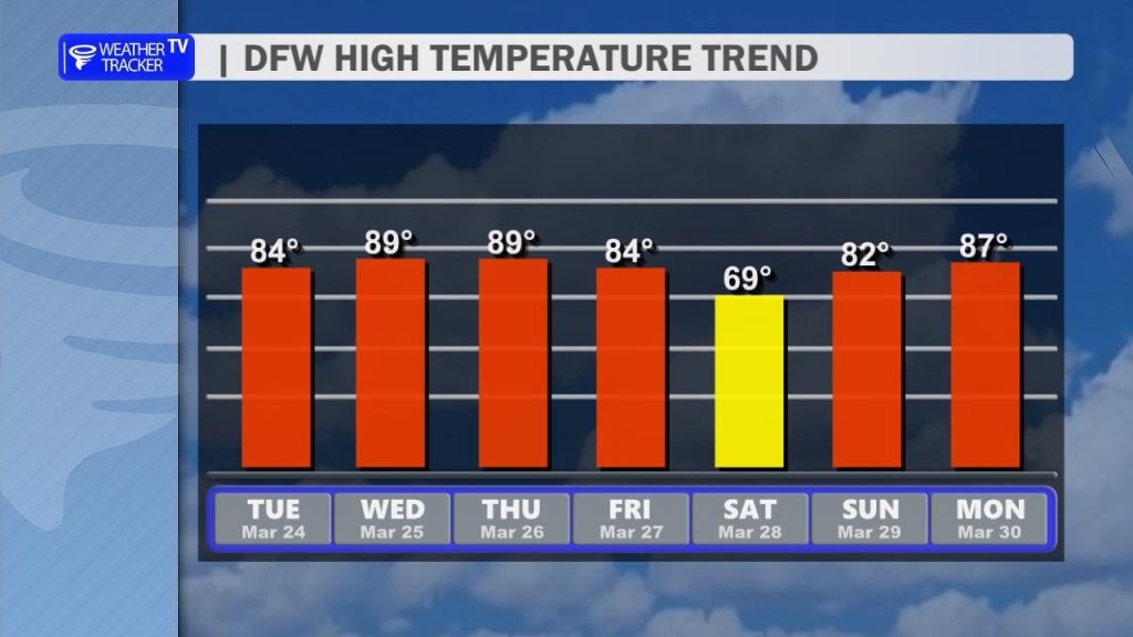
It’s going to be an active start to our Easter weekend across North Texas. Today will be mostly cloudy, humid, and breezy with afternoon highs climbing into the low-to-mid 80s. While a few isolated showers or pop-up storms are possible this afternoon—including for the Rangers home opener—the primary storm threat holds off until this evening and overnight.
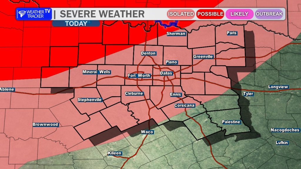
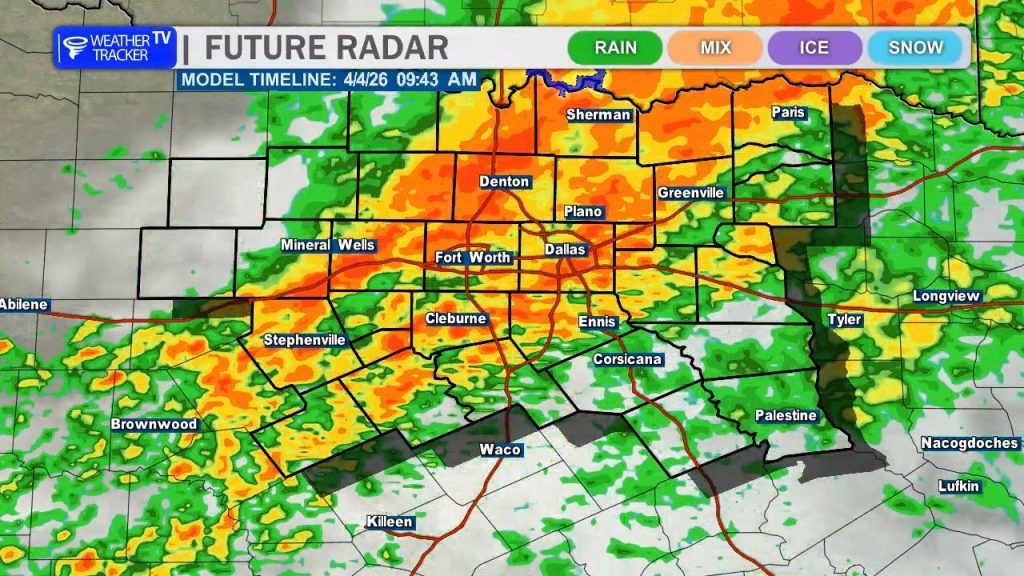
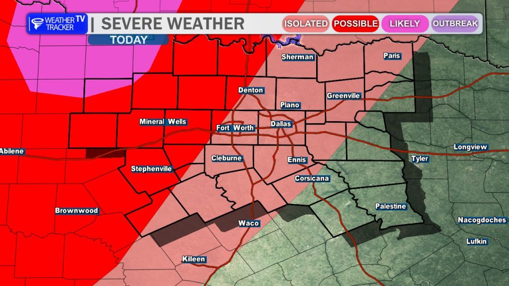
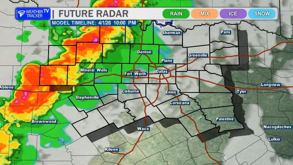
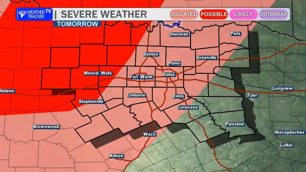
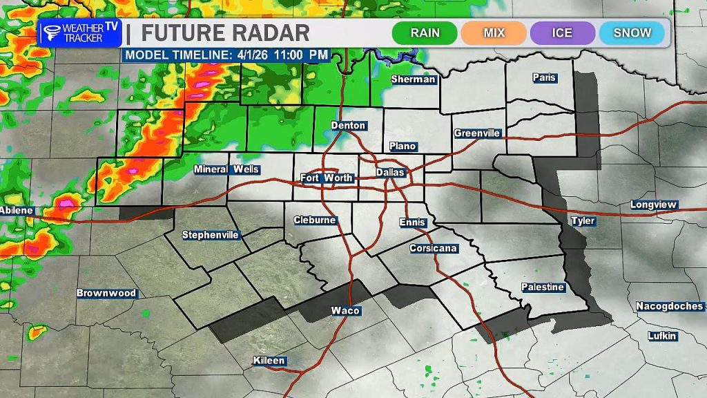
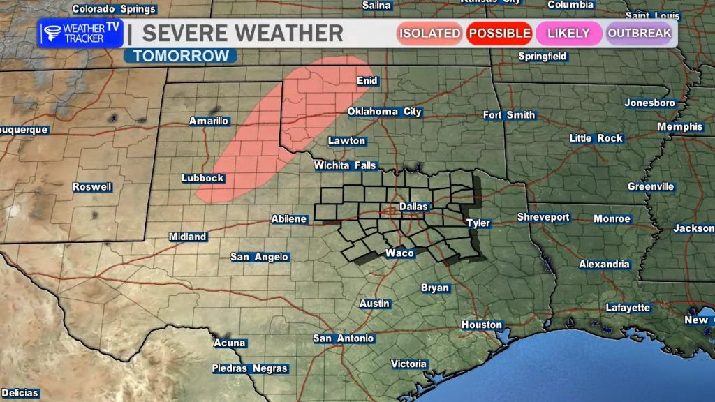
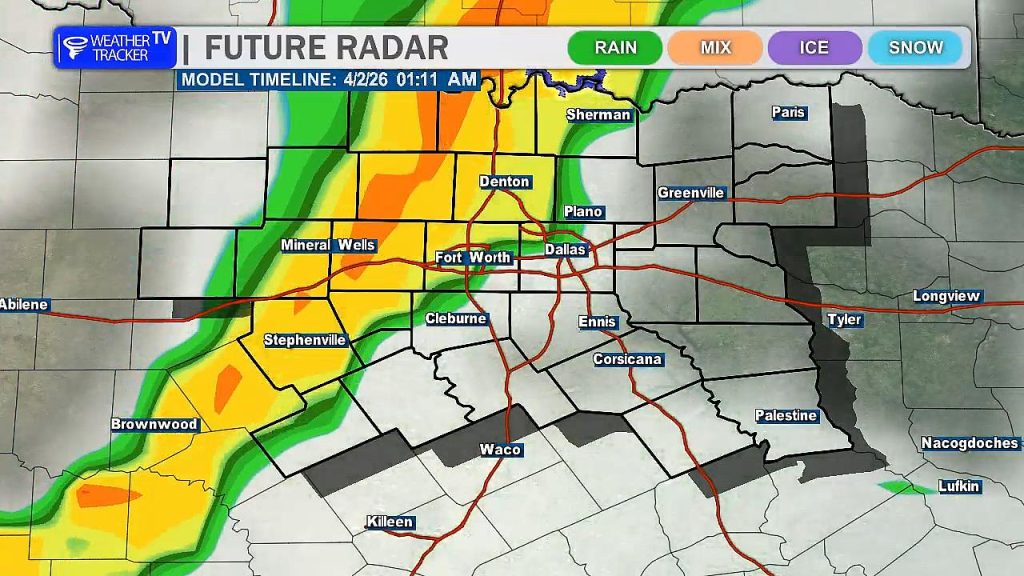
This Evening: The risk of severe weather increases, especially for areas west and northwest of the Metroplex (Level 2 “Slight” Risk). Initially, discrete storms are expected to form along the dryline in the Big Country before pushing east into North Texas. These could be supercells capable of producing ping-pong ball-sized hail and wind gusts up to 65 mph. While the tornado threat is low, a brief spin-up cannot be ruled out as the activity expands.
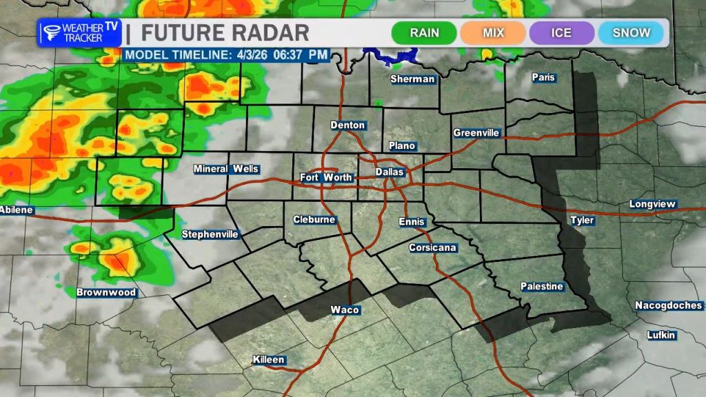
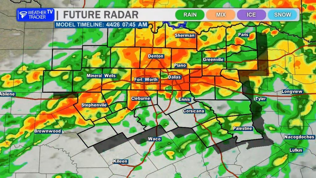
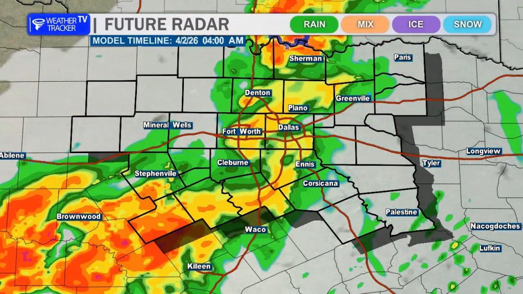
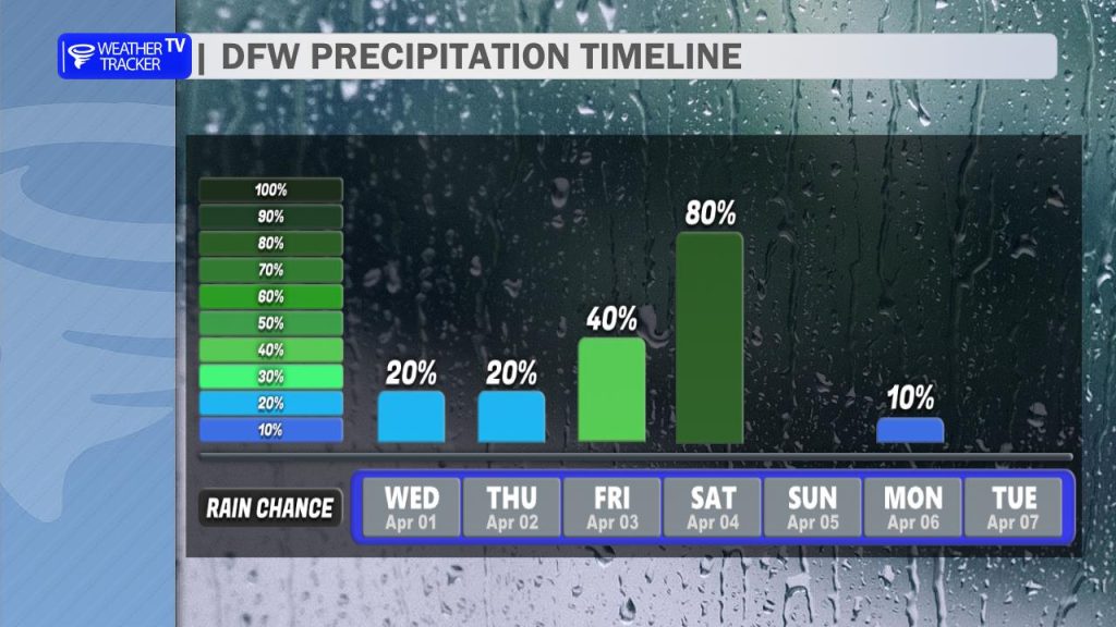
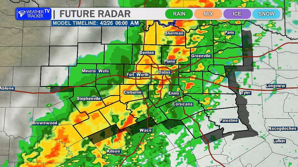
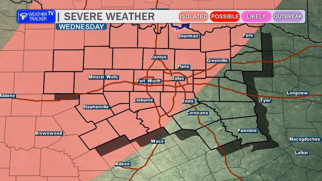
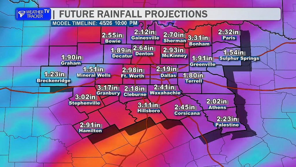
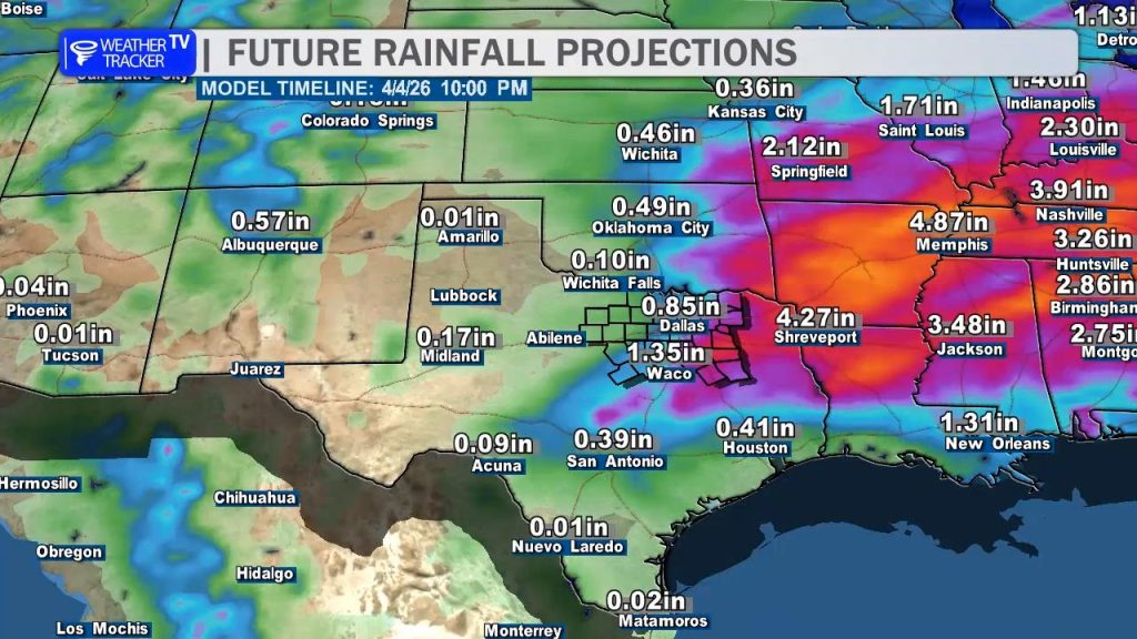
Overnight: A cold front will push into the area, sparking a second, more widespread round of rain and thunderstorms. While the severe threat will gradually ease after midnight, the focus shifts to heavy rain and localized flooding. Latest data suggests widespread totals of 1–3″, which could lead to ponding on roads by the Saturday morning commute.
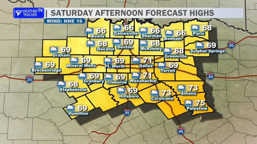
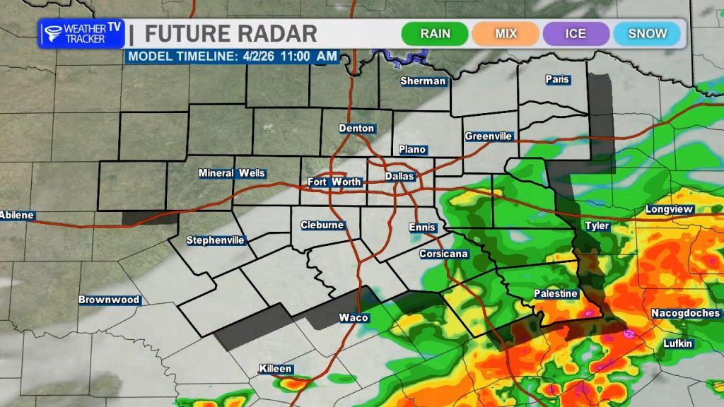
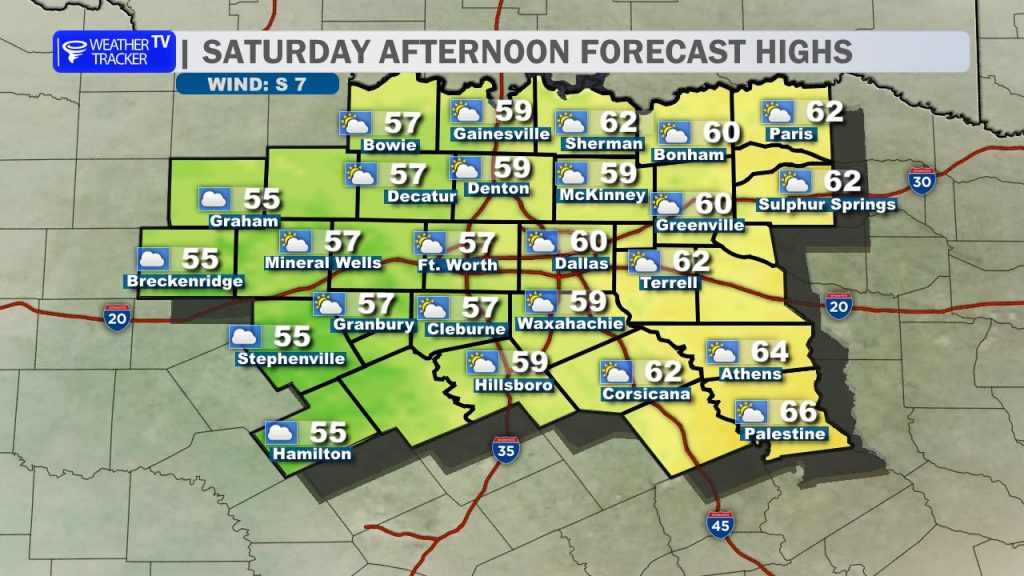
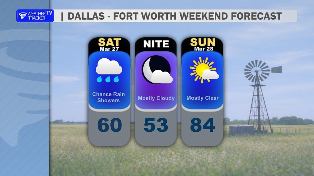
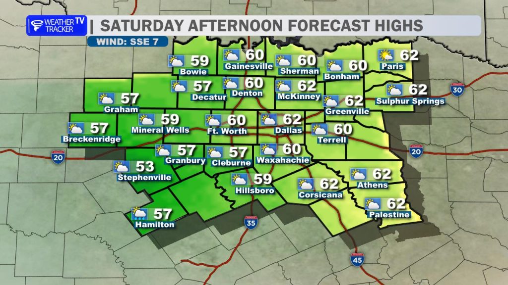
Saturday: Rain and storm activity will taper off from northwest to southeast through the afternoon. It will feel noticeably cooler behind the front, with clearing skies and highs struggling to reach the upper 60s.
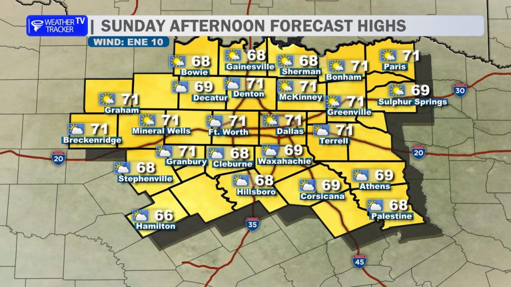
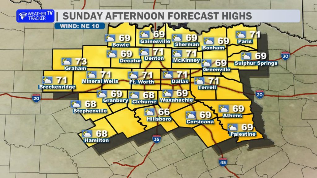
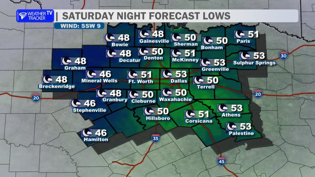
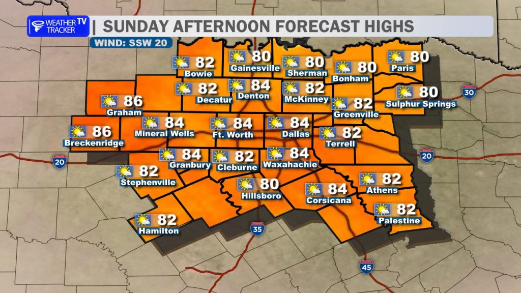
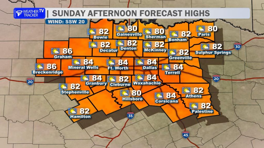
Easter Sunday: This looks like the “pick of the week!” Expect beautiful conditions with mostly sunny skies and light winds. If you’re heading to an early sunrise service, grab a light jacket—morning lows will be in the chilly 40s and 50s. Afternoon highs will recover nicely into the low 70s.